




























































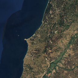
Caminho Português da Costa


Caminho Português da Costa in brief
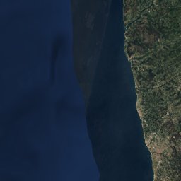
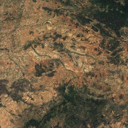
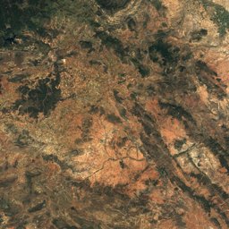
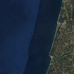
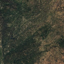
Caminho Português da Costa is a 271 km long-distance trail from Porto to Santiago de Compostela, Spain.
It climbs 4,394 m and descends 4,214 m, topping out at 261 m; it starts at 75 m and ends at 256 m.
Walked end to end it takes about 79 hours (DIN 33466, without breaks), spread over 12 stages.
8% of the way is on natural paths, 5% on gravel and 87% on tarmac; 26% of it runs through forest.
The best months are April–September, judged by temperature and rain at the highest point.
At the high point the warmest month, August, averages 25° by day.
A bus stop or station lies within 800 m of the start or the finish. There is a car park near the start.
Facts
- Distance
- 271 km
- Ascent / descent
- 4,394 m / 4,214 m
- Highest / lowest point
- 261 m / 0 m
- Walking time
- 79 h
- Effort
- multi-day
- Steepest kilometre
- 10 %
- In forest
- 26 %
- Best months
- Apr–Sep
- Start
- Porto
- Finish
- Santiago de Compostela
- Network
- National route · CPC
- Stages
- 12
The line on the ground
Elevation profile
Height every 20 m · dashed lines: stage endsThe year month by month
- Jangood, wetter
- Febgood, wetter
- Margood, wetter
- Aprgood
- Maygood
- Jungood
- Julgood
- Auggood
- Sepgood
- Octgood, wetter
- Novgood, wetter
- Decgood, wetter
Climate at the high point (261 m)
Averages 1981–2010 adjusted to the height with 6.5 °C per km; daylight at the start| Month | Jan | Feb | Mar | Apr | May | Jun | Jul | Aug | Sep | Oct | Nov | Dec |
|---|---|---|---|---|---|---|---|---|---|---|---|---|
| Average high | 12° | 13° | 15° | 17° | 20° | 22° | 25° | 25° | 24° | 20° | 15° | 13° |
| Average low | 5° | 4° | 6° | 7° | 9° | 12° | 14° | 14° | 12° | 10° | 7° | 5° |
| Precipitation | 217 mm | 173 mm | 157 mm | 154 mm | 144 mm | 67 mm | 43 mm | 56 mm | 113 mm | 237 mm | 226 mm | 279 mm |
| Daylight | 9 h 32 min | 10 h 38 min | 11 h 54 min | 13 h 18 min | 14 h 29 min | 15 h 07 min | 14 h 52 min | 13 h 51 min | 12 h 30 min | 11 h 09 min | 9 h 54 min | 9 h 14 min |
This week on the route
Loading the latest forecast…
Loading the latest forecast…
Loading the latest forecast…
Kilometre by kilometre
| km | What | Name | Elevation |
|---|---|---|---|
| 0.0 | Town or village | Mafamude · 2.0 km off the route | 99 m |
| 0.0 | Town or village | Vila Nova de Gaia · 2.1 km off the route | 122 m |
| 0.0 | Sight | Porto Cathedral | – |
| 0.0 | Sight | Episcopal Palace, Porto | – |
| 0.1 | Town or village | Bonjoia · 2.4 km off the route | 63 m |
| 0.1 | Town or village | Noeda · 2.4 km off the route | 63 m |
| 0.1 | Sight | Historic Centre of Porto | – |
| 0.4 | Town or village | Porto | 91 m |
| 0.9 | Sight | Livraria Lello | – |
| 1.5 | Town or village | Massarelos · 1.3 km off the route | 17 m |
| 3.5 | Town or village | Senhora do Porto · 0.7 km off the route | 87 m |
| 3.7 | Town or village | Francos · 1.0 km off the route | 80 m |
| 4.7 | Town or village | Ramalde do Meio · 1.0 km off the route | 71 m |
| 7.2 | Town or village | São Tiago de Custoias · 0.5 km off the route | 84 m |
| 8.7 | Town or village | Leça do Bailio · 0.7 km off the route | 90 m |
| 13.1 | Town or village | Pedras Rubras | 79 m |
| 14.1 | Town or village | Vila Nova da Telha · 0.8 km off the route | 73 m |
| 28.3 | Town or village | Vila do Conde | 12 m |
| 32.0 | Town or village | Póvoa de Varzim | 16 m |
| 35.7 | Town or village | Aver-o-Mar | 5 m |
| 53.0 | Town or village | Esposende | 7 m |
| 56.9 | Town or village | Marinhas | 15 m |
| 74.9 | Town or village | Darque | 91 m |
| 78.1 | Sight | Igreja matriz de Viana do Castelo | – |
| 78.7 | Town or village | Viana do Castelo | 12 m |
| 95.8 | Sight | Anta da Barrosa | – |
| 111.5 | Town or village | A Guarda | 39 m |
| 142.6 | Town or village | Baiona | 45 m |
| 150.1 | Town or village | Nigrán · 0.9 km off the route | 39 m |
| 170.5 | Town or village | Vigo · 1.1 km off the route | 86 m |
| 185.5 | Town or village | Redondela | 6 m |
| 197.5 | Town or village | Vilaboa · 0.7 km off the route | 36 m |
| 206.0 | Sight | Church of the Pilgrim Virgin | – |
| 206.0 | Town or village | Pontevedra | 29 m |
| 227.3 | Town or village | Caldas de Reis | 28 m |
| 246.2 | Town or village | Padrón | 13 m |
| 271.3 | Town or village | Santiago de Compostela | 257 m |
| 271.3 | Sight | Way of Saint James | – |
| 271.3 | Sight | Cathedral of Santiago de Compostela | – |
| 271.3 | Sight | Plaza del Obradoiro | – |
| 271.3 | Sight | Palacio de Rajoy | – |
| 271.3 | Sight | Colexio de San Xerome | – |
Surface, shade and gradients
12 stages from start to finish
| # | Stage | Distance | Ascent | Descent | Highest point | Walking time | Grade |
|---|---|---|---|---|---|---|---|
| 1 | Porto – Mindelo | 23.3 km | 248 m | 290 m | 118 m | 6 h 30 min | – |
| 2 | Mindelo – Apúlia | 23.1 km | 174 m | 194 m | 32 m | 6 h 15 min | – |
| 3 | Apúlia – Castelo do Neiva | 18.3 km | 180 m | 137 m | 54 m | 5 h | – |
| 4 | Castelo do Neiva – Carreço | 22.1 km | 378 m | 401 m | 136 m | 6 h 35 min | – |
| 5 | Carreço – A Guarda | 24.0 km | 364 m | 347 m | 142 m | 6 h 55 min | – |
| 6 | A Guarda – Mougás | 19.1 km | 220 m | 233 m | 52 m | 5 h 20 min | – |
| 7 | Mougás – Nigrán | 20.3 km | 353 m | 380 m | 116 m | 6 h | – |
| 8 | Nigrán – Vigo | 20.3 km | 440 m | 336 m | 109 m | 6 h 10 min | – |
| 9 | Vigo – Pontesampaio | 23.1 km | 517 m | 622 m | 183 m | 7 h 15 min | – |
| 10 | Pontesampaio – Porriña | 22.9 km | 550 m | 487 m | 148 m | 7 h 10 min | – |
| 11 | Porriña – Puentecesures | 26.8 km | 428 m | 474 m | 164 m | 7 h 55 min | – |
| 12 | Puentecesures – Santiago de Compostela | 27.6 km | 568 m | 332 m | 261 m | 8 h 10 min | – |
Seen along the route


Start, stops and airports
- Start
- 41.14296° N, 8.61153° W · 75 m
- Finish
- 42.88007° N, 8.54529° W · 256 m
- Car park at the start
- yes · 13 m
- Stop at the start
- São Bento · Railway station · 117 m
- Stop at the finish
- San Clemente (IES Rosalía de Castro) · Bus stop · 39 m
- Nearest airport
- Francisco de Sá Carneiro Airport (OPO) · 13.1 km
- Nearest airport
- Vila Real Airport (VRL) · 76.0 km
More routes near Porto
Conditions change: check the official sources, the signposts and the weather before you set off. Walking times follow DIN 33466 and do not include breaks. Route data as of 2026-10-16. Report an error