Skip to content
Destinations
Weather & climate
Nature
Outdoors
Culture
Events
Sky & live
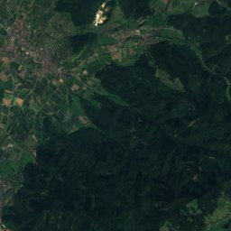
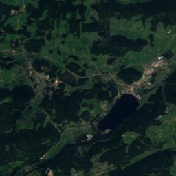
Satellite: Sentinel-2 cloudless 2016 by EOX IT Services GmbH · CC BY 4.0 · Contains modified Copernicus Sentinel data 2016
SkiingFeldberg, Baden-Wurttemberg

Skigebiet Feldberg

Ski area26 kmSnow Jan–Mar · Dec
Pistes26 kmdownhill
Lifts21in the area
Snow seasonJan–Mar · DecSeebuck
Nearest townFeldberg1.6 km
47.86° N, 8.02° EUTC+2 · Central European Summer Time
When to goFeldberg · weather score
JanFebMarAprMayJunJulAugSepOctNovDec17October
Best timeJun–Aug
October: high / low10° / 2°
Skiing

Skigebiet Feldberg in brief

Skigebiet Feldberg is a ski area in Feldberg, Baden-Wurttemberg, Germany with about 26 km of downhill pistes and 21 lifts.

At Seebuck (1,449 m), the nearest summit, precipitation falls mostly as snow in Jan–Mar · Dec.

The nearest town in the atlas is Feldberg, 1.6 km away.

The resort's website

Weather nearby now

Feldberg
6°
Partly cloudy now
Wind12 km/h
Humidity61%
Cloud cover50%
Today
22 Oct
5°
1°
1 mm
Fri
23 Oct
5°
1°
9 mm
Sat
24 Oct
3°
-1°
9 mm
Sun
25 Oct
6°
1°
38 mm
Mon
26 Oct
7°
2°
2 mm

Model run 00:00 UTCRefreshed several times a day

Fresh snow, next 10 days

Thu 22Fri 23Sat 24Sun 25Mon 26Tue 27Wed 28Thu 29Fri 30Sat 31Total
Feldberg1,236 m–3°–3°4 cm1°–4°–4°–11°–7°–5°–7°–4°4 cm

Estimate: the forecast's precipitation at each height shown, as snow when it is cold enough there (about 1 cm per mm). Resorts publish their own snow reports.

Pistes by difficulty

Kilometres of downhill piste, as mapped
Blue (easy)11 km
Red (intermediate)7.7 km
Black (difficult)6.9 km

Lifts

21
  • Moving carpets7
  • T-bars6
  • Chairlifts5
  • Platter lifts3

Snow through the year

Seebuck · 1,449 m
Jan❄-2°
Feb❄-3°
Mar❄0°
Apr·3°
May·7°
Jun·10°
Jul·12°
Aug·12°
Sep·9°
Oct·6°
Nov·1°
Dec❄-2°
Snow: months when the mean temperature at the summit is at most +1 °C and at least 10 mm falls. Below: mean temperature at the summit.
Stay nearby

Towns close by

Feldberg
Photo: Flominator · CC BY-SA 3.0 · Wikimedia CommonsReport this photo · linked, not stored

Feldberg

Baden-Wurttemberg · 1.6 km E
10°Oct high
14wet days
17score
Feldberg
Todtnauberg
Photo: Werner Schreiber · CC BY-SA 3.0 · Wikimedia CommonsReport this photo · linked, not stored

Todtnauberg

Baden-Wurttemberg · 5.9 km W
11°Oct high
14wet days
22score
Todtnauberg
Todtnau
Photo: Wladyslaw Sojka · CC BY-SA 3.0 · Wikimedia CommonsReport this photo · linked, not stored

Todtnau

Baden-Wurttemberg · 6.4 km SW
13°Oct high
14wet days
37score
Todtnau
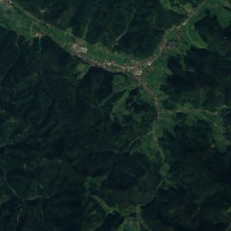
Satellite: Sentinel-2 cloudless 2016 by EOX IT Services GmbH · CC BY 4.0 · Contains modified Copernicus Sentinel data 2016

Bernau

Baden-Wurttemberg · 6.4 km S
12°Oct high
14wet days
29score
Bernau
Around here

Feldberg and around

Feldberg
Photo: Flominator · CC BY-SA 3.0 · Wikimedia CommonsReport this photo · linked, not stored

Feldberg

Baden-Wurttemberg · Germany
Jun–Augbest months
17°July high
1,236 maltitude
Feldberg

Nature

Schluchsee
Photo: Michael Overmeyer · CC BY-SA 3.0 · Wikimedia CommonsReport this photo · linked, not stored
9.4 km SE

Schluchsee

Lake · 930 m
Schluchsee
Wiese
Photo: Wladyslaw · CC BY-SA 3.0 · Wikimedia CommonsReport this photo · linked, not stored
1.1 km W

Wiese

River
Wiese
Alb, Baden-Wurttemberg
Photo: Schermuuser · CC BY-SA 3.0 · Wikimedia CommonsReport this photo · linked, not stored
1.0 km W

Alb, Baden-Wurttemberg

River · 310 m
Alb, Baden-Wurttemberg

Mountains

Feldberg (Black Forest)
Photo: Jörg Braukmann · CC BY-SA 4.0 · Wikimedia CommonsReport this photo · linked, not stored
3.1 km NW

Feldberg (Black Forest)

1,494 m · Black Forest
Feldberg (Black Forest)
Seebuck
Photo: J. Braukmann Milseburg · CC BY-SA 3.0 · Wikimedia CommonsReport this photo · linked, not stored
1.4 km NW

Seebuck

1,449 m · Black Forest
Seebuck
Herzogenhorn
Photo: Neptuna · CC BY-SA 3.0 · Wikimedia CommonsReport this photo · linked, not stored
3.0 km SW

Herzogenhorn

1,416 m · Black Forest
Herzogenhorn

Heritage

St. Oswald, Breitnau
Photo: Flominator (talk) · CC BY-SA 3.0 · Wikimedia CommonsReport this photo · linked, not stored
6.9 km N

St. Oswald, Breitnau

Kulturdenkmal · 1101
St. Oswald, Breitnau
St.-Jakobus-Münster
Photo: © Jörgens.mi · CC BY-SA 3.0 · Wikimedia CommonsReport this photo · linked, not stored
14 km NE

St.-Jakobus-Münster

Kulturdenkmal
St.-Jakobus-Münster
Barbarastollen underground archive
Photo: user:Joergens.mi · CC BY-SA 3.0 · Wikimedia CommonsReport this photo · linked, not stored
11 km NW

Barbarastollen underground archive

Cultural property under special protection · 1903
Barbarastollen underground archive

Museums

Volante (Kirchzarten)
Photo: © Jörgens.mi · CC BY-SA 3.0 · Wikimedia CommonsReport this photo · linked, not stored
13 km NW

Volante (Kirchzarten)

Automobile museum
Volante (Kirchzarten)
Heimethus
Photo: Tourist-Information Todtmoos · CC BY-SA 3.0 · Wikimedia CommonsReport this photo · linked, not stored
14 km S

Heimethus

Local museum · 1991
Heimethus
Hans-Thoma-Kunstmuseum
Photo: Rauenstein · CC BY-SA 3.0 · Wikimedia CommonsReport this photo · linked, not stored
6.3 km S

Hans-Thoma-Kunstmuseum

Art museum · 1949
Hans-Thoma-Kunstmuseum