Skip to content
Destinations
Weather & climate
Nature
Outdoors
Culture
Events
Sky & live
Vockeröder Lindengruppe
Photo: Heinz K. S. · CC BY-SA 4.0 · Wikimedia Commons
Vockeröder LindengruppeReport this photo · linked, not stored
Molkenbaum
Photo: Heinz K. S. · CC BY 4.0 · Wikimedia Commons
MolkenbaumReport this photo · linked, not stored
Molkenbaum
Evangelische Kirche Wolfterode
Photo: Barbara Arand · CC BY-SA 4.0 · Wikimedia Commons
Evangelische Kirche WolfterodeReport this photo · linked, not stored
Evangelische Kirche Wolfterode
Frau-Holle-Teich
Photo: Willow · CC BY 2.5 · Wikimedia Commons
Frau-Holle-TeichReport this photo · linked, not stored
Frau-Holle-Teich
Mühlstein (Wolfterode)
Photo: Heinz K. S. · CC BY-SA 4.0 · Wikimedia Commons
Mühlstein (Wolfterode)Report this photo · linked, not stored
Mühlstein (Wolfterode)
groveWaldkappel, Hesse

Vockeröder Lindengruppe

Single natural monument in Hesse
Typegrove
Built–
Best monthsMay · Aug–Sepweather in Waldkappel
51.22° N, 9.90° EUTC+1 · Central European Standard Time
When to goWaldkappel · weather score
JanFebMarAprMayJunJulAugSepOctNovDec39October
Best timeMay · Aug–Sep
October: high / low13° / 5°
iAbout

Vockeröder Lindengruppe in brief

Vockeröder Lindengruppe is a grove in Waldkappel, Hesse, Germany.

It holds the designation Single natural monument in Hesse.

For a visit, the weather in Waldkappel is best in May, August and September; in October afternoons average 13°.

Waldkappel: weather and travel guide

Facts

Type
grove
Designation
Single natural monument in Hesse
Nearest town
Waldkappel
Region
Hesse
Coordinates
51.21524, 9.89723
iiLocation

Where to find it

iiiWhen to visit

Weather in Waldkappel

Climate guide

Month score for sightseeing

Best May · Aug–Sep
15
Jan
21
Feb
22
Mar
53
Apr
65
May
64
Jun
65
Jul
66
Aug
70
Sep
39
Oct
16
Nov
13
Dec
ivNearby

More heritage close by

All monuments in Germany
Molkenbaum
Photo: Heinz K. S. · CC BY 4.0 · Wikimedia CommonsReport this photo · linked, not stored

Molkenbaum

1.5 km N
Single natural monument in Hesse
Molkenbaum
Evangelische Kirche Wolfterode
Photo: Barbara Arand · CC BY-SA 4.0 · Wikimedia CommonsReport this photo · linked, not stored

Evangelische Kirche Wolfterode

1.6 km NE
cultural heritage monument in Hesse
Evangelische Kirche Wolfterode
Frau-Holle-Teich
Photo: Willow · CC BY 2.5 · Wikimedia CommonsReport this photo · linked, not stored

Frau-Holle-Teich

2.0 km W
Single natural monument in Hesse
Frau-Holle-Teich
Mühlstein (Wolfterode)
Photo: Heinz K. S. · CC BY-SA 4.0 · Wikimedia CommonsReport this photo · linked, not stored

Mühlstein (Wolfterode)

2.0 km NE
Single natural monument in Hesse
Mühlstein (Wolfterode)
Kloster Germerode
Photo: YPS · CC BY-SA 3.0 · Wikimedia CommonsReport this photo · linked, not stored

Kloster Germerode

2.4 km S
cultural heritage monument in Hesse
Kloster Germerode
Dorflinde in Frankenhain
Photo: Heinz K. S. · CC BY-SA 4.0 · Wikimedia CommonsReport this photo · linked, not stored

Dorflinde in Frankenhain

2.7 km N
Single natural monument in Hesse
Dorflinde in Frankenhain
Around here

Waldkappel and around

Waldkappel
Photo: Kodronchris · CC BY 3.0 · Wikimedia CommonsReport this photo · linked, not stored

Waldkappel

Hesse · Germany
May · Aug–Sepbest months
24°July high
237 maltitude
Waldkappel

Nature

Losse
Photo: Olof Hreiðarsson · CC BY 3.0 · Wikimedia CommonsReport this photo · linked, not stored
10 km NW

Losse

River
Losse
Frau-Holle-Teich
Photo: Willow · CC BY 2.5 · Wikimedia CommonsReport this photo · linked, not stored
8.3 km N

Frau-Holle-Teich

Lake · 623 m
Frau-Holle-Teich
Essebach
Photo: GeorgDerReisende · CC BY-SA 4.0 · Wikimedia CommonsReport this photo · linked, not stored
11 km W

Essebach

River · 223 m
Essebach

Mountains

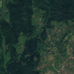
Satellite: Sentinel-2 cloudless 2016 by EOX IT Services GmbH · CC BY 4.0 · Contains modified Copernicus Sentinel data 2016
9.4 km N

Kasseler Kuppe

754 m
Kasseler Kuppe
Hoher Meissner
Photo: © Heinrich Stürzl / Wikimedia Commons · CC BY-SA 4.0 · Wikimedia CommonsReport this photo · linked, not stored
7.3 km N

Hoher Meissner

753 m
Hoher Meissner
Kalbe
Photo: Nemracc · CC BY-SA 4.0 · Wikimedia CommonsReport this photo · linked, not stored
8.0 km N

Kalbe

720 m · Hoher Meissner
Kalbe

Heritage

St.-Georgs-Kirche Waldkappel
Photo: Tilman2007 · CC BY-SA 4.0 · Wikimedia CommonsReport this photo · linked, not stored
0.1 km S

St.-Georgs-Kirche Waldkappel

cultural heritage monument in Hesse
St.-Georgs-Kirche Waldkappel
Linde am Kreuzstein
Photo: Heinz K. S. · CC BY-SA 4.0 · Wikimedia CommonsReport this photo · linked, not stored
2.6 km NW

Linde am Kreuzstein

Single natural monument in Hesse
Linde am Kreuzstein
Evangelische Kirche Friemen
Photo: Heinz K. S. · CC BY-SA 4.0 · Wikimedia CommonsReport this photo · linked, not stored
3.0 km SW

Evangelische Kirche Friemen

cultural heritage monument in Hesse
Evangelische Kirche Friemen

Museums

Grube Gustav (Abterode)
Photo: Baummapper · CC BY-SA 3.0 de · Wikimedia CommonsReport this photo · linked, not stored
10 km NE

Grube Gustav (Abterode)

Show mine
Grube Gustav (Abterode)
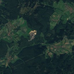
Satellite: Sentinel-2 cloudless 2016 by EOX IT Services GmbH · CC BY 4.0 · Contains modified Copernicus Sentinel data 2016
11 km S

Cornberger Sandsteinmuseum
Cornberger Sandsteinmuseum
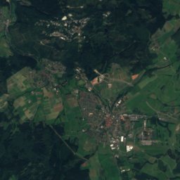
Satellite: Sentinel-2 cloudless 2016 by EOX IT Services GmbH · CC BY 4.0 · Contains modified Copernicus Sentinel data 2016
8.5 km SE

Mühlen-Museum Steinmühle Sontra

Mühlen-Museum Steinmühle Sontra