Skip to content
Destinations
Weather & climate
Nature
Outdoors
Culture
Events
Sky & live
Urasoe
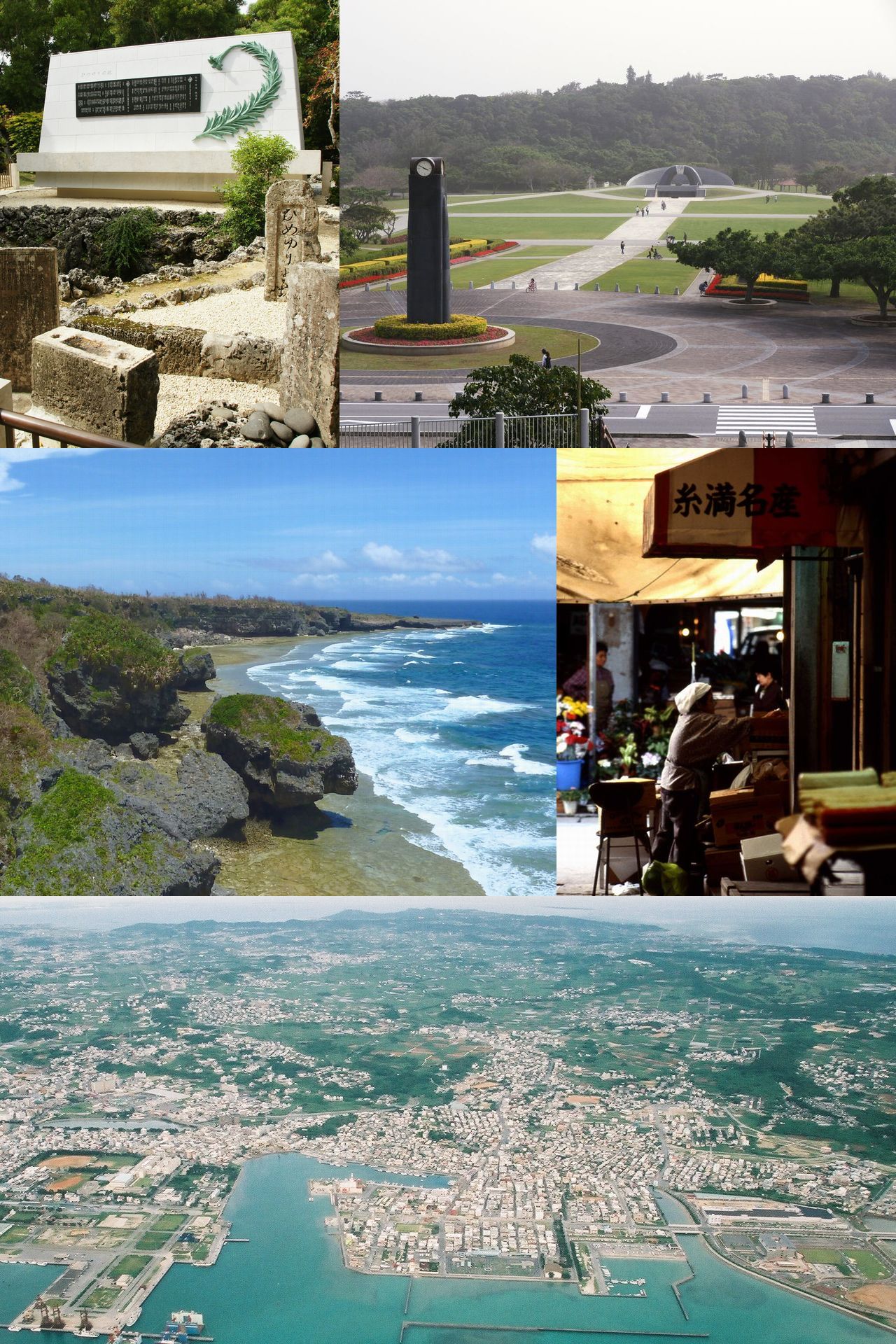
Oroku-baka Tomb
Oroku-baka Tomb
Ōyama Shell Mound
Ōyama Shell Mound
Shuri Castle
Shuri Castle
Nakagusuku Castle
Nakagusuku Castle
Okinawa, Japan

Urasoe

Urasoe is a city in Okinawa, Japan, close to the sea. It has a population of about 115,855 (2021). The climate is classified as humid subtropical (Köppen Cfa), with rain spread through the year and no real dry season.

Now25°C
Best timeJan–Feb · Oct
Population115,855
Local time23:47
26.26° N, 127.73° EElevation 50 mUTC+9 · Japan Standard Time
The year in Urasoeweather score
JanFebMarAprMayJunJulAugSepOctNovDec68October
October: high / low26° / 24°
Rain this month179mm
Sea this month27°
Best timeJan–Feb · Oct

Best: Jan–Feb · Oct. Warmth, sunshine and dry days, month by month.

Urasoe at a glance

Best time to visitJan–Feb · Oct

The months with the highest weather score

Warmest month29°C

Average high in August

Coolest month17°C

Average low in January

Wettest monthJune

304 mm of rain

Driest monthJanuary

125 mm of rain

Warmest sea29°C

August

Monuments nearby10+

5 of them World Heritage

Weather in Urasoe

Now and the next ten days. The 14 and 30-day outlooks are one click away.

14-day forecast
25°C

Rain · wind 33 km/h · humidity 93%

Today hour by hour
Today22 Oct26°25°24.9 mm
Fri23 Oct28°25°13.2 mm
Sat24 Oct29°26°10.7 mm
Sun25 Oct29°26°4.9 mm
Mon26 Oct29°26°4 mm
Tue27 Oct27°24°0.9 mm
Wed28 Oct24°22°
Thu29 Oct26°23°1.5 mm
Fri30 Oct25°23°54.7 mm
Sat31 Oct26°24°7.8 mm

When to go to Urasoe

Each month's weather score (warmth, sun, dry days) with its temperatures and rain.

Climate month by month
JanFebMarAprMayJunJulAugSepOctNovDec
Score686863625950495054686861
High19°19°20°22°24°27°28°29°28°26°23°20°
Low17°17°18°20°23°25°27°27°26°24°22°19°
Rain (mm)125142194187281304172273280179128133
Wet days101013142122192118121214
Sea22°22°22°23°25°27°29°29°28°27°25°24°

What's on in Urasoe

Concerts, football matches, the public holidays ahead and the town's festivals through the year.

All events

Music venues

沖縄コンベンションセンター〒901-2224 沖縄県宜野湾市真志喜四丁目3-1 · 2.3 km
3 shows
沖縄コンベンションセンター 展示棟〒 901-2224 沖縄県宜野湾市真志喜 4-3-1 · 2.4 km
2 shows

Monuments and museums in Urasoe

All monuments

More museums: Urasoe Castle Site and Youdore Museum · 浦添市 歴史にふれる館

Outdoors around Urasoe

Hiking routes from the town, and what there is to do within 15 km: huts, viewpoints, climbing, camping, ski areas and dive sites.

Things to do
沖縄こどもの国Zoos
1 km
UNKO MUSEUM OKINAWATheme parks
1.3 km
おきなわワールドTheme parks
1.5 km
ハブ博物公園Zoos
1.5 km
中城公園Camp sites
1.7 km
Ryukyu Golf ClubGolf courses
1.8 km
パイレーツおきなわDive site
1.5 km
Ocean GateDive site
3.8 km
ウィズミーダイブDive site
4.6 km
Dive site
5.1 km

Nature around Urasoe

Nature in Japan

Wildlife in October

The birds and mammals of Japan seen most this month, compared with the rest of their year.

The sky over Urasoe

Eclipses and meteor showers

Earthquakes around Urasoe

The last 30 days within 300 km, and the record since 1950.

Earthquakes

Strongest nearby since 1950

7.0Nanjō 70 km →2010 · 78 km
6.7Nanjō 90 km ↘1968 · 101 km
6.7Aguni 72 km ↖1963 · 130 km
6.5Yaese 93 km ↘1962 · 105 km

Tropical storms · Urasoe

Tropical storm archive
TSTropical Storm Krovanh (2026)24 km · 65 km/hC5Typhoon Dolphin (2026)61 km · 165 km/hC1Typhoon Jangmi (2026)54 km · 100 km/hTSTropical Storm Francisco (2025)69 km · 65 km/hC4Typhoon Khanun (2023)91 km · 213 km/hC5Typhoon Mawar (2023)71 km · 83 km/hTSTropical Storm Aere (2022)40 km · 74 km/hC1Typhoon Prapiroon (2018)93 km · 120 km/hTSTropical Storm Gaemi (2018)65 km · 74 km/hC1Typhoon Saola (2017)72 km · 111 km/hTSTropical Storm Nakri (2014)75 km · 74 km/hC5Typhoon Jelawat (2012)46 km · 185 km/hC5Typhoon Sanba (2012)87 km · 194 km/hC4Typhoon Bolaven (2012)47 km · 194 km/hC5Typhoon Muifa (2011)82 km · 157 km/hTSTropical Storm Aere (2011)38 km · 65 km/hTSTropical Storm Malou (2010)94 km · 65 km/hC3Typhoon Kompasu (2010)77 km · 176 km/hC4Typhoon Nari (2007)82 km · 213 km/hC4Typhoon Man-Yi (2007)37 km · 232 km/hC4Typhoon Songda (2004)57 km · 213 km/hC3Typhoon Conson (2004)96 km · 157 km/hC3Typhoon Choi-Wan (2003)33 km · 102 km/hC3Typhoon Sinlaku (2002)36 km · 176 km/hTSTropical Storm Nakri (2002)95 km · 74 km/hC4Typhoon Halong (2002)15 km · 167 km/hTSTropical Storm Cimaron (2001)47 km · 83 km/hTSTropical Storm Bopha (2000)83 km · 102 km/hC5Typhoon Saomai (2000)47 km · 185 km/hC4Typhoon Jelawat (2000)98 km · 148 km/hTSTropical Storm Bolaven (2000)93 km · 65 km/hC5Typhoon Bart (1999)53 km · 259 km/hTSTropical Storm Rachel (1999)66 km · 65 km/hC1Typhoon Olga (1999)40 km · 120 km/hC2Typhoon Kirk (1996)18 km · 176 km/hC1Typhoon Percy (1993)78 km · 83 km/hC4Typhoon Bobbie (1992)41 km · 167 km/hC2Typhoon Kinna (1991)60 km · 167 km/hC2Typhoon Ellie (1991)96 km · 120 km/hC2Typhoon Hattie (1990)76 km · 167 km/h

Universities and research institutes

Incorporated Foundation Okinawa Prefecture Environment Science CenterResearch institute

Towns and villages around Urasoe

Each with its own page: weather, climate and the best time to visit.

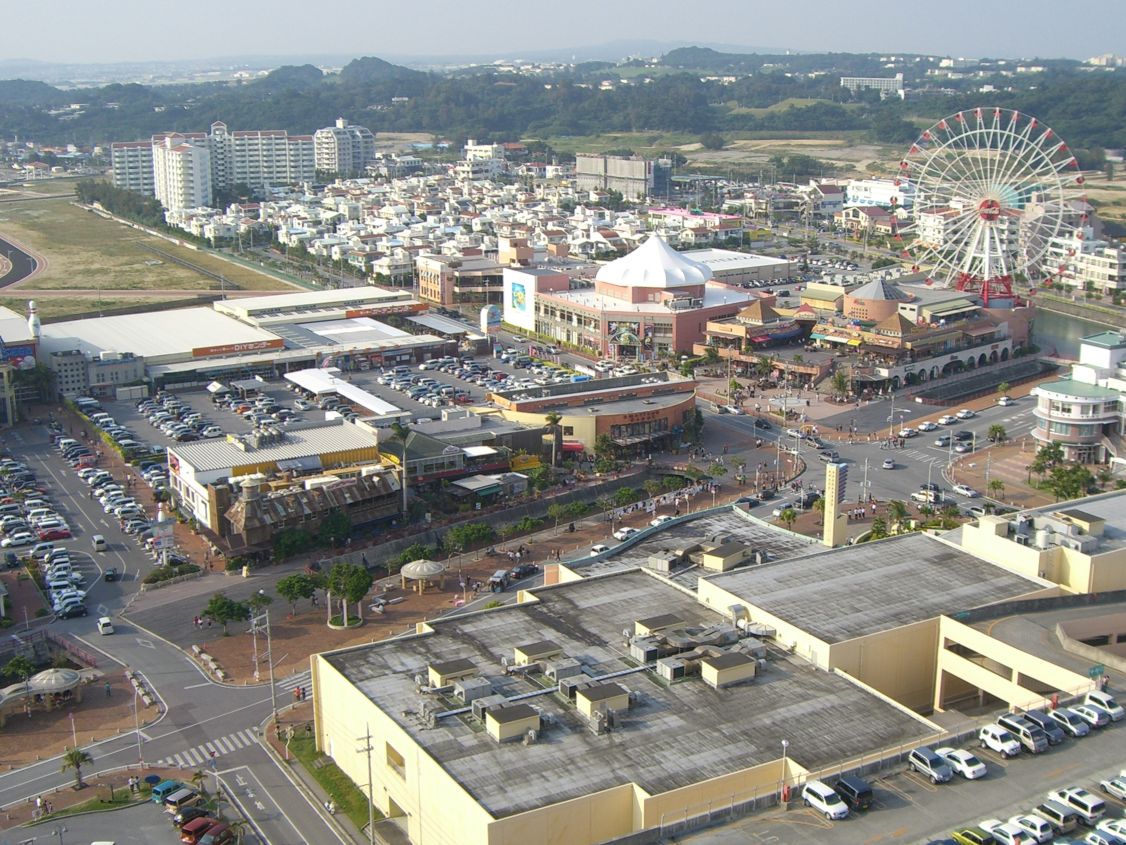
Urasoe from above

Getting to Urasoe

Naha International AirportOKA
12 km
Kumejima AirportUEO
102 km
Yoron AirportRNJ
110 km
浦添前田Railway station
1.7 km
てだこ浦西Railway station
2.3 km
経塚Railway station
2.5 km
那覇新港名瀬
5.7 km
那覇(泊)兼城港 · 座間味 · 渡名喜
6.1 km

Places near Urasoe

Places with a climate like Urasoe

Matched month by month on temperature, rain and sunshine.

Frequently asked questions

When is the best time to visit Urasoe?
Based on 30-year climate normals, January, February and October offer the best balance of comfortable temperatures, low rainfall and sunshine in Urasoe.
What is the hottest month in Urasoe?
August is the warmest month, with average highs of 29°C and lows of 27°C.
What is the coldest month in Urasoe?
January is the coldest month, with average highs of 19°C and lows of 17°C.
What is the rainiest month in Urasoe?
June is the wettest month with about 304 mm of precipitation on 22 wet days.
How warm is the sea near Urasoe?
The sea is warmest in August at about 29°C and coolest in February at about 22°C.