













Way of Saint James


Way of Saint James in brief
Way of Saint James is a 244 km long-distance trail (T2), Switzerland.
It climbs 11,140 m and descends 10,390 m, topping out at 2,605 m; it starts at 1,913 m and ends at 2,039 m.
The official walking times of its 19 stages add up to about 78 hours.
On the SAC hiking scale it is graded T2 (mountain hiking).
39% of the route runs through forest.
The best months are July–August, judged by temperature and rain at the highest point.
At the high point the warmest month, August, averages 11° by day.
A bus stop or station lies within 800 m of the start or the finish. There is a car park near the start.
Facts
- Distance
- 244 km
- Ascent / descent
- 11,140 m / 10,390 m
- Highest / lowest point
- 2,605 m / 575 m
- Walking time
- 78 h
- Grade
- T2 · mountain hiking
- Effort
- multi-day
- Steepest kilometre
- 26 %
- In forest
- 39 %
- Best months
- Jul–Aug
- Start
- Lü
- Network
- Regional route · 43
- Stages
- 19
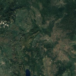
The line on the ground
Elevation profile
Height every 20 m · dashed lines: stage endsThe year month by month
- Janunsuitable
- Febunsuitable
- Marunsuitable
- Aprunsuitable
- Mayunsuitable
- Junpossible
- Julgood, wetter
- Auggood, wetter
- Seppossible
- Octpossible
- Novunsuitable
- Decunsuitable
Climate at the high point (2,605 m)
Averages 1981–2010 adjusted to the height with 6.5 °C per km; daylight at the start| Month | Jan | Feb | Mar | Apr | May | Jun | Jul | Aug | Sep | Oct | Nov | Dec |
|---|---|---|---|---|---|---|---|---|---|---|---|---|
| Average high | -4° | -5° | -3° | 0° | 4° | 8° | 11° | 11° | 7° | 4° | -1° | -3° |
| Average low | -18° | -14° | -9° | -6° | -1° | 2° | 4° | 5° | 2° | -1° | -11° | -17° |
| Precipitation | 107 mm | 89 mm | 109 mm | 115 mm | 174 mm | 213 mm | 237 mm | 240 mm | 176 mm | 142 mm | 150 mm | 115 mm |
| Daylight | 8 h 58 min | 10 h 19 min | 11 h 51 min | 13 h 33 min | 15 h 00 min | 15 h 49 min | 15 h 29 min | 14 h 14 min | 12 h 36 min | 10 h 58 min | 9 h 26 min | 8 h 35 min |
This week on the route
Loading the latest forecast…
Loading the latest forecast…
Loading the latest forecast…
Kilometre by kilometre
| km | What | Name | Elevation |
|---|---|---|---|
| 0.2 | Town or village | Lü | 1,928 m |
| 14.0 | Town or village | S-charl | 1,810 m |
| 27.6 | Town or village | Scuol | 1,250 m |
| 28.4 | Sight | Scuol-Tarasp railway station | – |
| 32.4 | Town or village | Ftan | 1,638 m |
| 38.5 | Town or village | Ardez | 1,466 m |
| 42.7 | Sight | Guarda | – |
| 46.9 | Sight | Lavin | – |
| 47.0 | Town or village | Lavin | 1,414 m |
| 58.1 | Sight | Wildenberg Castle | – |
| 58.3 | Town or village | Zernez | 1,477 m |
| 58.5 | Sight | Zernez railway station | – |
| 99.5 | Town or village | Davos | 1,560 m |
| 101.9 | Sight | Mountain Hotel Schatzalp (former sanatorium) | – |
| 112.7 | Sight | Reformed Church, Litzirüti | – |
| 114.0 | Sight | Langwieser Viaduct | – |
| 118.4 | Town or village | Peist · 1.1 km off the route | 1,335 m |
| 119.8 | Town or village | Sankt Peter · 0.8 km off the route | 1,294 m |
| 127.8 | Town or village | Praden | 1,176 m |
| 135.8 | Sight | Antistitium | – |
| 135.8 | Town or village | Chur | 601 m |
| 140.5 | Town or village | Felsberg · 0.8 km off the route | 570 m |
| 144.8 | Town or village | Domat/Ems | 585 m |
| 149.1 | Town or village | Tamins | 667 m |
| 149.1 | Sight | Tamins | – |
| 153.1 | Town or village | Trin | 873 m |
| 163.8 | Town or village | Valendas · 1.2 km off the route | 813 m |
| 165.4 | Town or village | Sagogn | 785 m |
| 166.8 | Town or village | Laax | 1,011 m |
| 167.2 | Lake | Laaxersee | 1,016 m |
| 171.0 | Town or village | Schluein · 1.5 km off the route | 763 m |
| 171.1 | Town or village | Falera | 1,220 m |
| 177.6 | Town or village | Ruschein | 1,157 m |
| 178.3 | Town or village | Schnaus · 1.1 km off the route | 720 m |
| 180.9 | Town or village | Siat | 1,306 m |
| 197.1 | Lake | Lag da Breil | 1,254 m |
| 198.0 | Town or village | Breil/Brigels | 1,281 m |
| 203.0 | Town or village | Schlans | 1,177 m |
| 207.5 | Town or village | Trun | 871 m |
| 207.7 | Sight | Trun | – |
| 210.4 | Town or village | Rabius | 955 m |
| 212.4 | Town or village | Sumvitg | 1,055 m |
| 219.8 | Sight | Disentis Abbey | – |
| 220.4 | Town or village | Disentis | 1,155 m |
Surface, shade and gradients
19 stages from start to finish
| # | Stage | Distance | Ascent | Descent | Highest point | Walking time | Grade |
|---|---|---|---|---|---|---|---|
| 1 | Müstair – Lü | 17.6 km | 820 m | 160 m | 1,918 m | 5 h | T2 |
| 2 | Lü – S-charl | 15.0 km | 500 m | 620 m | 2,251 m | 4 h 10 min | T2 |
| 3 | S-charl – Scuol | 13.6 km | 280 m | 800 m | 1,811 m | 3 h 40 min | T2 |
| 4 | Scuol – Guarda | 14.7 km | 740 m | 380 m | 1,672 m | 4 h 20 min | T2 |
| 5 | Guarda – Zernez | 16.3 km | 480 m | 660 m | 1,663 m | 4 h 25 min | T2 |
| 6 | Zernez – S-chanf (Cinous-chel) | 9.9 km | 340 m | 180 m | 1,721 m | 2 h 40 min | T2 |
| 7 | S-chanf (Cinous-chel) – Dürrboden | 17.9 km | 1,050 m | 660 m | 2,605 m | 5 h 40 min | T2 |
| 8 | Dürrboden – Davos Dorf | 12.7 km | 70 m | 520 m | 2,007 m | 3 h | T2 |
| 9 | Davos Dorf – Langwies | 14.2 km | 840 m | 1,050 m | 2,349 m | 5 h | T2 |
| 10 | Langwies – Tschiertschen | 12.4 km | 640 m | 680 m | 1,433 m | 4 h | T2 |
| 11 | Tschiertschen – Chur | 11.3 km | 240 m | 1,000 m | 1,347 m | 3 h 20 min | T2 |
| 12 | Chur – Tamins | 13.0 km | 360 m | 300 m | 741 m | 3 h 25 min | T2 |
| 13 | Tamins – Trin Digg | 4.7 km | 260 m | 110 m | 825 m | 1 h 25 min | T2 |
| 14 | Trin Digg – Laax (Falera) | 17.2 km | 950 m | 560 m | 1,214 m | 5 h 20 min | T2 |
| 15 | Laax (Falera) – Brigels (Andiast) | 20.9 km | 800 m | 820 m | 1,512 m | 6 h | T2 |
| 16 | Brigels (Andiast) – Trun | 15.6 km | 640 m | 950 m | 1,301 m | 4 h 45 min | T2 |
| 17 | Trun – Disentis | 12.7 km | 580 m | 300 m | 1,163 m | 3 h 40 min | T2 |
| 18 | Disentis – Rueras | 12.1 km | 500 m | 220 m | 1,453 m | 3 h 20 min | T2 |
| 19 | Rueras – Oberalppass | 12.1 km | 1,050 m | 420 m | 2,157 m | 4 h 20 min | T2 |
Seen along the route


Start, stops and airports
- Start
- 46.62164° N, 10.37010° E · 1,913 m
- Finish
- 46.66122° N, 8.67188° E · 2,039 m
- Car park at the start
- yes · 9 m
- Stop at the start
- Lü Cumün · Bus stop · 6 m
- Stop at the finish
- Oberalppass · Railway station · 88 m
- Nearest airport
- Bolzano Airport (BZO) · 75.2 km
- Nearest airport
- Innsbruck Airport (INN) · 103 km
Conditions change: check the official sources, the signposts and the weather before you set off. Walking times follow DIN 33466 and do not include breaks. Route data as of 2026-10-16. Report an error