























Skip to content
Destinations
Weather & climate
Nature
Outdoors
Culture
Events
Sky & live
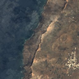
Satellite: Sentinel-2 cloudless 2016 by EOX IT Services GmbH · CC BY 4.0 · Contains modified Copernicus Sentinel data 2016
Peñas del Chache
Photo: Frank Vincentz · CC BY-SA 3.0 · Wikimedia Commons
Peñas del ChacheReport this photo · linked, not stored
Peñas del Chache
Famara
Photo: Dguendel · CC BY 3.0 · Wikimedia Commons
FamaraReport this photo · linked, not stored
Famara
Monte Corona
Photo: Chrumps · CC BY-SA 4.0 · Wikimedia Commons
Monte CoronaReport this photo · linked, not stored
Monte Corona
Montaña Tamia
Photo: Patrice78500 · CC BY-SA 4.0 · Wikimedia Commons
Montaña TamiaReport this photo · linked, not stored
Montaña Tamia
BeachCaleta de Sebo, Canary Islands

El Risco

BeachBest Apr · Jun–Jul
Elevation–above sea level
Sea, warmest23°CSeptember
Nearest townCaleta de Sebo2.1 km
29.21° N, 13.50° WUTC+0 · Western European Standard Time
When to goCaleta de Sebo · weather score
JanFebMarAprMayJunJulAugSepOctNovDec89October
Best timeApr · Jun–Jul
October: high / low26° / 19°
Beach

El Risco in brief

El Risco is a beach in Caleta de Sebo, Canary Islands, Spain.

The nearest town is Caleta de Sebo, 2.1 km to the N, where the weather is best in April, June and July.

The sea is warmest in September, at about 23°C.

Caleta de Sebo: weather and travel guide

Weather nearby now

Forecast for Caleta de Sebo
25°
Cloudy now
Wind15 km/h
Humidity76%
Cloud cover61%
Today
27 Oct
28°
21°
Wed
28 Oct
27°
20°
Thu
29 Oct
26°
20°
Fri
30 Oct
26°
19°
Sat
31 Oct
26°
19°

Model run 00:00 UTCRefreshed several times a day

Sea and air through the year

Sea surface temperature off the coast and the average daily high in Caleta de Sebo, month by month.
Jan19°20°
Feb18°20°
Mar18°21°
Apr19°22°
May20°23°
Jun21°24°
Jul22°25°
Aug22°26°
Sep23°26°
Oct23°26°
Nov22°24°
Dec20°21°
seaair, daily high
When to go

The best months around El Risco

Climate of Caleta de Sebo

Month score in Caleta de Sebo

Comfort, dry days and sunshine · out of 100
93
Jan
92
Feb
94
Mar
97
Apr
97
May
100
Jun
98
Jul
93
Aug
94
Sep
89
Oct
89
Nov
92
Dec
Map

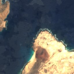
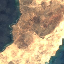
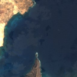
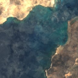
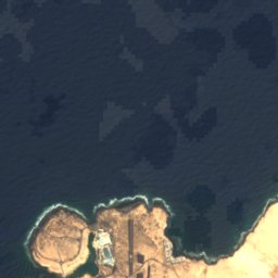
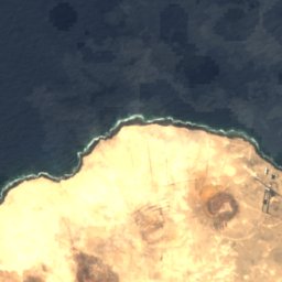
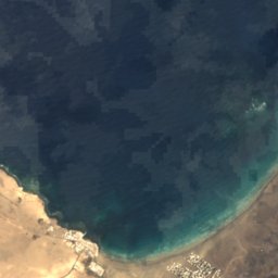
El Risco from above

Nature nearbyAll of Spain
Satellite: Sentinel-2 cloudless 2016 by EOX IT Services GmbH · CC BY 4.0 · Contains modified Copernicus Sentinel data 2016
El EmbarcaderoBeach1.4 kmSWEl Embarcadero
Satellite: Sentinel-2 cloudless 2016 by EOX IT Services GmbH · CC BY 4.0 · Contains modified Copernicus Sentinel data 2016
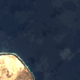
La LajaBeach1.6 kmNWLa Laja
Satellite: Sentinel-2 cloudless 2016 by EOX IT Services GmbH · CC BY 4.0 · Contains modified Copernicus Sentinel data 2016
Caleta del PuertoBeach2.3 kmNCaleta del Puerto
Satellite: Sentinel-2 cloudless 2016 by EOX IT Services GmbH · CC BY 4.0 · Contains modified Copernicus Sentinel data 2016
El SaladoBeach2.6 kmNWEl Salado
Satellite: Sentinel-2 cloudless 2016 by EOX IT Services GmbH · CC BY 4.0 · Contains modified Copernicus Sentinel data 2016
FrancesaBeach3.1 kmWFrancesa
Satellite: Sentinel-2 cloudless 2016 by EOX IT Services GmbH · CC BY 4.0 · Contains modified Copernicus Sentinel data 2016
Caleta de ArribaBeach3.4 kmNCaleta de Arriba
Summits nearbyMountains of Spain
Photo: Frank Vincentz · CC BY-SA 3.0 · Wikimedia CommonsReport this photo · linked, not stored
Peñas del Chache11 km S672 mJuly 26°Peñas del Chache
Photo: Dguendel · CC BY 3.0 · Wikimedia CommonsReport this photo · linked, not stored
Famara10 km S671 mJuly 25°Famara
Photo: Chrumps · CC BY-SA 4.0 · Wikimedia CommonsReport this photo · linked, not stored
Monte Corona3.4 km S609 mJuly 26°Monte Corona
Photo: Patrice78500 · CC BY-SA 4.0 · Wikimedia CommonsReport this photo · linked, not stored
Montaña Tamia24 km SW550 mJuly 25°Montaña Tamia
Photo: Patrice78500 · CC BY-SA 4.0 · Wikimedia CommonsReport this photo · linked, not stored
Montaña Tinache25 km SW448 mJuly 25°Montaña Tinache
Photo: Patrice78500 · CC BY-SA 4.0 · Wikimedia CommonsReport this photo · linked, not stored
Montaña Timbaiba22 km SW340 mJuly 25°Montaña Timbaiba
Stay nearby

Towns close by

Caleta de Sebo
Photo: Marc Ryckaert · CC BY 3.0 · Wikimedia CommonsReport this photo · linked, not stored

Caleta de Sebo

Canary Islands · 2.1 km N
26°Oct high
3wet days
89score
Caleta de Sebo
Yé
Photo: Frank Vincentz · CC BY-SA 3.0 · Wikimedia CommonsReport this photo · linked, not stored

Yé

Canary Islands · 2.9 km SE
24°Oct high
3wet days
92score
Yé
Guinate
Photo: Patrice78500 · CC BY-SA 4.0 · Wikimedia CommonsReport this photo · linked, not stored

Guinate

Canary Islands · 3.6 km S
25°Oct high
3wet days
92score
Guinate
Órzola
Photo: Michiel1972 · CC BY-SA 3.0 · Wikimedia CommonsReport this photo · linked, not stored

Órzola

Canary Islands · 4.4 km E
26°Oct high
3wet days
90score
Órzola
Around here

Caleta de Sebo and around

Caleta de Sebo
Photo: Marc Ryckaert · CC BY 3.0 · Wikimedia CommonsReport this photo · linked, not stored

Caleta de Sebo

Canary Islands · Spain
Apr · Jun–Julbest months
25°July high
11 maltitude
Caleta de Sebo

Nature

Cueva de los Verdes
Photo: Lviatour · CC BY-SA 3.0 · Wikimedia CommonsReport this photo · linked, not stored
10 km SE

Cueva de los Verdes

Cave
Cueva de los Verdes
Jameos del Agua
Photo: Frank Vincentz · CC BY-SA 3.0 · Wikimedia CommonsReport this photo · linked, not stored
11 km SE

Jameos del Agua

Cave
Jameos del Agua
Las Cuevas De Maquez
Photo: Ceever · CC BY-SA 4.0 · Wikimedia CommonsReport this photo · linked, not stored
8.2 km SE

Las Cuevas De Maquez

Cave
Las Cuevas De Maquez

Mountains

Peñas del Chache
Photo: Frank Vincentz · CC BY-SA 3.0 · Wikimedia CommonsReport this photo · linked, not stored
13 km S

Peñas del Chache

672 m · Famara
Peñas del Chache
Famara
Photo: Dguendel · CC BY 3.0 · Wikimedia CommonsReport this photo · linked, not stored
12 km S

Famara

671 m
Famara
Monte Corona
Photo: Chrumps · CC BY-SA 4.0 · Wikimedia CommonsReport this photo · linked, not stored
5.5 km S

Monte Corona

609 m
Monte Corona

Museums

Mirador del Río
Photo: H. Zell · CC BY-SA 3.0 · Wikimedia CommonsReport this photo · linked, not stored
2.9 km SE

Mirador del Río

Visitor center · 1973
Mirador del Río
Satellite: Sentinel-2 cloudless 2016 by EOX IT Services GmbH · CC BY 4.0 · Contains modified Copernicus Sentinel data 2016
under 100 m E

Chinijo Museum

Chinijo Museum
Casa-Museo César Manrique
Photo: MiguelAlanCS · CC BY-SA 4.0 · Wikimedia CommonsReport this photo · linked, not stored
10 km S

Casa-Museo César Manrique

Historic house museum
Casa-Museo César Manrique