Skip to content
Destinations
Weather & climate
Nature
Outdoors
Culture
Events
Sky & live
Goûter Refuge
Photo: Coronium · CC BY-SA 3.0 · Wikimedia Commons
Goûter RefugeReport this photo · linked, not stored
Bourgeat Glacier
Photo: Florian Pépellin · CC BY-SA 4.0 · Wikimedia Commons
Bourgeat GlacierReport this photo · linked, not stored
Bourgeat Glacier
Griaz Glacier
Photo: Rémih · CC BY-SA 4.0 · Wikimedia Commons
Griaz GlacierReport this photo · linked, not stored
Griaz Glacier
Tête Rousse Glacier
Photo: Rémih · CC BY-SA 4.0 · Wikimedia Commons
Tête Rousse GlacierReport this photo · linked, not stored
Tête Rousse Glacier
Tête Rousse Hut
Photo: original : Oxensepp (talk) modification : O.Taris · CC BY-SA 3.0 · Wikimedia Commons
Tête Rousse HutReport this photo · linked, not stored
Tête Rousse Hut
Mountain hutLes Houches, Auvergne-Rhône-Alpes

Goûter Refuge

Mountain hut3,835 m elevationBest Jul–Sep
Elevation3,835 mabove sea level
Area–surface
Nearest townLes Houches4.7 km
45.85° N, 6.83° EElevation 3,835 mUTC+2 · Central European Summer Time
When to goLes Houches · weather score
JanFebMarAprMayJunJulAugSepOctNovDec50October
Best timeJul–Sep
October: high / low15° / 5°
Mountain hut

Goûter Refuge in brief

Goûter Refuge is a mountain hut in Les Houches, Auvergne-Rhône-Alpes, France — mountain refuge in the French department of Haute-Savoie.

It lies at 3,835 m above sea level.

The nearest town in the atlas is Les Houches, 4.7 km to the NW, where the weather is best in July, August and September.

Les Houches: weather and travel guide

Weather nearby now

Forecast for Les Houches
11°
Cloudy now
Wind1 km/h
Humidity50%
Cloud cover91%
Today
22 Oct
11°
1°
Fri
23 Oct
10°
4°
12 mm
Sat
24 Oct
7°
3°
16 mm
Sun
25 Oct
11°
5°
22 mm
Mon
26 Oct
15°
2°

Model run 00:00 UTCRefreshed several times a day

When to go

The best months around Goûter Refuge

Climate of Les Houches

Month score in Les Houches

Comfort, dry days and sunshine · out of 100
26
Jan
29
Feb
23
Mar
41
Apr
61
May
64
Jun
66
Jul
65
Aug
67
Sep
50
Oct
23
Nov
23
Dec
Map

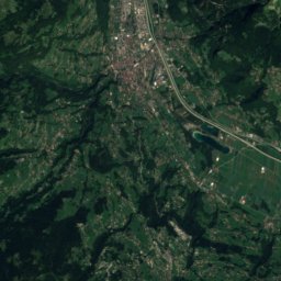
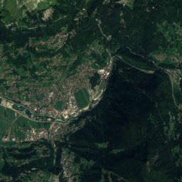
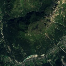
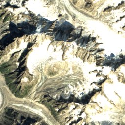
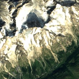
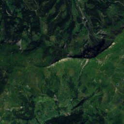
Goûter Refuge from above

Nature nearbyAll of France
Photo: Florian Pépellin · CC BY-SA 4.0 · Wikimedia CommonsReport this photo · linked, not stored
Bourgeat GlacierGlacier0.4 kmNBourgeat Glacier
Photo: Rémih · CC BY-SA 4.0 · Wikimedia CommonsReport this photo · linked, not stored
Griaz GlacierGlacier0.7 kmNWGriaz Glacier
Photo: Rémih · CC BY-SA 4.0 · Wikimedia CommonsReport this photo · linked, not stored
Tête Rousse GlacierGlacier0.9 kmWTête Rousse Glacier
Photo: original : Oxensepp (talk) modification : O.Taris · CC BY-SA 3.0 · Wikimedia CommonsReport this photo · linked, not stored
Tête Rousse HutMountain hut1.0 kmWTête Rousse Hut
Photo: f.corageoud · CC BY-SA 3.0 · Wikimedia CommonsReport this photo · linked, not stored
Glacier de TaconnazGlacier2.0 kmNEGlacier de Taconnaz
Photo: Rémih · CC BY-SA 4.0 · Wikimedia CommonsReport this photo · linked, not stored
Refuge du Nid d'AigleMountain hut2.4 kmWRefuge du Nid d'Aigle
Summits nearbyMountains of France
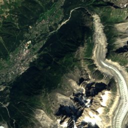
Satellite: Sentinel-2 cloudless 2016 by EOX IT Services GmbH · CC BY 4.0 · Contains modified Copernicus Sentinel data 2016
Central Pillar of Frêney4.2 km SE4,810 mJuly -1°Central Pillar of Frêney
Photo: Christian David · CC BY-SA 4.0 · Wikimedia CommonsReport this photo · linked, not stored
Mont Blanc3.5 km SE4,806 mJuly 0°Mont Blanc
Photo: Franco56 · CC BY-SA 3.0 · Wikimedia CommonsReport this photo · linked, not stored
rocher de la Tournette3.2 km SE4,677 mJuly 0°rocher de la Tournette
Photo: This file is not in the public domain. Therefore you are requested to use the fo · CC BY-SA 3.0 · Wikimedia CommonsReport this photo · linked, not stored
Petite Bosse2.7 km SE4,547 mJuly 1°Petite Bosse
Photo: Rémih · CC BY-SA 4.0 · Wikimedia CommonsReport this photo · linked, not stored
les Bosses2.9 km SE4,547 mJuly 1°les Bosses
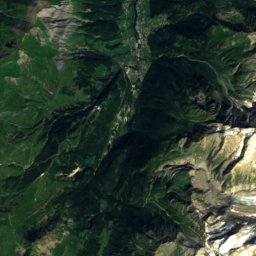
Satellite: Sentinel-2 cloudless 2016 by EOX IT Services GmbH · CC BY 4.0 · Contains modified Copernicus Sentinel data 2016
Grande Bosse2.8 km SE4,510 mJuly 1°Grande Bosse
Stay nearby

Towns close by

Les Houches
Photo: Tiia Monto · CC BY-SA 3.0 · Wikimedia CommonsReport this photo · linked, not stored

Les Houches

Auvergne-Rhône-Alpes · 4.7 km NW
15°Oct high
12wet days
50score
Les Houches
Chamonix-Mont-Blanc
Photo: Tiia Monto · CC BY-SA 3.0 · Wikimedia CommonsReport this photo · linked, not stored

Chamonix-Mont-Blanc

Auvergne-Rhône-Alpes · 8.4 km N
14°Oct high
12wet days
49score
Chamonix-Mont-Blanc
Les Contamines-Montjoie
Photo: Guilhem Vellut from Annecy, France · CC BY 2.0 · Wikimedia CommonsReport this photo · linked, not stored

Les Contamines-Montjoie

Auvergne-Rhône-Alpes · 8.6 km SW
13°Oct high
12wet days
44score
Les Contamines-Montjoie
Saint-Gervais-les-Bains
Photo: Jean-Pol GRANDMONT · CC BY 3.0 · Wikimedia CommonsReport this photo · linked, not stored

Saint-Gervais-les-Bains

Auvergne-Rhône-Alpes · 9.7 km NW
14°Oct high
12wet days
47score
Saint-Gervais-les-Bains
Around here

Les Houches and around

Les Houches
Photo: Tiia Monto · CC BY-SA 3.0 · Wikimedia CommonsReport this photo · linked, not stored

Les Houches

Auvergne-Rhône-Alpes · France
Jul–Sepbest months
24°July high
1,038 maltitude
Les Houches

Nature

Bossons Glacier
Photo: Daniel*D · CC BY-SA 3.0 · Wikimedia CommonsReport this photo · linked, not stored
4.8 km E

Bossons Glacier

Glacier
Bossons Glacier
Miage Glacier
Photo: SNappa2006 (https://www.flickr.com/people/snappa2006/) · CC BY 2.0 · Wikimedia CommonsReport this photo · linked, not stored
10 km S

Miage Glacier

Glacier
Miage Glacier
Glacier de la Brenva
Photo: Hagai Agmon-Snir حچاي اچمون-سنير חגי אגמון-שניר · CC BY-SA 4.0 · Wikimedia CommonsReport this photo · linked, not stored
10 km SE

Glacier de la Brenva

Glacier
Glacier de la Brenva

Mountains

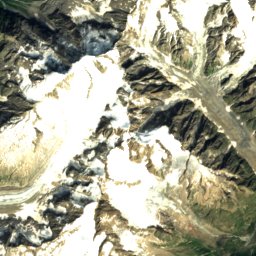
Satellite: Sentinel-2 cloudless 2016 by EOX IT Services GmbH · CC BY 4.0 · Contains modified Copernicus Sentinel data 2016
8.7 km SE

Central Pillar of Frêney

4,810 m
Central Pillar of Frêney
Mont Blanc
Photo: Christian David · CC BY-SA 4.0 · Wikimedia CommonsReport this photo · linked, not stored
8.1 km SE

Mont Blanc

4,806 m · Mont Blanc massif
Mont Blanc
rocher de la Tournette
Photo: Franco56 · CC BY-SA 3.0 · Wikimedia CommonsReport this photo · linked, not stored
7.8 km SE

rocher de la Tournette

4,677 m · Mont Blanc massif
rocher de la Tournette

Heritage

Statue of Christ the King
Photo: Christian David · CC BY-SA 4.0 · Wikimedia CommonsReport this photo · linked, not stored
1.2 km N

Statue of Christ the King

monument historique inscrit · 1934
Statue of Christ the King
Église Notre-Dame de Toute Grâce du Plateau d'Assy
Photo: Henk Monster · CC BY 3.0 · Wikimedia CommonsReport this photo · linked, not stored
9.1 km NW

Église Notre-Dame de Toute Grâce du Plateau d'Assy

Patrimoine du XXᵉ siècle · 1946
Église Notre-Dame de Toute Grâce du Plateau d'Assy
Église Saint-Gervais de Saint-Gervais-les-Bains
Photo: Jean-Pol GRANDMONT · CC BY 3.0 · Wikimedia CommonsReport this photo · linked, not stored
7.4 km W

Église Saint-Gervais de Saint-Gervais-les-Bains

classified historical monument · 1698
Église Saint-Gervais de Saint-Gervais-les-Bains

Museums

Mont Blanc Tramway
Photo: Florian Pépellin · CC BY-SA 4.0 · Wikimedia CommonsReport this photo · linked, not stored
7.4 km W

Mont Blanc Tramway

Heritage railway · 1913
Mont Blanc Tramway
Chemin de fer du Montenvers
Photo: Tiia Monto · CC BY-SA 3.0 · Wikimedia CommonsReport this photo · linked, not stored
6.3 km NE

Chemin de fer du Montenvers

Heritage railway · 1909
Chemin de fer du Montenvers
Petit Train du Parc Thermal
Photo: Rémih · CC BY-SA 4.0 · Wikimedia CommonsReport this photo · linked, not stored
7.8 km W

Petit Train du Parc Thermal

Heritage railway
Petit Train du Parc Thermal