Skip to content
Destinations
Weather & climate
Nature
Outdoors
Culture
Events
Sky & live
Venter Ache
Photo: Mikmaq · CC BY 3.0 · Wikimedia Commons
Venter AcheReport this photo · linked, not stored
Gurgler Ache
Photo: Ailura, CC BY-SA 3.0 AT · CC BY-SA 3.0 at · Wikimedia Commons
Gurgler AcheReport this photo · linked, not stored
Gurgler Ache
Ötztaler Ache
Photo: I, Tubantia · CC BY-SA 3.0 · Wikimedia Commons
Ötztaler AcheReport this photo · linked, not stored
Ötztaler Ache
Brunnenkogelhaus
Photo: Steffen 962 · CC BY-SA 3.0 · Wikimedia Commons
BrunnenkogelhausReport this photo · linked, not stored
Brunnenkogelhaus
Gaislacher See
Photo: Gordon from Deutschland · CC BY 2.0 · Wikimedia Commons
Gaislacher SeeReport this photo · linked, not stored
Gaislacher See
RiverSölden, Tyrol

Venter Ache

RiverBest Jun–Aug
Elevation–above sea level
Length14 kmsource to mouth
Nearest townSölden3.7 km
46.94° N, 11.03° EUTC+2 · Central European Summer Time
When to goSölden · weather score
JanFebMarAprMayJunJulAugSepOctNovDec29October
Best timeJun–Aug
October: high / low11° / 2°
River

Venter Ache in brief

Venter Ache is a river in Sölden, Tyrol, Austria.

The nearest town in the atlas is Sölden, 3.7 km to the NW, where the weather is best in June, July and August.

Venter Ache is 14 km long.

Sölden: weather and travel guide

Weather nearby now

Forecast for Sölden
2°
Sunny now
Wind1 km/h
Humidity51%
Cloud cover5%
Today
22 Oct
4°
-4°
1 mm
Fri
23 Oct
7°
-1°
2 mm
Sat
24 Oct
1°
-7°
2 mm
Sun
25 Oct
10°
-2°
7 mm
Mon
26 Oct
10°
-2°

Model run 00:00 UTCRefreshed several times a day

The course of the river

As mapped in OpenStreetMap, with the towns of the atlas along its banks.
sourcemouth (or where the mapped line leaves the country)
When to go

The best months around Venter Ache

Climate of Sölden

Month score in Sölden

Comfort, dry days and sunshine · out of 100
24
Jan
26
Feb
20
Mar
21
Apr
44
May
62
Jun
64
Jul
62
Aug
51
Sep
29
Oct
22
Nov
23
Dec
Map

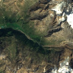
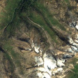
Venter Ache from above

Nature nearbyAll of Austria
Photo: Ailura, CC BY-SA 3.0 AT · CC BY-SA 3.0 at · Wikimedia CommonsReport this photo · linked, not stored
Gurgler AcheRiverunder 100 mNGurgler Ache
Photo: I, Tubantia · CC BY-SA 3.0 · Wikimedia CommonsReport this photo · linked, not stored
Ötztaler AcheRiverunder 100 mNÖtztaler Ache
Photo: Steffen 962 · CC BY-SA 3.0 · Wikimedia CommonsReport this photo · linked, not stored
BrunnenkogelhausMountain hut2.0 kmNEBrunnenkogelhaus
Photo: Gordon from Deutschland · CC BY 2.0 · Wikimedia CommonsReport this photo · linked, not stored
Gaislacher SeeLake4.5 kmWGaislacher See
Photo: Doronenko · CC BY-SA 4.0 · Wikimedia CommonsReport this photo · linked, not stored
LaubkarseeLake4.9 kmNLaubkarsee
Photo: Tiia Monto · CC BY 4.0 · Wikimedia CommonsReport this photo · linked, not stored
Seekarsee, TyrolLake5.0 kmNESeekarsee, Tyrol
Summits nearbyMountains of Austria
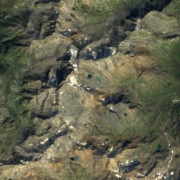
Photo: Pirmin Olde Weghuis · CC BY-SA 3.0 · Wikimedia CommonsReport this photo · linked, not stored
Wildspitze13 km SW3,768 mJuly 5°Wildspitze
Photo: Svíčková · CC BY-SA 3.0 · Wikimedia CommonsReport this photo · linked, not stored
Hinterer Brochkogel15 km SW3,628 mJuly 5°Hinterer Brochkogel
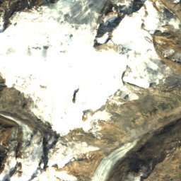
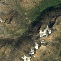
Satellite: Sentinel-2 cloudless 2016 by EOX IT Services GmbH · CC BY 4.0 · Contains modified Copernicus Sentinel data 2016
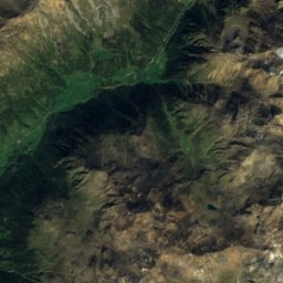
Hintere Schwärze20 km SW3,624 mJuly 5°Hintere Schwärze
Satellite: Sentinel-2 cloudless 2016 by EOX IT Services GmbH · CC BY 4.0 · Contains modified Copernicus Sentinel data 2016
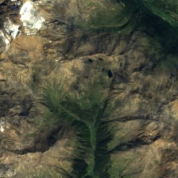
Similaun22 km SW3,597 mJuly 5°Similaun
Photo: Doronenko · CC BY-SA 4.0 · Wikimedia CommonsReport this photo · linked, not stored
Vorderer Brochkogel15 km SW3,565 mJuly 6°Vorderer Brochkogel
Photo: Dschanz · CC BY-SA 3.0 · Wikimedia CommonsReport this photo · linked, not stored
Ötztaler Urkund13 km SW3,556 mJuly 6°Ötztaler Urkund
Stay nearby

Towns close by

Sölden
Photo: Anton-kurt · CC BY-SA 3.0 · Wikimedia CommonsReport this photo · linked, not stored

Sölden

Tyrol · 3.7 km NW
11°Oct high
13wet days
29score
Sölden
Obergurgl
Photo: Suppengrün · Public domain · Wikimedia CommonsReport this photo · linked, not stored

Obergurgl

Tyrol · 8.0 km S
9°Oct high
13wet days
21score
Obergurgl
Längenfeld
Photo: Hans Georg Zach · CC BY-SA 3.0 at · Wikimedia CommonsReport this photo · linked, not stored

Längenfeld

Tyrol · 16 km N
13°Oct high
12wet days
40score
Längenfeld
Moos in Passeier
Photo: Svíčková · CC BY-SA 3.0 · Wikimedia CommonsReport this photo · linked, not stored

Moos in Passeier

Trentino-Alto Adige · 16 km SE
13°Oct high
13wet days
38score
Moos in Passeier
Around here

Sölden and around

Sölden
Photo: Anton-kurt · CC BY-SA 3.0 · Wikimedia CommonsReport this photo · linked, not stored

Sölden

Tyrol · Austria
Jun–Augbest months
21°July high
1,368 maltitude
Sölden

Nature

Ötztaler Ache
Photo: I, Tubantia · CC BY-SA 3.0 · Wikimedia CommonsReport this photo · linked, not stored
3.7 km SE

Ötztaler Ache

River
Ötztaler Ache
Rettenbach glacier
Photo: Steffen 962 · CC BY-SA 4.0 · Wikimedia CommonsReport this photo · linked, not stored
5.9 km SW

Rettenbach glacier

Glacier · 2,671 m
Rettenbach glacier
Rifflsee
Photo: Tiia Monto · CC BY 4.0 · Wikimedia CommonsReport this photo · linked, not stored
12 km W

Rifflsee

Lake · 2,232 m
Rifflsee

Mountains

Wildspitze
Photo: Pirmin Olde Weghuis · CC BY-SA 3.0 · Wikimedia CommonsReport this photo · linked, not stored
14 km SW

Wildspitze

3,768 m · Weißkamm
Wildspitze
Weißkugel
Photo: Cactus26 · CC BY-SA 3.0 · Wikimedia CommonsReport this photo · linked, not stored
28 km SW

Weißkugel

3,738 m · Weißkamm
Weißkugel
Hinterer Brochkogel
Photo: Svíčková · CC BY-SA 3.0 · Wikimedia CommonsReport this photo · linked, not stored
15 km SW

Hinterer Brochkogel

3,628 m · Weißkamm
Hinterer Brochkogel

Heritage

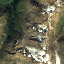
Satellite: Sentinel-2 cloudless 2016 by EOX IT Services GmbH · CC BY 4.0 · Contains modified Copernicus Sentinel data 2016
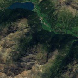
0.6 km E

Mariä Heimsuchung, Sölden

Listed objects in Austria
Mariä Heimsuchung, Sölden
Sankt Katharina (Längenfeld)
Photo: Anton-kurt · CC BY-SA 3.0 · Wikimedia CommonsReport this photo · linked, not stored
12 km N

Sankt Katharina (Längenfeld)

Listed objects in Austria
Sankt Katharina (Längenfeld)
Kropfbühelkirche
Photo: Anton-kurt · CC BY-SA 3.0 · Wikimedia CommonsReport this photo · linked, not stored
12 km N

Kropfbühelkirche

Listed objects in Austria
Kropfbühelkirche

Museums

007 Elements
Photo: Otto Domes · CC BY-SA 4.0 · Wikimedia CommonsReport this photo · linked, not stored
3.7 km SW

007 Elements

2018
007 Elements
Top Mountain Motorcycle Museum
Photo: Asurnipal · CC BY-SA 4.0 · Wikimedia CommonsReport this photo · linked, not stored
7.5 km SE

Top Mountain Motorcycle Museum

2016
Top Mountain Motorcycle Museum
Ötztaler Freilichtmuseum
Photo: Helge Klaus Rieder · CC0 · Wikimedia CommonsReport this photo · linked, not stored
14 km N

Ötztaler Freilichtmuseum

Open-air museum · 1979
Ötztaler Freilichtmuseum