
Photo: Walter Siegmund (talk) · CC BY-SA 3.0 · Wikimedia Commons
Mount RainierReport this photo · linked, not stored
Mount RainierReport this photo · linked, not stored

Photo: Stan Shebs · CC BY-SA 3.0 · Wikimedia Commons
Liberty Cap, ParadiseReport this photo · linked, not stored
Liberty Cap, ParadiseLiberty Cap, ParadiseReport this photo · linked, not stored

Photo: Ron Clausen · CC BY-SA 4.0 · Wikimedia Commons
Little Tahoma PeakReport this photo · linked, not stored
Little Tahoma PeakLittle Tahoma PeakReport this photo · linked, not stored

Photo: Ron Clausen · CC BY-SA 4.0 · Wikimedia Commons
Mount RuthReport this photo · linked, not stored
Mount RuthMount RuthReport this photo · linked, not stored

Photo: Ron Clausen · CC BY-SA 4.0 · Wikimedia Commons
Burroughs MountainReport this photo · linked, not stored
Burroughs MountainBurroughs MountainReport this photo · linked, not stored
Cascade Range · Washington · United StatesSummit weather, forecast and climate
Mount Rainier
Volcano14,400 ftUltra-prominent peakSnow likely Jan–Dec
Elevation14,400 ftabove sea level
Prominence13,222 ftindependent height
Isolation–to a higher summit
Summit, Jul33°average high
46.85° N, 121.76° WElevation 14,400 ftUTC−7 · Pacific Daylight Time
From the valley to the top
- Summit14,400 ft
- Mid-mountain9,908 ft
- Valley · Paradise5,427 ft
Freezing level in October: 7,710 ft
iThe mountain
Mount Rainier in brief
Mount Rainier rises to 14,400 ft in the Cascade Range, Washington, United States. Its topographic prominence — the height it stands above the lowest contour enclosing a higher summit — is 13,222 ft, which makes it an ultra-prominent peak.
At the summit, August is the mildest month with average highs of 34°, while nights stay below freezing all year. Daytime highs climb above zero from July to August.
The nearest town in the atlas is Paradise, 4.7 mi to the S at 5,427 ft.
Facts
- Elevation
- 14,400 ft
- Prominence
- 13,222 ft
- Range
- Cascade Range
- Region
- Washington
- Country
- United States
- Coordinates
- 46.8517, -121.7603
- Nearest airport
- Tacoma Narrows Airport (TIW) · 48 mi
iiForecast
Weather at three heights
Temperatures are adjusted to each height; summits are usually colder and windier than the valley forecast suggests.
Loading the latest forecast…
Loading the latest forecast…
Loading the latest forecast…
iiiSummit climate
The top of Mount Rainier by month
Summit temperatures and precipitation
Climate normals for the summit area (~1 km grid), station-adjusted| Month | Jan | Feb | Mar | Apr | May | Jun | Jul | Aug | Sep | Oct | Nov | Dec |
|---|---|---|---|---|---|---|---|---|---|---|---|---|
| Average high | 2° | 2° | 4° | 8° | 15° | 24° | 33° | 34° | 28° | 17° | 4° | 1° |
| Average low | -8° | -10° | -10° | -9° | -3° | 4° | 10° | 11° | 7° | 0° | -8° | -10° |
| Precipitation | 25.6 in | 18.4 in | 18.4 in | 13.0 in | 10.5 in | 8.6 in | 3.3 in | 3.1 in | 7.4 in | 17.6 in | 30.3 in | 26.9 in |
| Cloud cover | 59% | 55% | 56% | 50% | 43% | 33% | 18% | 19% | 24% | 41% | 57% | 58% |
| Daylight | 8h 57 | 10h 20 | 11h 52 | 13h 35 | 15h 03 | 15h 51 | 15h 30 | 14h 14 | 12h 35 | 10h 56 | 9h 23 | 8h 33 |
| Month score | 13 | 15 | 14 | 17 | 20 | 24 | 35 | 36 | 25 | 20 | 14 | 13 |
Snow and freezing level
Average height of the 0 °C level from the summit normals (6.5 °C per km); snow months have a summit mean at or below +1 °C| Month | Jan | Feb | Mar | Apr | May | Jun | Jul | Aug | Sep | Oct | Nov | Dec |
|---|---|---|---|---|---|---|---|---|---|---|---|---|
| Freezing level | 4,593 ft | 4,265 ft | 4,593 ft | 5,249 ft | 7,054 ft | 9,350 ft | 11,483 ft | 11,647 ft | 10,335 ft | 7,710 ft | 4,921 ft | 4,101 ft |
| Summit | ❄ snow | ❄ snow | ❄ snow | ❄ snow | ❄ snow | ❄ snow | ❄ snow | ❄ snow | ❄ snow | ❄ snow | ❄ snow | ❄ snow |
ivTerrain
Mount Rainier in 3D
vNeighbours
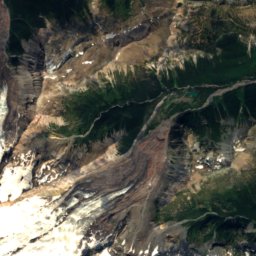
Mountains of the United StatesPeaks nearby
| Mountain | Elevation | Prominence | Distance | July summit high |
|---|---|---|---|---|
| Liberty Cap, Paradise | 14,111 ft | 492 ft | 1.0 mi NW | 35° |
| Little Tahoma Peak | 11,138 ft | 818 ft | 2.3 mi E | 48° |
| Muir Peak | 10,194 ft | 105 ft | 1.8 mi SE | 47° |
| Mount Ruth | 8,690 ft | – | 2.7 mi NE | 54° |
| Observation Rock | 8,337 ft | – | 4.1 mi NW | 54° |
| Echo Rock | 7,854 ft | – | 4.3 mi NW | 54° |
| Burroughs Mountain | 7,828 ft | 388 ft | 4.1 mi NE | 56° |
| Tokaloo Rock | 7,684 ft | – | 3.9 mi W | 56° |
viBase towns
Where to stay nearby

Photo: Walter Siegmund (talk) · CC BY-SA 3.0 · Wikimedia CommonsReport this photo · linked, not stored
Paradise
Washington · 4.7 mi S
45°Oct high
15wet days
16score

Photo: Walter Siegmund (talk) · CC BY-SA 3.0 · Wikimedia CommonsReport this photo · linked, not stored
Packwood
Washington · 17 mi S
62°Oct high
15wet days
55score

Around here
Paradise and around
Photo: Walter Siegmund (talk) · CC BY-SA 3.0 · Wikimedia CommonsReport this photo · linked, not stored
Paradise
Washington · United States
Jul–Sepbest months
61°July high
5,427 ftaltitude
Nature

Photo: Ricardo Martins from Gent, Belgium · CC BY 2.0 · Wikimedia CommonsReport this photo · linked, not stored
Mount Rainier National Park
National park


Mountains
Heritage


Edith Creek Chlorination House
National Register of Historic Places contributing property · 1930

Photo: © Steven Pavlov / http://commons.wikimedia.org/wiki/User:Senapa · CC BY-SA 4.0 · Wikimedia CommonsReport this photo · linked, not stored
Narada Falls Bridge
National Register of Historic Places contributing property · 1927
Museums

Henry M. Jackson Visitor Center
National Park Service visitor center


Photo: © Steven Pavlov / https://commons.wikimedia.org/wiki/User:Senapa · CC BY-SA 4.0 · Wikimedia CommonsReport this photo · linked, not stored

Longmire Administration Building
National Park Service visitor center · 1928