
Photo: Walter Hellebrand at nl.wikipedia · CC BY-SA 3.0 · Wikimedia Commons
The QuillReport this photo · linked, not stored
The QuillReport this photo · linked, not stored

Photo: Earth Science and Remote Sensing Unit, Lyndon B. Johnson Space Center · Public domain · Wikimedia Commons
Mount LiamuigaReport this photo · linked, not stored
Mount LiamuigaMount LiamuigaReport this photo · linked, not stored

Photo: Christine Warner Hawks · CC BY 2.0 · Wikimedia Commons
BovenReport this photo · linked, not stored
BovenBovenReport this photo · linked, not stored
 Bergje
Sint Eustatius · NetherlandsSummit weather, forecast and climate
The Quill
Volcano601 mMajor summit
Elevation601 mabove sea level
Prominence601 mindependent height
Isolation21 kmto a higher summit
Summit, Jul26°average high
17.48° N, 62.96° WElevation 601 mUTC−4 · Atlantic Standard Time
From the valley to the top
- Summit601 m
- Mid-mountain330 m
- Valley · Saint Paul Capisterre59 m
Freezing level in October: above the summit
iThe mountain
The Quill in brief
The Quill rises to 601 m in the Sint Eustatius, Netherlands. Its topographic prominence — the height it stands above the lowest contour enclosing a higher summit — is 601 m, a major independent summit.
At the summit, August is the mildest month with average highs of 26°, while nights rarely fall below freezing.
The nearest town in the atlas is Saint Paul Capisterre, 15 km to the SE at 59 m.
Facts
- Elevation
- 601 m · 1,972 ft
- Prominence
- 601 m
- Range
- Sint Eustatius
- Country
- Netherlands
- Coordinates
- 17.4778, -62.9597
- Nearest airport
- F. D. Roosevelt Airport (EUX) · 2.9 km
iiForecast
Weather at three heights
Temperatures are adjusted to each height; summits are usually colder and windier than the valley forecast suggests.
Loading the latest forecast…
Loading the latest forecast…
Loading the latest forecast…
iiiSummit climate
The top of The Quill by month
Summit temperatures and precipitation
Climate normals for the summit area (~1 km grid), station-adjusted| Month | Jan | Feb | Mar | Apr | May | Jun | Jul | Aug | Sep | Oct | Nov | Dec |
|---|---|---|---|---|---|---|---|---|---|---|---|---|
| Average high | 23° | 23° | 23° | 24° | 25° | 26° | 26° | 26° | 26° | 26° | 25° | 24° |
| Average low | 22° | 22° | 22° | 23° | 24° | 24° | 24° | 25° | 24° | 24° | 24° | 23° |
| Precipitation | 68 mm | 53 mm | 48 mm | 65 mm | 105 mm | 79 mm | 104 mm | 112 mm | 136 mm | 153 mm | 154 mm | 100 mm |
| Cloud cover | 11% | 14% | 14% | 18% | 31% | 33% | 30% | 30% | 38% | 36% | 24% | 15% |
| Daylight | 11h 12 | 11h 35 | 12h 02 | 12h 32 | 12h 57 | 13h 10 | 13h 05 | 12h 43 | 12h 15 | 11h 45 | 11h 19 | 11h 05 |
| Month score | 81 | 85 | 87 | 82 | 71 | 74 | 68 | 65 | 59 | 61 | 67 | 73 |
Snow and freezing level
Average height of the 0 °C level from the summit normals (6.5 °C per km); snow months have a summit mean at or below +1 °C| Month | Jan | Feb | Mar | Apr | May | Jun | Jul | Aug | Sep | Oct | Nov | Dec |
|---|---|---|---|---|---|---|---|---|---|---|---|---|
| Freezing level | 4,100 m | 4,050 m | 4,100 m | 4,200 m | 4,350 m | 4,450 m | 4,450 m | 4,500 m | 4,500 m | 4,450 m | 4,350 m | 4,200 m |
| Summit | above 0 °C | above 0 °C | above 0 °C | above 0 °C | above 0 °C | above 0 °C | above 0 °C | above 0 °C | above 0 °C | above 0 °C | above 0 °C | above 0 °C |
ivTerrain
The Quill in 3D
vNeighbours
Mountains of the NetherlandsPeaks nearby
| Mountain | Elevation | Prominence | Distance | July summit high |
|---|---|---|---|---|
| Mount Liamuiga | 1,156 m | 1,156 m | 21 km SE | 25° |
| Boven | 296 m | 230 m | 6.0 km NW | 28° |
| Bergje | 73 m | – | 3.5 km NW | 28° |
viBase towns
Where to stay nearby




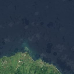



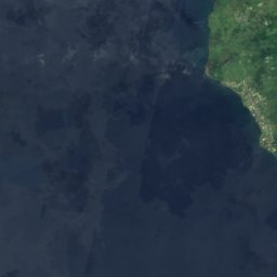
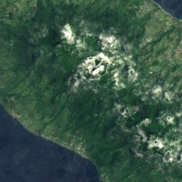
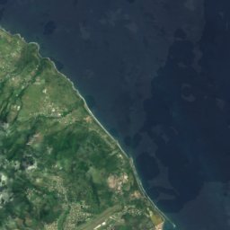
Satellite: Sentinel-2 cloudless 2016 by EOX IT Services GmbH · CC BY 4.0 · Contains modified Copernicus Sentinel data 2016
Saint Paul Capisterre
Saint Paul Capesterre · 15 km SE
27°Oct high
17wet days
55score


