
Skip to content
Destinations
Weather & climate
Nature
Outdoors
Culture
Events
Sky & live
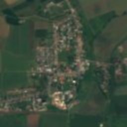
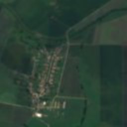
Satellite: Sentinel-2 cloudless 2016 by EOX IT Services GmbH · CC BY 4.0 · Contains modified Copernicus Sentinel data 2016
castleŠirkovce, Banská Bystrica Region

Kapla

cultural heritage of SlovakiaBuilt 1300
TypecastleGothic
Built1300
Best monthsApr–May · Sepweather in Širkovce
48.28° N, 20.07° EUTC+1 · Central European Standard Time
Standing for726 years
built 1300today 2026
When to goŠirkovce · weather score
JanFebMarAprMayJunJulAugSepOctNovDec62October
Best timeApr–May · Sep
October: high / low15° / 5°
iAbout

Kapla in brief

Kapla is a castle in Širkovce, Banská Bystrica Region, Slovakia.

It holds the designation cultural heritage of Slovakia.

The castle dates from 1300 and is built in the Gothic style.

For a visit, the weather in Širkovce is best in April, May and September; in October afternoons average 15°.

Širkovce: weather and travel guide

Facts

Type
castle
Designation
cultural heritage of Slovakia
Built
1300
Style
Gothic
Nearest town
Širkovce
Region
Banská Bystrica Region
Coordinates
48.28410, 20.07140
iiLocation

Where to find it

iiiWhen to visit

Weather in Širkovce

Climate guide

Month score for sightseeing

Best Apr–May · Sep
29
Jan
30
Feb
37
Mar
73
Apr
65
May
65
Jun
57
Jul
64
Aug
76
Sep
62
Oct
29
Nov
27
Dec
Around here

Širkovce and around

Širkovce
Photo: Ladislav Luppa · CC BY-SA 4.0 · Wikimedia CommonsReport this photo · linked, not stored

Širkovce

Banská Bystrica Region · Slovakia
Apr–May · Sepbest months
27°July high
183 maltitude
Širkovce

Nature

Gortva
Photo: Ladislav Luppa · CC BY-SA 4.0 · Wikimedia CommonsReport this photo · linked, not stored
0.9 km NW

Gortva

River
Gortva
Turiec, Banská Bystrica Region
Photo: Ladislav Luppa · CC BY-SA 4.0 · Wikimedia CommonsReport this photo · linked, not stored
21 km NE

Turiec, Banská Bystrica Region

River · 170 m
Turiec, Banská Bystrica Region
Blh
Photo: Szeder László · CC BY-SA 4.0 · Wikimedia CommonsReport this photo · linked, not stored
13 km E

Blh

River · 157 m
Blh

Mountains

Istállós-kő
Photo: Gyurika at Hungarian Wikipedia · CC BY-SA 3.0 · Wikimedia CommonsReport this photo · linked, not stored
35 km SE

Istállós-kő

958 m · Bükk
Istállós-kő
Bálvány
Photo: Pear Blossom · CC BY-SA 3.0 · Wikimedia CommonsReport this photo · linked, not stored
36 km SE

Bálvány

956 m · Bükk
Bálvány
Satellite: Sentinel-2 cloudless 2016 by EOX IT Services GmbH · CC BY 4.0 · Contains modified Copernicus Sentinel data 2016
38 km SE

Tar-kő

949 m · Bükk
Tar-kő

Heritage

Church of Saint John the Baptist (Rimavské Janovce)
Photo: Ľuboš Repta · CC BY-SA 4.0 · Wikimedia CommonsReport this photo · linked, not stored
6.0 km N

Church of Saint John the Baptist (Rimavské Janovce)

Cultural Heritage Monuments of Slovakia · 1200
Church of Saint John the Baptist (Rimavské Janovce)
Evangelical A. C. church (Dúžava)
Photo: Ladislav Luppa · CC BY-SA 4.0 · Wikimedia CommonsReport this photo · linked, not stored
10 km NW

Evangelical A. C. church (Dúžava)

Cultural Heritage Monuments of Slovakia · 1786
Evangelical A. C. church (Dúžava)
Reformed church in Žíp
Photo: Ľuboš Repta · CC BY-SA 4.0 · Wikimedia CommonsReport this photo · linked, not stored
12 km NE

Reformed church in Žíp

Cultural Heritage Monuments of Slovakia · 1500
Reformed church in Žíp

Museums

Gemer-Malohont Museum
Photo: Ladislav Luppa · CC BY-SA 4.0 · Wikimedia CommonsReport this photo · linked, not stored
12 km NW

Gemer-Malohont Museum

Gemer-Malohont Museum