Skip to content
Destinations
Weather & climate
Nature
Outdoors
Culture
Events
Sky & live
Mentone
Photo: Thebusofdoom · CC BY-SA 3.0 · Wikimedia Commons
MentoneReport this photo · linked, not stored
station located on surfaceElsternwick, Victoria

Mentone

listed on the Victorian Heritage Register
Typestation located on surface
Built–
Best monthsFeb–Aprweather in Elsternwick
37.98° S, 145.07° EUTC+11 · Australian Eastern Daylight Time
When to goElsternwick · weather score
JanFebMarAprMayJunJulAugSepOctNovDec63October
Best timeFeb–Apr
October: high / low17° / 11°
iAbout

Mentone in brief

Mentone is a station located on surface in Elsternwick, Victoria, Australia.

It holds the designation listed on the Victorian Heritage Register.

For a visit, the weather in Elsternwick is best in February, March and April; in October afternoons average 17°.

Elsternwick: weather and travel guide

Facts

Type
station located on surface
Designation
listed on the Victorian Heritage Register
Nearest town
Elsternwick
Region
Victoria
Coordinates
-37.98200, 145.06520
iiLocation

Where to find it

iiiWhen to visit

Weather in Elsternwick

Climate guide

Month score for sightseeing

Best Feb–Apr
76
Jan
86
Feb
80
Mar
77
Apr
61
May
40
Jun
36
Jul
45
Aug
59
Sep
63
Oct
68
Nov
76
Dec
ivNearby

More heritage close by

All monuments in Australia
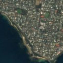
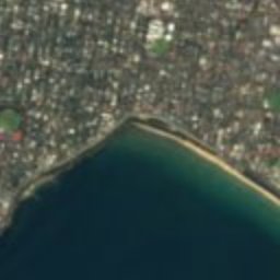
Satellite: Sentinel-2 cloudless 2016 by EOX IT Services GmbH · CC BY 4.0 · Contains modified Copernicus Sentinel data 2016

Black Rock House

4.1 km W
listed on the Victorian Heritage Register
Black Rock House
Around here

Elsternwick and around

Elsternwick
Photo: MusikAnimal · CC BY-SA 4.0 · Wikimedia CommonsReport this photo · linked, not stored

Elsternwick

Victoria · Australia
Feb–Aprbest months
13°July high
22 maltitude
Elsternwick

Nature

Albert Park and Lake
Photo: Donaldytong · Public domain · Wikimedia CommonsReport this photo · linked, not stored
5.3 km NW

Albert Park and Lake

Lake
Albert Park and Lake
Dights Falls
Photo: Michael Schmatz · Public domain · Wikimedia CommonsReport this photo · linked, not stored
9.9 km N

Dights Falls

Waterfall
Dights Falls
Yarra Falls
Photo: Antoine Fauchery / Richard Daintree · Public domain · Wikimedia CommonsReport this photo · linked, not stored
8.1 km N

Yarra Falls

Waterfall
Yarra Falls

Mountains

Mount Dandenong
Photo: Andrew Amos · CC BY-SA 3.0 · Wikimedia CommonsReport this photo · linked, not stored
31 km E

Mount Dandenong

621 m · Dandenong Ranges
Mount Dandenong
Doncaster Hill
Photo: Nick carson at English Wikipedia · Public domain · Wikimedia CommonsReport this photo · linked, not stored
15 km NE

Doncaster Hill

120 m
Doncaster Hill

Heritage

Seccull House
Photo: Rohanstorey · CC BY-SA 4.0 · Wikimedia CommonsReport this photo · linked, not stored
1.6 km SW

Seccull House

listed on the Victorian Heritage Register · 1972
Seccull House
Elsternwick Metropolitan Fire Brigade Station
Photo: Donaldtong at English Wikipedia · Public domain · Wikimedia CommonsReport this photo · linked, not stored
0.3 km N

Elsternwick Metropolitan Fire Brigade Station

listed on the Victorian Heritage Register · 1896
Elsternwick Metropolitan Fire Brigade Station
Kamesburgh
Photo: Donaldytong · CC BY-SA 3.0 · Wikimedia CommonsReport this photo · linked, not stored
1.5 km S

Kamesburgh

listed on the Victorian Heritage Register
Kamesburgh

Museums

Jewish Holocaust Museum and Research Centre
Photo: Beeyan · CC BY-SA 4.0 · Wikimedia CommonsReport this photo · linked, not stored
0.4 km N

Jewish Holocaust Museum and Research Centre

Holocaust museum · 1984
Jewish Holocaust Museum and Research Centre
Jewish Museum of Australia
Photo: Joyofmuseums · CC BY-SA 4.0 · Wikimedia CommonsReport this photo · linked, not stored
3.2 km NW

Jewish Museum of Australia

Jewish museum · 1982
Jewish Museum of Australia
Monash University Museum of Art
Photo: Dariusdl · CC0 · Wikimedia CommonsReport this photo · linked, not stored
4.0 km E

Monash University Museum of Art

Art museum · 2010
Monash University Museum of Art