Skip to content
Destinations
Weather & climate
Nature
Outdoors
Culture
Events
Sky & live
Xochitepec
Xochicalco
Xochicalco
Morelos, Mexico

Xochitepec

Xochitepec is a town in Morelos, Mexico, 1,103 m above sea level. It has a population of about 21,862 (2020). The climate is classified as tropical savanna (Köppen Aw), with .

Now23°C
Best timeJan · Nov–Dec
Population21,862
Local time08:38
18.78° N, 99.23° WElevation 1,103 mUTC−6 · Central Standard Time
The year in Xochitepecweather score
JanFebMarAprMayJunJulAugSepOctNovDec49October
October: high / low29° / 18°
Rain this month64mm
Best timeJan · Nov–Dec

Best: Jan · Nov–Dec. Warmth, sunshine and dry days, month by month.

Xochitepec at a glance

Best time to visitJan · Nov–Dec

The months with the highest weather score

Warmest month34°C

Average high in April

Coolest month14°C

Average low in January

Wettest monthAugust

189 mm of rain

Driest monthDecember

4 mm of rain

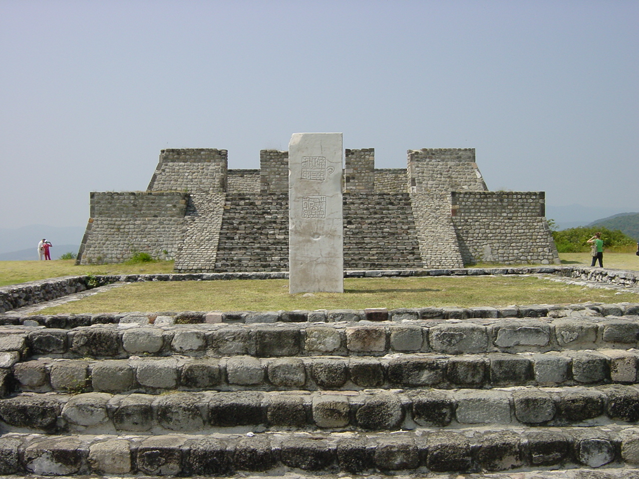
Monuments nearby1+

1 of them World Heritage

Weather in Xochitepec

Now and the next ten days. The 14 and 30-day outlooks are one click away.

14-day forecast
23°C

Sunny · wind 0 km/h · humidity 72%

Today hour by hour
Today22 Oct30°20°7.8 mm
Fri23 Oct27°18°1.5 mm
Sat24 Oct25°19°
Sun25 Oct26°19°
Mon26 Oct29°18°5.8 mm
Tue27 Oct27°18°7.9 mm
Wed28 Oct26°18°2.5 mm
Thu29 Oct25°18°3.4 mm
Fri30 Oct26°18°5.4 mm
Sat31 Oct26°17°13.2 mm

When to go to Xochitepec

Each month's weather score (warmth, sun, dry days) with its temperatures and rain.

Climate month by month
JanFebMarAprMayJunJulAugSepOctNovDec
Score797262423237383844497481
High28°31°33°34°34°30°30°30°29°29°29°28°
Low14°15°16°19°20°20°19°19°19°18°16°14°
Rain (mm)1075125619619218918964124
Wet days323813202527261442

What's on in Xochitepec

Concerts, football matches, the public holidays ahead and the town's festivals through the year.

Monuments and museums in Xochitepec

All monuments

More museums: Centro Cultural Xochitepequense

Outdoors around Xochitepec

Hiking routes from the town, and what there is to do within 15 km: huts, viewpoints, climbing, camping, ski areas and dive sites.

Things to do
Paraíso Country ClubGolf courses
1.2 km
fraccionamiento huertos Agualinda, TlaltizapanMountain huts
1.9 km
Santa Fe Social Golf ClubGolf courses
2.1 km
Olivos Water ParkWater parks
2.1 km

Nature around Xochitepec

Nature in Mexico

Wildlife in October

The birds and mammals of Mexico seen most this month, compared with the rest of their year.

The sky over Xochitepec

Eclipses and meteor showers

Earthquakes around Xochitepec

The last 30 days within 300 km, and the record since 1950.

Earthquakes

Strongest nearby since 1950

7.1San Juan Raboso 6 km ↙2017 · 82 km
6.5Cocula 31 km ↙2011 · 106 km
6.4Acatlán de Osorio 20 km ←1980 · 122 km
6.1Arcelia 11 km ←2012 · 131 km

Towns and villages around Xochitepec

Each with its own page: weather, climate and the best time to visit.

Lauro Ortega Martínez (Rancho la Joya)0.6 kmEl Aguacate [Laboratorio]0.7 kmCampo Canela0.7 kmCampo Huitzilac1 kmUnidad Mariano Matamoros1.1 kmColonia Lázaro Cárdenas1.3 kmCampo San Rafael1.4 kmFrancisco Villa1.6 kmNinguno [Conducciones y Caminos Constructora]1.7 kmPalo Bolero1.7 kmCampo el Bolón1.9 kmEl Paraíso [Trailer Park]2.1 kmLoma el Encanto2.3 kmCamino a la Ventana2.4 kmReal del Puente (El Gallito)2.4 kmEl Vergel2.4 kmLos Estanques2.4 kmCampo Solís2.5 kmChiconcuac2.5 kmCampo la Tehuixtlera2.5 kmSan Joaquín2.6 kmTierra Verde2.6 kmNinguno [Centro de Readaptación Social de Atlacholoaya]2.7 kmEl Pedregal2.7 kmColonia Acoculco (La Cruz)2.7 kmOjo de Agua2.7 kmAmpliación Miguel Hidalgo2.8 kmCarretera a Atlacholoaya2.8 kmUnidad Habitacional General Lázaro Cárdenas [Ingenio Emiliano Zapata]3.1 kmLa Esperanza3.1 kmLa Guamuchilera3.1 kmLa Presa3.1 kmPlan de Tlazala3.1 kmLomas del Manantial3.2 kmColonia Santa Cruz3.2 kmCampo los Tamarindos (Los Cuartos)3.3 kmCampo los Tamarindos3.3 kmLa Glorieta (El Zacatal)3.5 kmColonia Humberto Gutiérrez Corona3.5 kmCampo la Calavera3.6 kmCampo Ameyalco3.6 kmEl Kilómetro 33.7 kmAtzunco3.8 kmLos Regadillos (El Carrizal)3.8 kmColonia las Flores3.8 kmAhitec3.9 kmCampo Casa Grande3.9 kmCampo el Burro4 kmCampo la Leona4.1 kmSan Francisco4.2 kmAtlacholoaya4.3 kmLoma Bonita4.3 kmEl Sámano4.3 kmAmpliación el Calvario4.4 kmLoma del Tepehuaje4.4 kmColonia Ampliación 3 de Mayo4.7 kmColonia San José4.7 kmColonia Loma Bonita4.9 kmCoaxcomac5 kmEl Capiri (Las Palmas)5.2 kmLos Frailes (Kilómetro 5.5)5.2 kmAmpliación Cazahuatera5.3 kmFraccionamiento los Laureles5.3 kmLos Laureles (Barranca Ojo de Agua)5.3 kmAlpuyeca5.4 kmUnidad Habitacional José María Morelos y Pavón5.4 kmCerro del Metzontzin5.9 kmLas Palmas5.9 kmFraccionamiento Solares6 kmSanta Fe6 kmEl Crucero (El Kilómetro 100)6.3 kmFraccionamiento Cumbres del Campestre6.5 kmCampo los Olivos6.7 kmAmpliación la Pintora6.8 kmCampo el Corazón6.9 kmColonia la Pintora7.3 kmEl Anacahuite7.7 kmTetlama7.8 km

Xochitepec from above

Getting to Xochitepec

Adolfo López Mateos International AirportTLC
71 km
Mexico City Benito Juárez International AirportMEX
75 km
Hermanos Serdán International AirportPBC
100 km

Places near Xochitepec

Places with a climate like Xochitepec

Matched month by month on temperature, rain and sunshine.

Frequently asked questions

When is the best time to visit Xochitepec?
Based on 30-year climate normals, January, November and December offer the best balance of comfortable temperatures, low rainfall and sunshine in Xochitepec.
What is the hottest month in Xochitepec?
April is the warmest month, with average highs of 34°C and lows of 19°C.
What is the coldest month in Xochitepec?
January is the coldest month, with average highs of 28°C and lows of 14°C.
What is the rainiest month in Xochitepec?
August is the wettest month with about 189 mm of precipitation on 27 wet days.