Skip to content
Destinations
Weather & climate
Nature
Outdoors
Culture
Events
Sky & live
Celaya
Guanajuato, Mexico

Celaya

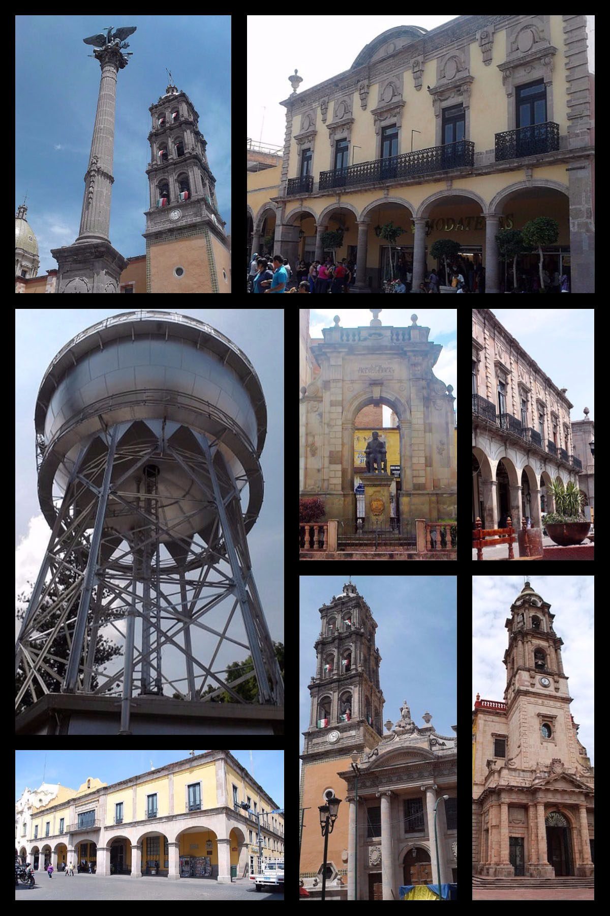
Celaya is a city in Guanajuato, Mexico, 1,766 m above sea level. It has a population of about 378,143 (2020). The climate is classified as hot semi-arid (Köppen BSh), with little rain, large day–night swings and strong sunshine.

Now21°C
Best timeJan · Nov–Dec
Population378,143
Local time08:36
20.52° N, 100.81° WElevation 1,766 mUTC−6 · Central Standard Time
Postal codes38033–38034, 38037 …
The year in Celayaweather score
JanFebMarAprMayJunJulAugSepOctNovDec79October
October: high / low27° / 13°
Rain this month36mm
Best timeJan · Nov–Dec

Best: Jan · Nov–Dec. Warmth, sunshine and dry days, month by month.

Celaya at a glance

Best time to visitJan · Nov–Dec

The months with the highest weather score

Warmest month32°C

Average high in May

Coolest month8°C

Average low in January

Wettest monthJuly

142 mm of rain

Driest monthDecember

5 mm of rain

How Celaya has grown

People living in the built-up area (66 km² today), every five years since 1975; 2030 is the projection.

+530%60k in 1975 → 381k in 2025
75
80
85
90
95
00
05
10
15
20
25
30

Weather in Celaya

Now and the next ten days. The 14 and 30-day outlooks are one click away.

14-day forecast
21°C

Cloudy · wind 18 km/h · humidity 64%

Today hour by hour
Today22 Oct28°15°
Fri23 Oct31°13°
Sat24 Oct28°14°
Sun25 Oct20°15°1.6 mm
Mon26 Oct26°14°1.4 mm
Tue27 Oct23°15°1.2 mm
Wed28 Oct27°15°3.4 mm
Thu29 Oct25°15°10.8 mm
Fri30 Oct24°15°2 mm
Sat31 Oct24°13°1.5 mm

When to go to Celaya

Each month's weather score (warmth, sun, dry days) with its temperatures and rain.

Climate month by month
JanFebMarAprMayJunJulAugSepOctNovDec
Score999180695339384753799395
High24°27°29°31°32°31°31°29°27°27°26°25°
Low8°10°11°14°16°16°14°15°15°13°11°9°
Rain (mm)141261132971421219736105
Wet days1112815191815522

What's on in Celaya

Concerts, football matches, the public holidays ahead and the town's festivals through the year.

Monuments and museums in Celaya

All monuments

More museums: Mumeia · Museo Imaginate la Bola

Outdoors around Celaya

Hiking routes from the town, and what there is to do within 15 km: huts, viewpoints, climbing, camping, ski areas and dive sites.

Club Campestre CelayaGolf courses
3.2 km
Parque Acuatico Agua CalienteWater parks
6.5 km

Nature around Celaya

Nature in Mexico

Wildlife in October

The birds and mammals of Mexico seen most this month, compared with the rest of their year.

The sky over Celaya

Eclipses and meteor showers

Earthquakes around Celaya

The last 30 days within 300 km, and the record since 1950.

Earthquakes

Strongest nearby since 1950

5.3Venta de Bravo 16 km ↖1979 · 83 km
5.1El Caracol 29 km ↙1976 · 129 km
5.0Venta de Bravo 8 km ↖1979 · 91 km

Tropical storms · Celaya

Tropical storm archive

Universities and research institutes

Technological Institute of CelayaUniversity or college · founded 1958
Universidad Latina de MéxicoUniversity or college · founded 1975
University of CelayaUniversity or college · founded 1988
Universidad BenaventeUniversity or college
University of Guanajuato, Celaya-Salvatierra CampusUniversity or college
Universidad del Centro del BajíoUniversity or college

Towns and villages around Celaya

Each with its own page: weather, climate and the best time to visit.

Miguel Ángel Rodríguez (Colonia Santa Isabel)2.2 kmSan Nicolás2.4 kmMonte Blanco3 kmCaja la Recibidora3 kmGranja los Arreguines (La Recibidora)3.3 kmLos Arreguines3.3 kmMuñiz3.4 kmLa Cano3.4 kmJesús Sánchez3.4 kmLos Albañiles (Ejido Santa María del Refugio)3.4 kmLos Ramírez3.6 kmLos Cármenes3.7 kmCliserio Albañil Mancera3.7 kmRancho los Ramírez (Los Centeno)3.7 kmGranja el Monte [Fábrica de Muelles]3.8 kmCampo Azul3.9 kmLucero del Río3.9 kmCaja los Rodríguez3.9 kmSantiago de la Cruz3.9 kmSan Martín de Camargo4 kmRancho Moralitos4.1 kmSan Isidro de Trojes4.1 kmCaja los Atravesaños4.2 kmSalvador Medina4.2 kmSan Judas4.2 kmEl Cajón (La Pomona)4.2 kmQuinta los Leones4.3 kmSan José de Silva4.3 kmSanta Lucía4.3 kmFracción el Cajón4.3 kmEl Romeral4.3 kmLa Cuchilla4.4 kmLa Mora4.4 kmLas Jacarandas4.4 kmCuarta Fracción Ex-Hacienda de Silva4.4 kmRaymundo Verde4.5 kmEl Bordo4.5 kmHeladio Aguilar4.6 kmLa Guayaba4.6 kmEx-Hacienda de Trojes4.6 kmPuerta Nueva4.6 kmEl Carrizo4.6 kmEl Mezquite Gordo4.7 kmRancho el Roble4.7 kmEl Magueyal4.7 kmPalace4.8 kmDon Gu4.8 kmMichinelas4.8 kmLos Cucús4.9 kmPozo Don Amador4.9 kmEl Becerro4.9 kmCaja San Miguel4.9 kmRaúl Granados González [Balneario]4.9 kmFraccionamiento San Lorenzo4.9 kmColonia Benito Juárez5 kmGranja los Ángeles5 kmPrimera Fracción de Crespo5 kmEl Alto5 kmSenda Real5 kmLos Prieto5.1 kmLa Tarasca5.1 kmFraccionamiento Parque Tabachines5.1 kmSerafín Rivera5.1 kmLas Albercas5.1 kmColonia los Pirules de Trojes5.1 kmCanal de Labradores5.2 kmLos Martínez (Los Pinos)5.2 kmEl Colorado5.2 kmValle de los Reyes5.2 kmSantos Degollado5.2 kmLa Retama5.2 kmCinco Barones5.3 kmNúmero 62 [Granja Avícola]5.3 kmEjido de Silva5.3 kmEl Rocío5.4 kmJuan Raúl Macías5.4 kmJesús Barroso (Santa Teresita)5.4 kmLa Laja5.4 kmEstrada5.4 kmLombardía5.5 km

Celaya from above

Postal codes

38033–380343803738040

Getting to Celaya

Querétaro Intercontinental AirportQRO
66 km
General Francisco J. Mujica International AirportMLM
78 km
Guanajuato International AirportBJX
87 km

Places near Celaya

Places with a climate like Celaya

Matched month by month on temperature, rain and sunshine.

Frequently asked questions

When is the best time to visit Celaya?
Based on 30-year climate normals, January, November and December offer the best balance of comfortable temperatures, low rainfall and sunshine in Celaya.
What is the hottest month in Celaya?
May is the warmest month, with average highs of 32°C and lows of 16°C.
What is the coldest month in Celaya?
January is the coldest month, with average highs of 24°C and lows of 8°C.
What is the rainiest month in Celaya?
July is the wettest month with about 142 mm of precipitation on 19 wet days.
What is the postal code of Celaya?
Celaya has 4 postal codes: 38033–38034, 38037, 38040.