Skip to content
Destinations
Weather & climate
Nature
Outdoors
Culture
Events
Sky & live
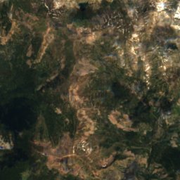
Satellite: Sentinel-2 cloudless 2016 by EOX IT Services GmbH · CC BY 4.0 · Contains modified Copernicus Sentinel data 2016
SkiingVail, Colorado

Vail

Ski area221 km
Pistes221 kmdownhill
Lifts33in the area
Snow season–
Nearest townVail3.4 mi
39.60° N, 106.34° WUTC−6 · Mountain Daylight Time
When to goVail · weather score
JanFebMarAprMayJunJulAugSepOctNovDec48October
Best timeJun · Aug–Sep
October: high / low55° / 25°
Skiing

Vail in brief

Vail is a ski area in Vail, Colorado, United States with about 221 km of downhill pistes and 33 lifts.

The nearest town in the atlas is Vail, 3.4 mi away.

The resort's website

Weather nearby now

Vail
45°
Rain now
Wind7 km/h
Humidity99%
Cloud cover98%
Today
22 Oct
60°
36°
0.3 in
Fri
23 Oct
58°
38°
Sat
24 Oct
52°
33°
Sun
25 Oct
58°
32°
0.0 in
Mon
26 Oct
44°
28°
0.3 in

Model run 00:00 UTCRefreshed several times a day

Fresh snow, next 10 days

Thu 22Fri 23Sat 24Sun 25Mon 26Tue 27Wed 28Thu 29Fri 30Sat 31Total
Vail8,189 ft–48°–48°–43°–45°–36°–39°–36°–34°–39°–37°0 cm

Estimate: the forecast's precipitation at each height shown, as snow when it is cold enough there (about 1 cm per mm). Resorts publish their own snow reports.

Pistes by difficulty

Kilometres of downhill piste, as mapped
Green (easy)53 km
Blue (intermediate)79 km
Black (difficult)89 km

Lifts

33
  • Chairlifts21
  • Moving carpets6
  • Platter lifts3
  • Gondolas2
  • T-bars1
Stay nearby

Towns close by

Vail
Photo: Nick Csakany · CC BY-SA 4.0 · Wikimedia CommonsReport this photo · linked, not stored

Vail

Colorado · 3.4 mi NW
55°Oct high
11wet days
48score
Vail
Minturn
Photo: Jeffrey Beall · CC BY 4.0 · Wikimedia CommonsReport this photo · linked, not stored

Minturn

Colorado · 5.0 mi W
57°Oct high
11wet days
52score
Minturn
Gilman
Photo: Canyoon · CC BY-SA 4.0 · Wikimedia CommonsReport this photo · linked, not stored

Gilman

Colorado · 5.5 mi SW
54°Oct high
11wet days
44score
Gilman
Eagle-Vail
Photo: Jeffrey Beall · CC BY 4.0 · Wikimedia CommonsReport this photo · linked, not stored

Eagle-Vail

Colorado · 8.0 mi W
58°Oct high
11wet days
57score
Eagle-Vail
Around here

Vail and around

Vail
Photo: Nick Csakany · CC BY-SA 4.0 · Wikimedia CommonsReport this photo · linked, not stored

Vail

Colorado · United States
Jun · Aug–Sepbest months
77°July high
8,189 ftaltitude
Vail

Nature

Gore Creek
Photo: Jeffrey Beall · CC BY 3.0 · Wikimedia CommonsReport this photo · linked, not stored
4.5 mi SW

Gore Creek

River · 7,713 ft
Gore Creek
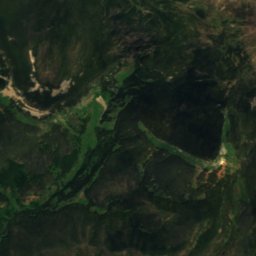
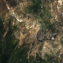
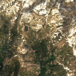
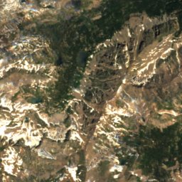
Satellite: Sentinel-2 cloudless 2016 by EOX IT Services GmbH · CC BY 4.0 · Contains modified Copernicus Sentinel data 2016
5.4 mi NE

Booth Lake, Colorado

Lake
Booth Lake, Colorado
East Fork Eagle River
Photo: Jeffrey Beall · CC BY 4.0 · Wikimedia CommonsReport this photo · linked, not stored
15 mi S

East Fork Eagle River

River
East Fork Eagle River

Mountains

Mount Lincoln (Colorado)
Photo: Original uploader was Matt Vincent at en.wikipedia · CC BY-SA 3.0 · Wikimedia CommonsReport this photo · linked, not stored
24 mi SE

Mount Lincoln (Colorado)

14,285 ft · Mosquito Range
Mount Lincoln (Colorado)
Quandary Peak
Photo: Stargazer7121 · Public domain · Wikimedia CommonsReport this photo · linked, not stored
22 mi SE

Quandary Peak

14,272 ft · Tenmile Range
Quandary Peak
Mount Democrat
Photo: Jeremiah LaRocco · CC BY-SA 2.0 · Wikimedia CommonsReport this photo · linked, not stored
24 mi SE

Mount Democrat

14,155 ft · Mosquito Range
Mount Democrat

Heritage

Red Cliff Bridge
Photo: Hustvedt · CC BY-SA 3.0 · Wikimedia CommonsReport this photo · linked, not stored
9.1 mi S

Red Cliff Bridge

National Register of Historic Places listed place · 1941
Red Cliff Bridge

Museums

Satellite: Sentinel-2 cloudless 2016 by EOX IT Services GmbH · CC BY 4.0 · Contains modified Copernicus Sentinel data 2016
0.2 mi N

Colorado Snowsports Museum

Colorado Snowsports Museum