


Satellite: Sentinel-2 cloudless 2016 by EOX IT Services GmbH · CC BY 4.0 · Contains modified Copernicus Sentinel data 2016
SkiingPenhas da Saúde, Castelo Branco
Estância de Ski da Serra da Estrela
Ski area5.4 kmSnow Jan–Feb
Pistes5.4 kmdownhill
Lifts4in the area
Snow seasonJan–FebTorre
Nearest townPenhas da Saúde6.0 km
40.33° N, 7.61° WUTC+1 · Western European Summer Time
When to goPenhas da Saúde · weather score
Best timeJun–Aug
October: high / low13° / 4°
Skiing
Estância de Ski da Serra da Estrela in brief
Estância de Ski da Serra da Estrela is a ski area in Penhas da Saúde, Castelo Branco, Portugal with about 5.4 km of downhill pistes and 4 lifts.
At Torre (1,993 m), the nearest summit, precipitation falls mostly as snow in Jan–Feb.
The nearest town in the atlas is Penhas da Saúde, 6.0 km away.
Weather nearby now
Penhas da Saúde13°
Partly cloudy now
Today
22 Oct
13°
3°
Fri
23 Oct
15°
5°
Sat
24 Oct
15°
3°
Sun
25 Oct
17°
2°
Mon
26 Oct
16°
6°
Model run 00:00 UTCRefreshed several times a day
Fresh snow, next 10 days
| Thu 22 | Fri 23 | Sat 24 | Sun 25 | Mon 26 | Tue 27 | Wed 28 | Thu 29 | Fri 30 | Sat 31 | Total | |
|---|---|---|---|---|---|---|---|---|---|---|---|
| Penhas da Saúde1,498 m | –8° | –10° | –9° | –9° | –11° | –9° | –10° | –10° | –10° | –8° | 0 cm |
| Torre1,993 m | –5° | –6° | –5° | –6° | –8° | –6° | –7° | –7° | –7° | –5° | 0 cm |
Estimate: the forecast's precipitation at each height shown, as snow when it is cold enough there (about 1 cm per mm). Resorts publish their own snow reports.
Pistes by difficulty
Kilometres of downhill piste, as mappedLifts
4- Drag lifts2
- Chairlifts1
- Moving carpets1
Snow through the year
Torre · 1,993 mJan❄0°
Feb❄0°
Mar·2°
Apr·2°
May·5°
Jun·11°
Jul·14°
Aug·14°
Sep·11°
Oct·6°
Nov·3°
Dec·1°
Snow: months when the mean temperature at the summit is at most +1 °C and at least 10 mm falls. Below: mean temperature at the summit.
Stay nearby
Towns close by

Photo: P.Fernandes (Trebaruna) · CC BY 3.0 · Wikimedia CommonsReport this photo · linked, not stored
Loriga
Guarda · 6.3 km W
19°Oct high
12wet days
66score


Photo: Vitor Oliveira from Torres Vedras, PORTUGAL · CC BY-SA 2.0 · Wikimedia CommonsReport this photo · linked, not stored
Sazes da Beira
Guarda · 11 km W
20°Oct high
12wet days
66score
Around here
Penhas da Saúde and around

Penhas da Saúde
Castelo Branco · Portugal
Jun–Augbest months
23°July high
1,498 maltitude
Nature

Photo: Paulo Valdivieso from Lisboa, Portugal · CC BY-SA 2.0 · Wikimedia CommonsReport this photo · linked, not stored
Lagoa Comprida
Lake · 1,591 m
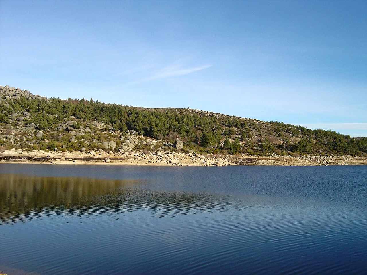
Photo: Vitor Oliveira from Torres Vedras, PORTUGAL · CC BY-SA 2.0 · Wikimedia CommonsReport this photo · linked, not stored
Vale do Rossim Reservoir
Lake · 1,428 m
Mountains

Photo: JC Ferreira - Fotografia · CC BY-SA 4.0 · Wikimedia CommonsReport this photo · linked, not stored
Torre
1,993 m · Serra da Estrela


Heritage

Photo: Roylindman at en.wikipedia · CC BY-SA 3.0 · Wikimedia CommonsReport this photo · linked, not stored
Sanatório dos Ferroviários
Immovable Cultural Heritage of Municipal Interest

Photo: Maria de Jesus Valente · CC BY-SA 4.0 · Wikimedia CommonsReport this photo · linked, not stored
Capela de São Sebastião, Paul
Monument of Public Interest
Satellite: Sentinel-2 cloudless 2016 by EOX IT Services GmbH · CC BY 4.0 · Contains modified Copernicus Sentinel data 2016
Covilhã train station
heritage without legal protection
Museums



Satellite: Sentinel-2 cloudless 2016 by EOX IT Services GmbH · CC BY 4.0 · Contains modified Copernicus Sentinel data 2016
Covilhã Royal Textile Factory
1764
Satellite: Sentinel-2 cloudless 2016 by EOX IT Services GmbH · CC BY 4.0 · Contains modified Copernicus Sentinel data 2016