Skip to content
Destinations
Weather & climate
Nature
Outdoors
Culture
Events
Sky & live
Södermalm
Photo: Batintherain · Public domain · Wikimedia Commons
SödermalmReport this photo · linked, not stored
Fatburen, Stockholm
Photo: Magnus Thorslundh · Public domain · Wikimedia Commons
Fatburen, StockholmReport this photo · linked, not stored
Fatburen, Stockholm
Stadsholmen
Photo: Arild Vågen · CC BY-SA 3.0 · Wikimedia Commons
StadsholmenReport this photo · linked, not stored
Stadsholmen
Riddarholmen
Photo: Benoît Derrier from Stockholm, Sweden · CC BY-SA 2.0 · Wikimedia Commons
RiddarholmenReport this photo · linked, not stored
Riddarholmen
Kastellholmen, Stockholm
Photo: Arild · CC BY-SA 2.0 · Wikimedia Commons
Kastellholmen, StockholmReport this photo · linked, not stored
Kastellholmen, Stockholm
IslandStockholm, Stockholm

Södermalm

IslandBest Jun–Aug
Elevation–above sea level
Area5.7 km²surface
Nearest townStockholm1.8 km
59.31° N, 18.07° EUTC+2 · Central European Summer Time
When to goStockholm · weather score
JanFebMarAprMayJunJulAugSepOctNovDec24October
Best timeJun–Aug
October: high / low10° / 5°
Island

Södermalm in brief

Södermalm is an island in Stockholm, Sweden.

It covers about 5.7 km².

The nearest town in the atlas is Stockholm, 1.8 km to the N, where the weather is best in June, July and August.

Stockholm: weather and travel guide

Weather nearby now

Forecast for Stockholm
12°
Cloudy now
Wind21 km/h
Humidity88%
Cloud cover100%
Today
22 Oct
13°
11°
1 mm
Fri
23 Oct
12°
6°
9 mm
Sat
24 Oct
12°
6°
3 mm
Sun
25 Oct
11°
7°
13 mm
Mon
26 Oct
11°
8°
1 mm

Model run 00:00 UTCRefreshed several times a day

The island from above

5.7 km² · coastline as mapped in OpenStreetMap
1 km
When to go

The best months around Södermalm

Climate of Stockholm

Month score in Stockholm

Comfort, dry days and sunshine · out of 100
Map

Södermalm from above

Nature nearbyAll of Sweden
Photo: Magnus Thorslundh · Public domain · Wikimedia CommonsReport this photo · linked, not stored
Fatburen, StockholmLake0.3 kmNWFatburen, Stockholm
Photo: Arild Vågen · CC BY-SA 3.0 · Wikimedia CommonsReport this photo · linked, not stored
StadsholmenIsland1.2 kmNStadsholmen
Photo: Benoît Derrier from Stockholm, Sweden · CC BY-SA 2.0 · Wikimedia CommonsReport this photo · linked, not stored
RiddarholmenIsland1.4 kmNRiddarholmen
Photo: Arild · CC BY-SA 2.0 · Wikimedia CommonsReport this photo · linked, not stored
Kastellholmen, StockholmIsland1.4 kmNEKastellholmen, Stockholm
Photo: Jan Ainali · CC BY-SA 3.0 · Wikimedia CommonsReport this photo · linked, not stored
Skeppsholmen, StockholmIsland1.6 kmNESkeppsholmen, Stockholm
Photo: Arild Vågen · CC BY-SA 3.0 · Wikimedia CommonsReport this photo · linked, not stored
StrömsborgIsland1.6 kmNStrömsborg
Summits nearbyMountains of Sweden
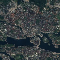
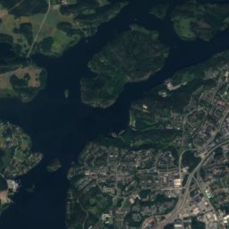
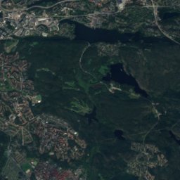
Satellite: Sentinel-2 cloudless 2016 by EOX IT Services GmbH · CC BY 4.0 · Contains modified Copernicus Sentinel data 2016
Hökarängstoppen6.5 km S102 mJuly 23°Hökarängstoppen
Stay nearby

Towns close by

Stockholm
Photo: Steven Lek · CC BY-SA 4.0 · Wikimedia CommonsReport this photo · linked, not stored

Stockholm

Stockholm · 1.8 km N
10°Oct high
12wet days
24score
Stockholm
Nacka
Photo: Jordgubbe · CC BY-SA 2.0 · Wikimedia CommonsReport this photo · linked, not stored

Nacka

Stockholm · 5.3 km E
10°Oct high
12wet days
24score
Nacka
Solna
Photo: Salcional · CC0 · Wikimedia CommonsReport this photo · linked, not stored

Solna

Stockholm · 6.5 km NW
10°Oct high
12wet days
25score
Solna
Lidingö
Photo: Lidingo · CC BY-SA 3.0 · Wikimedia CommonsReport this photo · linked, not stored

Lidingö

Stockholm · 6.9 km NE
10°Oct high
12wet days
24score
Lidingö
Around here

Stockholm and around

Stockholm
Photo: Steven Lek · CC BY-SA 4.0 · Wikimedia CommonsReport this photo · linked, not stored

Stockholm

Stockholm · Sweden
Jun–Augbest months
23°July high
17 maltitude
Stockholm

Nature

Royal National City Park
Photo: Arild Vågen · CC BY-SA 3.0 · Wikimedia CommonsReport this photo · linked, not stored
3.6 km N

Royal National City Park

National park
Royal National City Park
Norrström
Photo: Holger.Ellgaard · CC BY-SA 3.0 · Wikimedia CommonsReport this photo · linked, not stored
0.2 km SE

Norrström

River
Norrström
Brunnsviken
Photo: I, Holger.Ellgaard · CC BY-SA 3.0 · Wikimedia CommonsReport this photo · linked, not stored
4.6 km N

Brunnsviken

Lake · 9 m
Brunnsviken

Mountains

Satellite: Sentinel-2 cloudless 2016 by EOX IT Services GmbH · CC BY 4.0 · Contains modified Copernicus Sentinel data 2016
8.2 km S

Hökarängstoppen

102 m
Hökarängstoppen
Telegraph Hill
Photo: Salgo60 · CC0 · Wikimedia CommonsReport this photo · linked, not stored
33 km SE

Telegraph Hill

61 m
Telegraph Hill

Heritage

Stockholm Palace
Photo: Jorge Láscar from Melbourne, Australia · CC BY 2.0 · Wikimedia CommonsReport this photo · linked, not stored
0.3 km SE

Stockholm Palace

governmental listed building complex · 1760
Stockholm Palace
Klara Church
Photo: Arild Vågen · CC BY-SA 3.0 · Wikimedia CommonsReport this photo · linked, not stored
0.4 km NW

Klara Church

ecclesiastical listed building complex · 1572
Klara Church
Stockholm Synagogue
Photo: I99pema · CC BY-SA 4.0 · Wikimedia CommonsReport this photo · linked, not stored
0.4 km NE

Stockholm Synagogue

individual listed building complex · 1870
Stockholm Synagogue

Museums

Vasa Museum
Photo: Hanay · CC BY-SA 3.0 · Wikimedia CommonsReport this photo · linked, not stored
1.3 km E

Vasa Museum

Maritime museum · 1990
Vasa Museum
Skansen
Photo: Holger.Ellgaard · CC BY-SA 4.0 · Wikimedia CommonsReport this photo · linked, not stored
1.9 km E

Skansen

Open-air museum · 1891
Skansen
Nordic Museum
Photo: Jordgubbe · CC BY-SA 2.0 · Wikimedia CommonsReport this photo · linked, not stored
1.4 km E

Nordic Museum

Museum of culture · 1873
Nordic Museum