Skip to content
Destinations
Weather & climate
Nature
Outdoors
Culture
Events
Sky & live
Tenryū River
Photo: Tomio344456 · CC BY-SA 3.0 · Wikimedia Commons
Tenryū RiverReport this photo · linked, not stored
Togawa River
Photo: Triglav · CC BY-SA 3.0 · Wikimedia Commons
Togawa RiverReport this photo · linked, not stored
Togawa River
Hatsushima, Nagano
Photo: そらみみ · CC BY-SA 3.0 · Wikimedia Commons
Hatsushima, NaganoReport this photo · linked, not stored
Hatsushima, Nagano
Taruhime Falls
Photo: photo: Qurren (talk) Taken with Canon IXY 10S (Digital IXUS 210) · CC BY-SA 3.0 · Wikimedia Commons
Taruhime FallsReport this photo · linked, not stored
Taruhime Falls
Ushibuse River
Photo: photo: Qurren (talk) Taken with Canon IXY 10S · CC BY-SA 3.0 · Wikimedia Commons
Ushibuse RiverReport this photo · linked, not stored
Ushibuse River
RiverOkaya, Nagano

Tenryū River

RiverBest May · Sep–Oct
Elevation–above sea level
Length213 kmsource to mouth
Nearest townOkaya0.8 km
36.05° N, 138.05° EUTC+9 · Japan Standard Time
When to goOkaya · weather score
JanFebMarAprMayJunJulAugSepOctNovDec62October
Best timeMay · Sep–Oct
October: high / low18° / 8°
River

Tenryū River in brief

Tenryū River is a river in Okaya, Nagano, Japan.

The nearest town in the atlas is Okaya, 0.8 km to the NW, where the weather is best in May, September and October.

Tenryū River is 213 km long.

Okaya: weather and travel guide

Weather nearby now

Forecast for Okaya
7°
Partly cloudy now
Wind2 km/h
Humidity95%
Cloud cover47%
Today
23 Oct
21°
5°
Sat
24 Oct
18°
13°
9 mm
Sun
25 Oct
20°
15°
9 mm
Mon
26 Oct
18°
15°
30 mm
Tue
27 Oct
22°
12°
10 mm

Model run 00:00 UTCRefreshed several times a day

The course of the river

As mapped in OpenStreetMap, with the towns of the atlas along its banks.
1234567891011121314
  1. 1Okaya773 m
  2. 2Tatsuno726 m
  3. 3Minowa679 m
  4. 4Minamiminowa672 m
  5. 5Ina638 m
  6. 6Miyada618 m
  7. 7Komagane640 m
  8. 8Iijima639 m
  9. 9Nakagawa551 m
  10. 10Matsukawa615 m
  11. 11Takamori453 m
  12. 12Toyooka463 m
  13. 13Takagi496 m
  14. 14Shimojō500 m
sourcemouth (or where the mapped line leaves the country)
When to go

The best months around Tenryū River

Climate of Okaya

Month score in Okaya

Comfort, dry days and sunshine · out of 100
Map

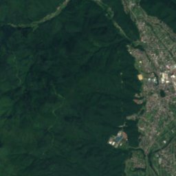
Tenryū River from above

Nature nearbyAll of Japan
Photo: Triglav · CC BY-SA 3.0 · Wikimedia CommonsReport this photo · linked, not stored
Togawa RiverRiver2.3 kmETogawa River
Photo: そらみみ · CC BY-SA 3.0 · Wikimedia CommonsReport this photo · linked, not stored
Hatsushima, NaganoIsland5.1 kmEHatsushima, Nagano
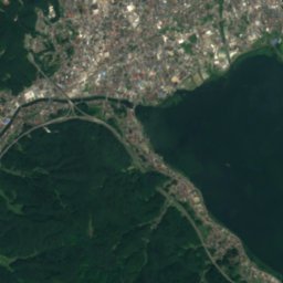
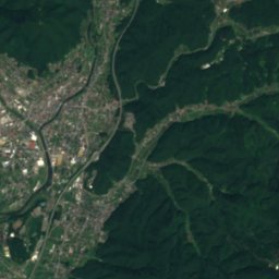
Satellite: Sentinel-2 cloudless 2016 by EOX IT Services GmbH · CC BY 4.0 · Contains modified Copernicus Sentinel data 2016
HonshuIsland7.6 kmSWHonshu
Photo: photo: Qurren (talk) Taken with Canon IXY 10S (Digital IXUS 210) · CC BY-SA 3.0 · Wikimedia CommonsReport this photo · linked, not stored
Taruhime FallsWaterfall16 kmSETaruhime Falls
Photo: photo: Qurren (talk) Taken with Canon IXY 10S · CC BY-SA 3.0 · Wikimedia CommonsReport this photo · linked, not stored
Ushibuse RiverRiver19 kmNUshibuse River
Photo: 禁樹なずな · CC BY-SA 3.0 · Wikimedia CommonsReport this photo · linked, not stored
Yugawa River, MatsumotoRiver22 kmNYugawa River, Matsumoto
Summits nearbyMountains of Japan
Photo: Mass Ave 975 · CC BY-SA 3.0 · Wikimedia CommonsReport this photo · linked, not stored
Mount Tateshina22 km E2,530 mJuly 16°Mount Tateshina
Photo: Σ64 · CC BY-SA 3.0 · Wikimedia CommonsReport this photo · linked, not stored
Mount Kitayoko24 km E2,480 mJuly 16°Mount Kitayoko
Photo: alpsdake · Public domain · Wikimedia CommonsReport this photo · linked, not stored
Mount Kyō, Nagano23 km SW2,296 mJuly 17°Mount Kyō, Nagano
Photo: 663highland · CC BY-SA 4.0 · Wikimedia CommonsReport this photo · linked, not stored
Utsukushigahara20 km N2,034 mJuly 19°Utsukushigahara
Photo: Σ64 (talk) · CC BY-SA 3.0 · Wikimedia CommonsReport this photo · linked, not stored
Mount Nyūkasa20 km SE1,955 mJuly 20°Mount Nyūkasa
Photo: Koda6029 · CC BY-SA 4.0 · Wikimedia CommonsReport this photo · linked, not stored
Mount Kirigamine12 km NE1,925 mJuly 21°Mount Kirigamine
Stay nearby

Towns close by

Okaya
Photo: photo: Qurren (talk) Taken with Canon IXY 10S (Digital IXUS 210) · CC BY-SA 3.0 · Wikimedia CommonsReport this photo · linked, not stored

Okaya

Nagano · 0.8 km NW
18°Oct high
15wet days
62score
Okaya
Shimosuwa
Photo: Qurren · CC BY-SA 4.0 · Wikimedia CommonsReport this photo · linked, not stored

Shimosuwa

Nagano · 3.3 km NE
18°Oct high
15wet days
64score
Shimosuwa
Suwa
Photo: C1815 · Public domain · Wikimedia CommonsReport this photo · linked, not stored

Suwa

Nagano · 5.7 km E
18°Oct high
15wet days
65score
Suwa
Tatsuno
Photo: photo: Qurren (talk) Taken with Canon IXY 10S · CC BY-SA 3.0 · Wikimedia CommonsReport this photo · linked, not stored

Tatsuno

Nagano · 9.2 km SW
18°Oct high
12wet days
68score
Tatsuno
Around here

Okaya and around

Okaya
Photo: photo: Qurren (talk) Taken with Canon IXY 10S (Digital IXUS 210) · CC BY-SA 3.0 · Wikimedia CommonsReport this photo · linked, not stored

Okaya

Nagano · Japan
May · Sep–Octbest months
27°July high
773 maltitude
Okaya

Nature

Togawa River
Photo: Triglav · CC BY-SA 3.0 · Wikimedia CommonsReport this photo · linked, not stored
2.9 km E

Togawa River

River
Togawa River
Lake Misuzu
Photo: Qurren · CC BY-SA 3.0 · Wikimedia CommonsReport this photo · linked, not stored
23 km N

Lake Misuzu

Lake
Lake Misuzu
Taruhime Falls
Photo: photo: Qurren (talk) Taken with Canon IXY 10S (Digital IXUS 210) · CC BY-SA 3.0 · Wikimedia CommonsReport this photo · linked, not stored
17 km SE

Taruhime Falls

Waterfall
Taruhime Falls

Mountains

Mount Senjō
Photo: alpsdake · CC0 · Wikimedia CommonsReport this photo · linked, not stored
39 km S

Mount Senjō

3,033 m · Akaishi Mountains
Mount Senjō
Mount Kaikoma
Photo: Alpsdake · Public domain · Wikimedia CommonsReport this photo · linked, not stored
37 km SE

Mount Kaikoma

2,967 m · Akaishi Mountains
Mount Kaikoma
Mount Kisokoma
Photo: Σ64 (talk) · CC BY-SA 3.0 · Wikimedia CommonsReport this photo · linked, not stored
37 km SW

Mount Kisokoma

2,956 m · Kiso Mountains
Mount Kisokoma

Heritage

Katakurakan
Photo: 663highland · CC BY 2.5 · Wikimedia CommonsReport this photo · linked, not stored
6.2 km E

Katakurakan

Important Cultural Property of Japan · 1928
Katakurakan
Shimosuwa Aozuka Kofun
Photo: Saigen Jiro · CC0 · Wikimedia CommonsReport this photo · linked, not stored
4.5 km NE

Shimosuwa Aozuka Kofun

Prefectural Historic Site · 600
Shimosuwa Aozuka Kofun
Suwa taisha
Photo: 663highland · CC BY 2.5 · Wikimedia CommonsReport this photo · linked, not stored
4.7 km NE

Suwa taisha

Important Cultural Property of Japan
Suwa taisha

Museums

Okaya Silk Museum
Photo: photo: Qurren Taken with Canon IXY 430F (Digital IXUS 245 HS) · CC BY-SA 3.0 · Wikimedia CommonsReport this photo · linked, not stored
1.0 km N

Okaya Silk Museum

Okaya Silk Museum
Okaya Art and Archaeological Museum
Photo: Qurren · CC BY-SA 4.0 · Wikimedia CommonsReport this photo · linked, not stored
0.3 km NE

Okaya Art and Archaeological Museum

Art museum
Okaya Art and Archaeological Museum
ILF Douga Museum of Art
Photo: photo: Qurren Taken with Canon IXY 430F (Digital IXUS 245 HS) · CC BY-SA 3.0 · Wikimedia CommonsReport this photo · linked, not stored
0.5 km NE

ILF Douga Museum of Art

Biographical museum
ILF Douga Museum of Art