Skip to content
Destinations
Weather & climate
Nature
Outdoors
Culture
Events
Sky & live
Weil
Photo: Simsalabimbam · CC BY-SA 3.0 · Wikimedia Commons
WeilReport this photo · linked, not stored
Rombachwasserfall
Photo: Leonhard Lenz · CC0 · Wikimedia Commons
RombachwasserfallReport this photo · linked, not stored
Rombachwasserfall
Urselbach
Photo: Iwoelbern · Public domain · Wikimedia Commons
UrselbachReport this photo · linked, not stored
Urselbach
Liederbach
Photo: EvaK · CC BY-SA 2.5 · Wikimedia Commons
LiederbachReport this photo · linked, not stored
Liederbach
Rombach (Liederbach)
Photo: Anarabert · CC BY-SA 3.0 · Wikimedia Commons
Rombach (Liederbach)Report this photo · linked, not stored
Rombach (Liederbach)
RiverGlashütten, Hesse

Weil

RiverBest Jun · Aug–Sep
Elevation–above sea level
Length47 kmsource to mouth
Nearest townGlashütten3.6 km
50.23° N, 8.45° EUTC+1 · Central European Standard Time
When to goGlashütten · weather score
JanFebMarAprMayJunJulAugSepOctNovDec34October
Best timeJun · Aug–Sep
October: high / low13° / 5°
River

Weil in brief

Weil is a river in Glashütten, Hesse, Germany.

The nearest town is Glashütten, 3.6 km to the W, where the weather is best in June, August and September.

Weil is 47 km long.

Glashütten: weather and travel guide

Weather nearby now

Forecast for Glashütten
13°
Partly cloudy now
Wind9 km/h
Humidity80%
Cloud cover22%
Today
27 Oct
13°
7°
Wed
28 Oct
11°
5°
5 mm
Thu
29 Oct
11°
4°
Fri
30 Oct
10°
3°
Sat
31 Oct
9°
3°

Model run 00:00 UTCRefreshed several times a day

The course of the river

As mapped in OpenStreetMap, with the towns along its banks.
123
  1. 1Weilmünster179 m
  2. 2Weinbach178 m
  3. 3Weilburg165 m
sourcemouth (or where the mapped line leaves the country)
When to go

The best months around Weil

Climate of Glashütten

Month score in Glashütten

Comfort, dry days and sunshine · out of 100
12
Jan
21
Feb
23
Mar
47
Apr
60
May
65
Jun
64
Jul
67
Aug
71
Sep
34
Oct
15
Nov
10
Dec
Map

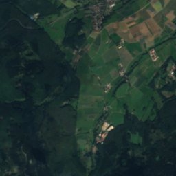
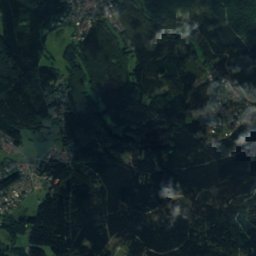
Weil from above

Nature nearbyAll of Germany
Photo: Leonhard Lenz · CC0 · Wikimedia CommonsReport this photo · linked, not stored
RombachwasserfallWaterfall3.7 kmSRombachwasserfall
Photo: Iwoelbern · Public domain · Wikimedia CommonsReport this photo · linked, not stored
UrselbachRiver3.7 kmEUrselbach
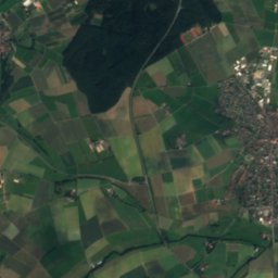
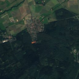
Satellite: Sentinel-2 cloudless 2016 by EOX IT Services GmbH · CC BY 4.0 · Contains modified Copernicus Sentinel data 2016
Erlenbach (Nidda)River4.6 kmNEErlenbach (Nidda)
Photo: EvaK · CC BY-SA 2.5 · Wikimedia CommonsReport this photo · linked, not stored
LiederbachRiver4.9 kmSLiederbach
Photo: Anarabert · CC BY-SA 3.0 · Wikimedia CommonsReport this photo · linked, not stored
Rombach (Liederbach)River4.9 kmSRombach (Liederbach)
Photo: Anarabert · CC BY-SA 2.0 de · Wikimedia CommonsReport this photo · linked, not stored
Reichenbach, HesseRiver4.9 kmSReichenbach, Hesse
Summits nearbyMountains of Germany
Photo: Jörg Braukmann · CC BY-SA 4.0 · Wikimedia CommonsReport this photo · linked, not stored
Großer Feldberg1.0 km NE879 mJuly 20°Großer Feldberg
Photo: X-angel · CC BY-SA 4.0 · Wikimedia CommonsReport this photo · linked, not stored
Kleiner Feldberg0.6 km S825 mJuly 20°Kleiner Feldberg
Photo: Jörg Braukmann · CC BY-SA 4.0 · Wikimedia CommonsReport this photo · linked, not stored
Altkönig2.9 km SE798 mJuly 21°Altkönig
Photo: dontworry · CC BY-SA 3.0 · Wikimedia CommonsReport this photo · linked, not stored
Weilsberg1.4 km W701 mJuly 21°Weilsberg
Photo: Jörg Braukmann · CC BY-SA 4.0 · Wikimedia CommonsReport this photo · linked, not stored
Kolbenberg3.8 km NE690 mJuly 21°Kolbenberg
Photo: Johannes Robalotoff · CC BY-SA 3.0 de · Wikimedia CommonsReport this photo · linked, not stored
Glaskopf2.4 km SW687 mJuly 22°Glaskopf
Stay nearby

Towns close by

Glashütten
Photo: Karsten Ratzke · CC0 · Wikimedia CommonsReport this photo · linked, not stored

Glashütten

Hesse · 3.6 km W
13°Oct high
12wet days
34score
Glashütten
Schmitten im Taunus
Photo: Karsten11 · Public domain · Wikimedia CommonsReport this photo · linked, not stored

Schmitten im Taunus

Hesse · 4.5 km N
13°Oct high
12wet days
33score
Schmitten im Taunus
Königstein im Taunus
Photo: Brion Vibber · CC BY-SA 3.0 · Wikimedia CommonsReport this photo · linked, not stored

Königstein im Taunus

Hesse · 5.5 km S
13°Oct high
12wet days
39score
Königstein im Taunus
Kronberg Tal
Photo: Johannes Robalotoff · CC BY-SA 3.0 de · Wikimedia CommonsReport this photo · linked, not stored

Kronberg Tal

Hesse · 6.6 km SE
14°Oct high
12wet days
43score
Kronberg Tal
Around here

Glashütten and around

Glashütten
Photo: Karsten Ratzke · CC0 · Wikimedia CommonsReport this photo · linked, not stored

Glashütten

Hesse · Germany
Jun · Aug–Sepbest months
23°July high
489 maltitude
Glashütten

Nature

Usa
Photo: Ballapete · CC0 · Wikimedia CommonsReport this photo · linked, not stored
9.8 km NE

Usa

River
Usa
Wörsbach
Photo: Volker Thies (Asdrubal) · CC BY-SA 3.0 · Wikimedia CommonsReport this photo · linked, not stored
9.8 km W

Wörsbach

River
Wörsbach
Urselbach
Photo: Iwoelbern · Public domain · Wikimedia CommonsReport this photo · linked, not stored
7.2 km E

Urselbach

River
Urselbach

Mountains

Großer Feldberg
Photo: Jörg Braukmann · CC BY-SA 4.0 · Wikimedia CommonsReport this photo · linked, not stored
4.5 km NE

Großer Feldberg

879 m · Taunus
Großer Feldberg
Kleiner Feldberg
Photo: X-angel · CC BY-SA 4.0 · Wikimedia CommonsReport this photo · linked, not stored
3.3 km E

Kleiner Feldberg

825 m · Taunus
Kleiner Feldberg
Altkönig
Photo: Jörg Braukmann · CC BY-SA 4.0 · Wikimedia CommonsReport this photo · linked, not stored
5.8 km E

Altkönig

798 m · Taunus
Altkönig

Heritage

St. Philippus und Jakobus, Glashütten
Photo: Karsten Ratzke · CC0 · Wikimedia CommonsReport this photo · linked, not stored
2.3 km SW

St. Philippus und Jakobus, Glashütten

cultural heritage monument in Hesse
St. Philippus und Jakobus, Glashütten
Schlosshotel Kronberg
Photo: dontworry · CC BY-SA 3.0 · Wikimedia CommonsReport this photo · linked, not stored
8.4 km E

Schlosshotel Kronberg

Kulturdenkmal · 1894
Schlosshotel Kronberg
Bad Homburg Castle
Photo: ziegelbrenner · CC BY-SA 3.0 · Wikimedia CommonsReport this photo · linked, not stored
15 km E

Bad Homburg Castle

cultural heritage monument in Hesse · 1680
Bad Homburg Castle

Museums

Hessenpark
Photo: Dontworry · CC BY-SA 3.0 · Wikimedia CommonsReport this photo · linked, not stored
11 km NE

Hessenpark

Open-air museum · 1974
Hessenpark
Stadtmuseum Hofheim
Photo: Karsten Ratzke · CC0 · Wikimedia CommonsReport this photo · linked, not stored
15 km S

Stadtmuseum Hofheim

Stadtmuseum Hofheim
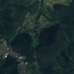
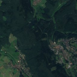
Satellite: Sentinel-2 cloudless 2016 by EOX IT Services GmbH · CC BY 4.0 · Contains modified Copernicus Sentinel data 2016
13 km E

Vortaunusmuseum

1987
Vortaunusmuseum