Skip to content
Destinations
Weather & climate
Nature
Outdoors
Culture
Events
Sky & live
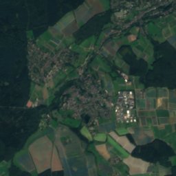
Hellenbach
Photo: LigaDue · CC BY-SA 4.0 · Wikimedia Commons
HellenbachReport this photo · linked, not stored
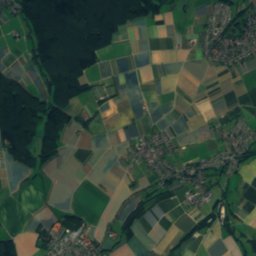
Harbach
Photo: LigaDue · CC BY-SA 4.0 · Wikimedia Commons
HarbachReport this photo · linked, not stored
Harbach
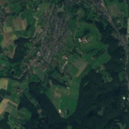
Ahr
Photo: Ralfk · CC BY-SA 3.0 · Wikimedia Commons
AhrReport this photo · linked, not stored
Ahr
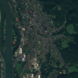
Vinxtbach
Photo: Volker39 · CC BY 3.0 · Wikimedia Commons
VinxtbachReport this photo · linked, not stored
Vinxtbach
Brohlbach
Photo: Hubbi24 · CC BY-SA 4.0 · Wikimedia Commons
BrohlbachReport this photo · linked, not stored
Brohlbach
RiverSinzig, Rheinland-Pfalz

Hellenbach

RiverBest Jul–Sep
Elevation–above sea level
Length7.7 kmsource to mouth
Nearest townSinzig0.7 km
50.55° N, 7.24° EUTC+2 · Central European Summer Time
When to goSinzig · weather score
JanFebMarAprMayJunJulAugSepOctNovDec48October
Best timeJul–Sep
October: high / low15° / 7°
River

Hellenbach in brief

Hellenbach is a river in Sinzig, Rheinland-Pfalz, Germany.

The nearest town in the atlas is Sinzig, 0.7 km to the S, where the weather is best in July, August and September.

Hellenbach is 7.7 km long.

Sinzig: weather and travel guide

Weather nearby now

Forecast for Sinzig
9°
Cloudy now
Wind14 km/h
Humidity90%
Cloud cover97%
Today
23 Oct
15°
8°
2 mm
Sat
24 Oct
13°
6°
10 mm
Sun
25 Oct
15°
9°
20 mm
Mon
26 Oct
13°
8°
1 mm
Tue
27 Oct
18°
10°
5 mm

Model run 12:00 UTCRefreshed several times a day

When to go

The best months around Hellenbach

Climate of Sinzig

Month score in Sinzig

Comfort, dry days and sunshine · out of 100
Map

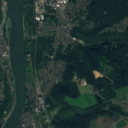
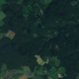
Hellenbach from above

Nature nearbyAll of Germany
Photo: LigaDue · CC BY-SA 4.0 · Wikimedia CommonsReport this photo · linked, not stored
HarbachRiver0.6 kmEHarbach
Photo: Ralfk · CC BY-SA 3.0 · Wikimedia CommonsReport this photo · linked, not stored
AhrRiver2.5 kmNEAhr
Satellite: Sentinel-2 cloudless 2016 by EOX IT Services GmbH · CC BY 4.0 · Contains modified Copernicus Sentinel data 2016
UnkelsteinIsland6.0 kmNWUnkelstein
Photo: Volker39 · CC BY 3.0 · Wikimedia CommonsReport this photo · linked, not stored
VinxtbachRiver7.2 kmSEVinxtbach
Photo: Hubbi24 · CC BY-SA 4.0 · Wikimedia CommonsReport this photo · linked, not stored
BrohlbachRiver9.6 kmSEBrohlbach
Photo: Colling-architektur · CC BY-SA 3.0 · Wikimedia CommonsReport this photo · linked, not stored
Rodder MaarLake10 kmSWRodder Maar
Summits nearbyMountains of Germany
Photo: Jörg Braukmann · CC BY-SA 3.0 · Wikimedia CommonsReport this photo · linked, not stored
Hohe Acht25 km SW746 mJuly 21°Hohe Acht
Photo: Mabol! · CC BY-SA 3.0 · Wikimedia CommonsReport this photo · linked, not stored
Raßberg22 km SW668 mJuly 21°Raßberg
Photo: Blueduck4711 · CC BY-SA 3.0 · Wikimedia CommonsReport this photo · linked, not stored
Hochsimmer21 km S588 mJuly 23°Hochsimmer
Photo: J. Braukmann Milseburg · CC BY-SA 3.0 · Wikimedia CommonsReport this photo · linked, not stored
Gänsehals17 km S575 mJuly 22°Gänsehals
Photo: J. Braukmann Milseburg · CC BY-SA 3.0 · Wikimedia CommonsReport this photo · linked, not stored
Hochstein (Eifel)20 km S563 mJuly 22°Hochstein (Eifel)
Photo: Mabol! · CC BY-SA 3.0 · Wikimedia CommonsReport this photo · linked, not stored
Häuschen13 km SW507 mJuly 22°Häuschen
Stay nearby

Towns close by

Sinzig
Photo: Tohma (talk) / Doris Antony, Berlin · CC BY-SA 3.0 · Wikimedia CommonsReport this photo · linked, not stored

Sinzig

Rheinland-Pfalz · 0.7 km S
15°Oct high
13wet days
48score
Sinzig
Remagen
Photo: Gernot Ingo Vazquez Vazquez · CC BY 3.0 · Wikimedia CommonsReport this photo · linked, not stored

Remagen

Rheinland-Pfalz · 3.5 km N
15°Oct high
13wet days
48score
Remagen
Dattenberg
Photo: Wolkenkratzer · CC BY-SA 4.0 · Wikimedia CommonsReport this photo · linked, not stored

Dattenberg

Rheinland-Pfalz · 3.5 km E
15°Oct high
13wet days
45score
Dattenberg
Linz am Rhein
Photo: Wolkenkratzer · CC BY-SA 3.0 · Wikimedia CommonsReport this photo · linked, not stored

Linz am Rhein

Rheinland-Pfalz · 3.6 km NE
15°Oct high
13wet days
47score
Linz am Rhein
Around here

Sinzig and around

Sinzig
Photo: Tohma (talk) / Doris Antony, Berlin · CC BY-SA 3.0 · Wikimedia CommonsReport this photo · linked, not stored

Sinzig

Rheinland-Pfalz · Germany
Jul–Sepbest months
25°July high
78 maltitude
Sinzig

Nature

Ahr
Photo: Ralfk · CC BY-SA 3.0 · Wikimedia CommonsReport this photo · linked, not stored
2.7 km NE

Ahr

River · 54 m
Ahr
Brohlbach
Photo: Hubbi24 · CC BY-SA 4.0 · Wikimedia CommonsReport this photo · linked, not stored
9.0 km SE

Brohlbach

River · 59 m
Brohlbach
Vinxtbach
Photo: Volker39 · CC BY 3.0 · Wikimedia CommonsReport this photo · linked, not stored
6.6 km SE

Vinxtbach

River
Vinxtbach

Mountains

Hohe Acht
Photo: Jörg Braukmann · CC BY-SA 3.0 · Wikimedia CommonsReport this photo · linked, not stored
24 km SW

Hohe Acht

746 m · High Eifel
Hohe Acht
Hochkelberg
Photo: Mabol! · CC BY-SA 3.0 · Wikimedia CommonsReport this photo · linked, not stored
37 km SW

Hochkelberg

675 m · Volcanic Eifel
Hochkelberg
Raßberg
Photo: Mabol! · CC BY-SA 3.0 · Wikimedia CommonsReport this photo · linked, not stored
22 km SW

Raßberg

668 m · High Eifel
Raßberg

Heritage

St. Peter (Westum)
Photo: GFreihalter · CC BY-SA 3.0 · Wikimedia CommonsReport this photo · linked, not stored
1.3 km SW

St. Peter (Westum)

Kulturdenkmal · 1846
St. Peter (Westum)
St. Sebastianus (Bad Bodendorf)
Photo: GFreihalter · CC BY-SA 3.0 · Wikimedia CommonsReport this photo · linked, not stored
2.5 km NW

St. Sebastianus (Bad Bodendorf)

cultural heritage monument in Rhineland-Palatinate · 1873
St. Sebastianus (Bad Bodendorf)
St. Johannes Nepomuk (Kripp)
Photo: GFreihalter · CC BY-SA 3.0 · Wikimedia CommonsReport this photo · linked, not stored
2.5 km NE

St. Johannes Nepomuk (Kripp)

cultural heritage monument in Rhineland-Palatinate
St. Johannes Nepomuk (Kripp)

Museums

Peace Museum Bridge of Remagen
Photo: MeCorbeau · CC0 · Wikimedia CommonsReport this photo · linked, not stored
3.8 km N

Peace Museum Bridge of Remagen

History museum · 1980
Peace Museum Bridge of Remagen
Satellite: Sentinel-2 cloudless 2016 by EOX IT Services GmbH · CC BY 4.0 · Contains modified Copernicus Sentinel data 2016
0.3 km NE

Heimatmuseum Sinzig im Schloss

Heimatmuseum Sinzig im Schloss
Arp Museum Bahnhof Rolandseck
Photo: Fusslkopp · CC BY-SA 3.0 · Wikimedia CommonsReport this photo · linked, not stored
10 km N

Arp Museum Bahnhof Rolandseck

Art museum · 2007
Arp Museum Bahnhof Rolandseck