Skip to content
Destinations
Weather & climate
Nature
Outdoors
Culture
Events
Sky & live
Flumm
Photo: Encyclomaniac · CC BY-SA 4.0 · Wikimedia Commons
FlummReport this photo · linked, not stored
Timmeler Meer
Photo: Frisia Orientalis · CC BY-SA 3.0 · Wikimedia Commons
Timmeler MeerReport this photo · linked, not stored
Timmeler Meer
Frauenmeer
Photo: Alpha Centauri Team · CC0 · Wikimedia Commons
FrauenmeerReport this photo · linked, not stored
Frauenmeer
Sandwater
Photo: Frisia Orientalis · CC BY-SA 3.0 · Wikimedia Commons
SandwaterReport this photo · linked, not stored
Sandwater
Sauteler Kanal
Photo: Ra Boe / Wikipedia · CC BY-SA 3.0 de · Wikimedia Commons
Sauteler KanalReport this photo · linked, not stored
Sauteler Kanal
RiverMittegroßefehn, Lower Saxony

Flumm

RiverBest May–Jul
Elevation–above sea level
Length27 kmsource to mouth
Nearest townMittegroßefehn5.5 km
53.37° N, 7.48° EUTC+1 · Central European Standard Time
When to goMittegroßefehn · weather score
JanFebMarAprMayJunJulAugSepOctNovDec39October
Best timeMay–Jul
October: high / low14° / 7°
River

Flumm in brief

Flumm is a river in Mittegroßefehn, Lower Saxony, Germany.

The nearest town is Mittegroßefehn, 5.5 km to the NE, where the weather is best in May, June and July.

Flumm is 27 km long.

Mittegroßefehn: weather and travel guide

Weather nearby now

Forecast for Mittegroßefehn
8°
Showers now
Wind26 km/h
Humidity86%
Cloud cover56%
Today
26 Oct
13°
7°
6 mm
Tue
27 Oct
17°
10°
3 mm
Wed
28 Oct
15°
7°
Thu
29 Oct
15°
8°
1 mm
Fri
30 Oct
14°
5°

Model run 12:00 UTCRefreshed several times a day

When to go

The best months around Flumm

Climate of Mittegroßefehn

Month score in Mittegroßefehn

Comfort, dry days and sunshine · out of 100
15
Jan
21
Feb
25
Mar
52
Apr
69
May
65
Jun
64
Jul
64
Aug
64
Sep
39
Oct
15
Nov
15
Dec
Map

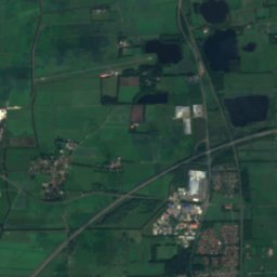
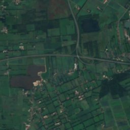
Flumm from above

Nature nearbyAll of Germany
Photo: Frisia Orientalis · CC BY-SA 3.0 · Wikimedia CommonsReport this photo · linked, not stored
Timmeler MeerLake2.3 kmSETimmeler Meer
Photo: Frisia Orientalis · CC BY-SA 3.0 · Wikimedia CommonsReport this photo · linked, not stored
Boekzeteler MeerLake2.7 kmSEBoekzeteler Meer
Photo: Alpha Centauri Team · CC0 · Wikimedia CommonsReport this photo · linked, not stored
FrauenmeerLake3.3 kmEFrauenmeer
Photo: Frisia Orientalis · CC BY-SA 3.0 · Wikimedia CommonsReport this photo · linked, not stored
SandwaterLake4.5 kmWSandwater
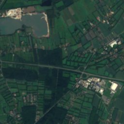
Satellite: Sentinel-2 cloudless 2016 by EOX IT Services GmbH · CC BY 4.0 · Contains modified Copernicus Sentinel data 2016
FlachsmeerLake9.5 kmSFlachsmeer
Photo: Ra Boe / Wikipedia · CC BY-SA 3.0 de · Wikimedia CommonsReport this photo · linked, not stored
Sauteler KanalRiver11 kmSWSauteler Kanal
Stay nearby

Towns close by

Mittegroßefehn
Photo: Frisia Orientalis · CC BY-SA 3.0 · Wikimedia CommonsReport this photo · linked, not stored

Mittegroßefehn

Lower Saxony · 5.5 km NE
14°Oct high
14wet days
39score
Mittegroßefehn
Jheringsfehn
Photo: Matthias Süßen · CC BY 3.0 · Wikimedia CommonsReport this photo · linked, not stored

Jheringsfehn

Lower Saxony · 6.2 km S
14°Oct high
14wet days
39score
Jheringsfehn
Neukamperfehn
Photo: Frisia Orientalis · CC BY-SA 3.0 de · Wikimedia CommonsReport this photo · linked, not stored

Neukamperfehn

Lower Saxony · 6.4 km SE
14°Oct high
14wet days
39score
Neukamperfehn
Moormerland
Photo: Matthias Süßen · CC BY 3.0 · Wikimedia CommonsReport this photo · linked, not stored

Moormerland

Lower Saxony · 7.8 km SW
14°Oct high
14wet days
39score
Moormerland
Around here

Mittegroßefehn and around

Mittegroßefehn
Photo: Frisia Orientalis · CC BY-SA 3.0 · Wikimedia CommonsReport this photo · linked, not stored

Mittegroßefehn

Lower Saxony · Germany
May–Julbest months
23°July high
3 maltitude
Mittegroßefehn

Nature

Sandwater
Photo: Frisia Orientalis · CC BY-SA 3.0 · Wikimedia CommonsReport this photo · linked, not stored
9.8 km W

Sandwater

Lake · -3 m
Sandwater
Boekzeteler Meer
Photo: Frisia Orientalis · CC BY-SA 3.0 · Wikimedia CommonsReport this photo · linked, not stored
5.2 km SW

Boekzeteler Meer

Lake · -3 m
Boekzeteler Meer
Ottermeer
Photo: Simplicius · CC BY-SA 3.0 · Wikimedia CommonsReport this photo · linked, not stored
10 km E

Ottermeer

Lake · 9 m
Ottermeer

Heritage

Mittegroßefehner Kirche
Photo: Frisia Orientalis · CC BY-SA 3.0 · Wikimedia CommonsReport this photo · linked, not stored
0.6 km NE

Mittegroßefehner Kirche

architectural heritage monument in Lower Saxony
Mittegroßefehner Kirche
Leinerstift
Photo: Hilgenholt · Public domain · Wikimedia CommonsReport this photo · linked, not stored
1.3 km E

Leinerstift

Kulturdenkmal
Leinerstift
Reformierte Kirche, Aurich
Photo: pixelfehler · CC BY-SA 2.5 · Wikimedia CommonsReport this photo · linked, not stored
10 km NW

Reformierte Kirche, Aurich

architectural heritage monument in Lower Saxony
Reformierte Kirche, Aurich

Museums

Fehnmuseum Eiland
Photo: Frisia Orientalis · CC BY 3.0 · Wikimedia CommonsReport this photo · linked, not stored
2.8 km W

Fehnmuseum Eiland

Fehnmuseum Eiland
Torf- und Siedlungsmuseum
Photo: Matthias Süßen · CC BY 3.0 · Wikimedia CommonsReport this photo · linked, not stored
11 km E

Torf- und Siedlungsmuseum

Torf- und Siedlungsmuseum
Historisches Museum Aurich
Photo: User:Matthias Süßen · CC BY 3.0 · Wikimedia CommonsReport this photo · linked, not stored
10 km NW

Historisches Museum Aurich

1985
Historisches Museum Aurich