











































Skip to content
Destinations
Weather & climate
Nature
Outdoors
Culture
Events
Sky & live
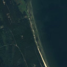
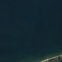
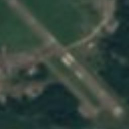
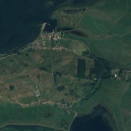
Satellite: Sentinel-2 cloudless 2016 by EOX IT Services GmbH · CC BY 4.0 · Contains modified Copernicus Sentinel data 2016
Greifswalder Oie
Photo: Unukorno · CC BY 4.0 · Wikimedia Commons
Greifswalder OieReport this photo · linked, not stored
Greifswalder Oie
Ruden
Photo: Chron-Paul · CC BY-SA 3.0 · Wikimedia Commons
RudenReport this photo · linked, not stored
Ruden
Streckelsberg
Photo: Dmicha · CC BY-SA 4.0 · Wikimedia Commons
StreckelsbergReport this photo · linked, not stored
Streckelsberg
IslandPeenemünde, Mecklenburg-Vorpommern

Ellenbogen

IslandBest Jun–Jul · Sep
Elevation–above sea level
Area–surface
Nearest townPeenemünde11 km
54.22° N, 13.87° EUTC+2 · Central European Summer Time
When to goPeenemünde · weather score
JanFebMarAprMayJunJulAugSepOctNovDec36October
Best timeJun–Jul · Sep
October: high / low13° / 7°
Island

Ellenbogen in brief

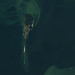
Ellenbogen is an island in Peenemünde, Mecklenburg-Vorpommern, Germany.

The nearest town in the atlas is Peenemünde, 11 km to the SW, where the weather is best in June, July and September.

Peenemünde: weather and travel guide

Weather nearby now

Forecast for Peenemünde
11°
Partly cloudy now
Wind30 km/h
Humidity78%
Cloud cover34%
Today
22 Oct
14°
9°
Fri
23 Oct
13°
6°
Sat
24 Oct
13°
8°
2 mm
Sun
25 Oct
13°
7°
10 mm
Mon
26 Oct
12°
6°
1 mm

Model run 12:00 UTCRefreshed several times a day

When to go

The best months around Ellenbogen

Climate of Peenemünde

Month score in Peenemünde

Comfort, dry days and sunshine · out of 100
14
Jan
20
Feb
28
Mar
45
Apr
66
May
71
Jun
69
Jul
66
Aug
70
Sep
36
Oct
15
Nov
14
Dec
Map

Ellenbogen from above

Nature nearbyAll of Germany
Satellite: Sentinel-2 cloudless 2016 by EOX IT Services GmbH · CC BY 4.0 · Contains modified Copernicus Sentinel data 2016
Oier RiffIsland2.2 kmNEOier Riff
Satellite: Sentinel-2 cloudless 2016 by EOX IT Services GmbH · CC BY 4.0 · Contains modified Copernicus Sentinel data 2016
GänsegrundIsland3.4 kmSWGänsegrund
Photo: Unukorno · CC BY 4.0 · Wikimedia CommonsReport this photo · linked, not stored
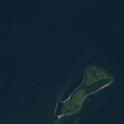
Greifswalder OieIsland4.7 kmNEGreifswalder Oie
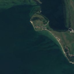
Satellite: Sentinel-2 cloudless 2016 by EOX IT Services GmbH · CC BY 4.0 · Contains modified Copernicus Sentinel data 2016

Peenemünder HakenIsland5.4 kmSWPeenemünder Haken
Photo: Chron-Paul · CC BY-SA 3.0 · Wikimedia CommonsReport this photo · linked, not stored
RudenIsland6.3 kmWRuden
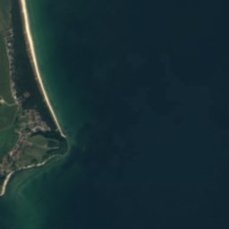
Satellite: Sentinel-2 cloudless 2016 by EOX IT Services GmbH · CC BY 4.0 · Contains modified Copernicus Sentinel data 2016

TonnenbankIsland9.4 kmSWTonnenbank
Summits nearbyMountains of Germany
Photo: Dmicha · CC BY-SA 4.0 · Wikimedia CommonsReport this photo · linked, not stored
Streckelsberg21 km SE58 mJuly 22°Streckelsberg
Stay nearby

Towns close by

Peenemünde
Photo: Gerolsteiner91 · CC BY-SA 3.0 · Wikimedia CommonsReport this photo · linked, not stored

Peenemünde

Mecklenburg-Vorpommern · 11 km SW
13°Oct high
14wet days
36score
Peenemünde
Thiessow
Photo: Klugschnacker · CC BY-SA 3.0 · Wikimedia CommonsReport this photo · linked, not stored

Thiessow

Mecklenburg-Vorpommern · 12 km NW
13°Oct high
14wet days
35score
Thiessow
Karlshagen
Photo: Zacke82 · CC BY-SA 3.0 · Wikimedia CommonsReport this photo · linked, not stored

Karlshagen

Mecklenburg-Vorpommern · 12 km S
13°Oct high
14wet days
36score
Karlshagen
Kröslin
Photo: Chron-Paul · CC BY-SA 3.0 · Wikimedia CommonsReport this photo · linked, not stored

Kröslin

Mecklenburg-Vorpommern · 13 km SW
13°Oct high
14wet days
36score
Kröslin
Around here

Peenemünde and around

Peenemünde
Photo: Gerolsteiner91 · CC BY-SA 3.0 · Wikimedia CommonsReport this photo · linked, not stored

Peenemünde

Mecklenburg-Vorpommern · Germany
Jun–Jul · Sepbest months
22°July high
1 maltitude
Peenemünde

Nature

Cämmerer See
Photo: Chron-Paul · CC BY-SA 3.0 · Wikimedia CommonsReport this photo · linked, not stored
0.8 km SE

Cämmerer See

Lake · 0 m
Cämmerer See
Ziese
Photo: User:UW · Public domain · Wikimedia CommonsReport this photo · linked, not stored
12 km S

Ziese

River
Ziese
Satellite: Sentinel-2 cloudless 2016 by EOX IT Services GmbH · CC BY 4.0 · Contains modified Copernicus Sentinel data 2016
6.2 km NW

Freesendorfer See

Lake · 0 m
Freesendorfer See

Mountains

Streckelsberg
Photo: Dmicha · CC BY-SA 4.0 · Wikimedia CommonsReport this photo · linked, not stored
18 km SE

Streckelsberg

58 m
Streckelsberg
Zirowberg
Photo: Niteshift · CC BY-SA 3.0 · Wikimedia CommonsReport this photo · linked, not stored
36 km SE

Zirowberg

58 m
Zirowberg
Hoher Zwerg
Photo: Assenmacher · CC BY-SA 3.0 · Wikimedia CommonsReport this photo · linked, not stored
16 km SW

Hoher Zwerg

43 m
Hoher Zwerg

Heritage

Kirche Kröslin
Photo: Klugschnacker · CC BY-SA 3.0 · Wikimedia CommonsReport this photo · linked, not stored
2.5 km SW

Kirche Kröslin

architectural heritage monument in Mecklenburg-Vorpommern
Kirche Kröslin
Satellite: Sentinel-2 cloudless 2016 by EOX IT Services GmbH · CC BY 4.0 · Contains modified Copernicus Sentinel data 2016
2.4 km NE

Peenemünde Army Research Center

architectural heritage monument in Mecklenburg-Vorpommern · 1936
Peenemünde Army Research Center
Memorial chapel
Photo: Unukorno · CC BY-SA 3.0 · Wikimedia CommonsReport this photo · linked, not stored
0.4 km N

Memorial chapel

architectural heritage monument in Mecklenburg-Vorpommern
Memorial chapel

Museums

The Peenemünde Historical Technical Museum
Photo: Peter Wippermann · CC BY-SA 3.0 · Wikimedia CommonsReport this photo · linked, not stored
0.2 km NW

The Peenemünde Historical Technical Museum

Military museum · 1991
The Peenemünde Historical Technical Museum
Satellite: Sentinel-2 cloudless 2016 by EOX IT Services GmbH · CC BY 4.0 · Contains modified Copernicus Sentinel data 2016
0.4 km SW

U-461

Museum ship
U-461
Satellite: Sentinel-2 cloudless 2016 by EOX IT Services GmbH · CC BY 4.0 · Contains modified Copernicus Sentinel data 2016
2.6 km W

Heimatstube Freest

Heimatstube Freest