Skip to content
Destinations
Weather & climate
Nature
Outdoors
Culture
Events
Sky & live
Veyle
Photo: Emico · Public domain · Wikimedia Commons
VeyleReport this photo · linked, not stored
Petite Grosne
Photo: Chabe01 · CC BY-SA 4.0 · Wikimedia Commons
Petite GrosneReport this photo · linked, not stored
Petite Grosne
Île Damprun
Photo: Chabe01 · CC BY-SA 4.0 · Wikimedia Commons
Île DamprunReport this photo · linked, not stored
Île Damprun
Lac de Cormoranche-sur-Saône
Photo: Chabe01 · CC BY-SA 4.0 · Wikimedia Commons
Lac de Cormoranche-sur-SaôneReport this photo · linked, not stored
Lac de Cormoranche-sur-Saône
Île Saint-Jean
Photo: Chabe01 · CC BY-SA 4.0 · Wikimedia Commons
Île Saint-JeanReport this photo · linked, not stored
Île Saint-Jean
RiverSaint-Laurent-sur-Saône, Auvergne-Rhône-Alpes

Veyle

RiverBest Apr · Jun · Sep
Elevation–above sea level
Length67 kmsource to mouth
Nearest townSaint-Laurent-sur-Saône1.3 km
46.29° N, 4.84° EUTC+2 · Central European Summer Time
When to goSaint-Laurent-sur-Saône · weather score
JanFebMarAprMayJunJulAugSepOctNovDec63October
Best timeApr · Jun · Sep
October: high / low17° / 9°
River

Veyle in brief

Veyle is a river in Saint-Laurent-sur-Saône, Auvergne-Rhône-Alpes, France.

The nearest town in the atlas is Saint-Laurent-sur-Saône, 1.3 km to the N, where the weather is best in April, June and September.

Veyle is 67 km long.

Saint-Laurent-sur-Saône: weather and travel guide

Weather nearby now

Forecast for Saint-Laurent-sur-Saône
14°
Cloudy now
Wind13 km/h
Humidity63%
Cloud cover98%
Today
22 Oct
15°
5°
Fri
23 Oct
17°
7°
3 mm
Sat
24 Oct
13°
7°
3 mm
Sun
25 Oct
15°
9°
4 mm
Mon
26 Oct
16°
6°

Model run 00:00 UTCRefreshed several times a day

The course of the river

As mapped in OpenStreetMap, with the towns of the atlas along its banks.
12345678
  1. 1Saint-Denis-lès-Bourg235 m
  2. 2Saint-Rémy250 m
  3. 3Buellas222 m
  4. 4Polliat225 m
  5. 5Montcet242 m
  6. 6Vandeins242 m
  7. 7Mézériat210 m
  8. 8Vonnas192 m
sourcemouth (or where the mapped line leaves the country)
When to go

The best months around Veyle

Climate of Saint-Laurent-sur-Saône

Month score in Saint-Laurent-sur-Saône

Comfort, dry days and sunshine · out of 100
21
Jan
29
Feb
44
Mar
67
Apr
64
May
67
Jun
61
Jul
63
Aug
76
Sep
63
Oct
27
Nov
19
Dec
Map

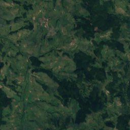
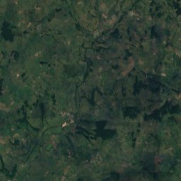
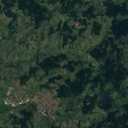
Veyle from above

Nature nearbyAll of France
Photo: Chabe01 · CC BY-SA 4.0 · Wikimedia CommonsReport this photo · linked, not stored
Petite GrosneRiver2.1 kmSWPetite Grosne
Photo: Chabe01 · CC BY-SA 4.0 · Wikimedia CommonsReport this photo · linked, not stored
Île DamprunIsland3.7 kmSWÎle Damprun
Photo: Chabe01 · CC BY-SA 4.0 · Wikimedia CommonsReport this photo · linked, not stored
Lac de Cormoranche-sur-SaôneLake4.4 kmSLac de Cormoranche-sur-Saône
Photo: Chabe01 · CC BY-SA 4.0 · Wikimedia CommonsReport this photo · linked, not stored
Île Saint-JeanIsland4.7 kmNÎle Saint-Jean
Photo: Chabe01 · CC BY-SA 4.0 · Wikimedia CommonsReport this photo · linked, not stored
LoëzeRiver7.8 kmNLoëze
Photo: Chabe01 · CC BY-SA 4.0 · Wikimedia CommonsReport this photo · linked, not stored
ruisseau de MontépinRiver8.3 kmEruisseau de Montépin
Summits nearbyMountains of France
Photo: Anthospace · CC BY-SA 3.0 · Wikimedia CommonsReport this photo · linked, not stored
Signal de la Mère Boitier16 km W758 mJuly 24°Signal de la Mère Boitier
Photo: Anthospace · CC BY-SA 3.0 · Wikimedia CommonsReport this photo · linked, not stored
Mont Saint-Romain23 km N579 mJuly 25°Mont Saint-Romain
Photo: Daniel CULSAN · CC BY-SA 3.0 · Wikimedia CommonsReport this photo · linked, not stored
Rock of Solutré9.1 km W493 mJuly 26°Rock of Solutré
Photo: Stéphane Batigne · CC BY 3.0 · Wikimedia CommonsReport this photo · linked, not stored
Rock of Vergisson9.6 km W485 mJuly 26°Rock of Vergisson
Photo: Pascal · CC BY-SA 3.0 · Wikimedia CommonsReport this photo · linked, not stored
Mount Brouilly25 km SW484 mJuly 27°Mount Brouilly
Stay nearby

Towns close by

Saint-Laurent-sur-Saône
Photo: Chabe01 · CC BY-SA 4.0 · Wikimedia CommonsReport this photo · linked, not stored

Saint-Laurent-sur-Saône

Auvergne-Rhône-Alpes · 1.3 km N
17°Oct high
12wet days
63score
Saint-Laurent-sur-Saône
Mâcon
Photo: Chabe01 · CC BY-SA 4.0 · Wikimedia CommonsReport this photo · linked, not stored

Mâcon

Bourgogne-Franche-Comté · 2.3 km N
17°Oct high
12wet days
62score
Mâcon
Replonges
Photo: Chabe01 · CC BY-SA 4.0 · Wikimedia CommonsReport this photo · linked, not stored

Replonges

Auvergne-Rhône-Alpes · 3.6 km E
17°Oct high
12wet days
63score
Replonges
Varennes-lès-Mâcon
Photo: Chabe01 · CC BY-SA 4.0 · Wikimedia CommonsReport this photo · linked, not stored

Varennes-lès-Mâcon

Bourgogne-Franche-Comté · 3.8 km SW
17°Oct high
12wet days
63score
Varennes-lès-Mâcon
Around here

Saint-Laurent-sur-Saône and around

Saint-Laurent-sur-Saône
Photo: Chabe01 · CC BY-SA 4.0 · Wikimedia CommonsReport this photo · linked, not stored

Saint-Laurent-sur-Saône

Auvergne-Rhône-Alpes · France
Apr · Jun · Sepbest months
28°July high
178 maltitude
Saint-Laurent-sur-Saône

Nature

Menthon
Photo: Chabe01 · CC BY-SA 4.0 · Wikimedia CommonsReport this photo · linked, not stored
9.2 km SE

Menthon

River · 199 m
Menthon
Loëze
Photo: Chabe01 · CC BY-SA 4.0 · Wikimedia CommonsReport this photo · linked, not stored
6.5 km N

Loëze

River
Loëze
Petite Grosne
Photo: Chabe01 · CC BY-SA 4.0 · Wikimedia CommonsReport this photo · linked, not stored
3.4 km S

Petite Grosne

River
Petite Grosne

Mountains

Mont Saint-Rigaud
Photo: Anthospace · CC BY-SA 3.0 · Wikimedia CommonsReport this photo · linked, not stored
29 km W

Mont Saint-Rigaud

1,009 m · Massif Central
Mont Saint-Rigaud
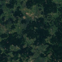
Satellite: Sentinel-2 cloudless 2016 by EOX IT Services GmbH · CC BY 4.0 · Contains modified Copernicus Sentinel data 2016
30 km SW

Mont Monet

1,001 m · Massif Central
Mont Monet
Roche d'Ajoux
Photo: PY54 · CC BY-SA 4.0 · Wikimedia CommonsReport this photo · linked, not stored
32 km SW

Roche d'Ajoux

970 m · Massif Central
Roche d'Ajoux

Heritage

Mâcon Cathedral
Photo: Chabe01 · CC BY-SA 4.0 · Wikimedia CommonsReport this photo · linked, not stored
0.5 km W

Mâcon Cathedral

classified historical monument
Mâcon Cathedral
Le Théâtre
Photo: Chabe01 · CC BY-SA 4.0 · Wikimedia CommonsReport this photo · linked, not stored
1.2 km N

Le Théâtre

Remarkable Contemporary Architecture · 1975
Le Théâtre
Église Saint-Pierre de Mâcon
Photo: Chabe01 · CC BY-SA 4.0 · Wikimedia CommonsReport this photo · linked, not stored
0.7 km W

Église Saint-Pierre de Mâcon

monument historique inscrit
Église Saint-Pierre de Mâcon

Museums

Musée des Ursulines
Photo: Chabe01 · CC BY-SA 4.0 · Wikimedia CommonsReport this photo · linked, not stored
0.7 km W

Musée des Ursulines

Art museum
Musée des Ursulines
Cité des vins et des climats de Bourgogne, site de Mâcon
Photo: Chabe01 · CC BY-SA 4.0 · Wikimedia CommonsReport this photo · linked, not stored
1.1 km N

Cité des vins et des climats de Bourgogne, site de Mâcon

Cité des vins et des climats de Bourgogne, site de Mâcon
Solutré, Museum of Prehistory
Photo: Chabe01 · CC BY-SA 4.0 · Wikimedia CommonsReport this photo · linked, not stored
9.3 km W

Solutré, Museum of Prehistory

1987
Solutré, Museum of Prehistory