Skip to content
Destinations
Weather & climate
Nature
Outdoors
Culture
Events
Sky & live
Teigitsch
Photo: JOADL · CC BY-SA 3.0 · Wikimedia Commons
TeigitschReport this photo · linked, not stored
Gößnitzbach
Photo: Liuthalas · CC BY-SA 4.0 · Wikimedia Commons
GößnitzbachReport this photo · linked, not stored
Gößnitzbach
Langmann-Stausee
Photo: Clemens Stockner · CC BY-SA 3.0 · Wikimedia Commons
Langmann-StauseeReport this photo · linked, not stored
Langmann-Stausee
Hirzmann-Stausee
Photo: Clemens Stockner · CC BY-SA 3.0 · Wikimedia Commons
Hirzmann-StauseeReport this photo · linked, not stored
Hirzmann-Stausee
Fleischhackerhöhle
Photo: Man77 · CC BY-SA 4.0 · Wikimedia Commons
FleischhackerhöhleReport this photo · linked, not stored
Fleischhackerhöhle
RiverKrottendorf bei Ligist, Styria

Teigitsch

RiverBest May–Jun · Sep
Elevation–above sea level
Length44 kmsource to mouth
Nearest townKrottendorf bei Ligist1.5 km
47.02° N, 15.20° EUTC+2 · Central European Summer Time
When to goKrottendorf bei Ligist · weather score
JanFebMarAprMayJunJulAugSepOctNovDec54October
Best timeMay–Jun · Sep
October: high / low15° / 6°
River

Teigitsch in brief

Teigitsch is a river in Krottendorf bei Ligist, Styria, Austria.

The nearest town in the atlas is Krottendorf bei Ligist, 1.5 km to the SE, where the weather is best in May, June and September.

Teigitsch is 44 km long.

Krottendorf bei Ligist: weather and travel guide

Weather nearby now

Forecast for Krottendorf bei Ligist
14°
Sunny now
Wind3 km/h
Humidity54%
Cloud cover17%
Today
22 Oct
15°
4°
Fri
23 Oct
15°
1°
Sat
24 Oct
11°
3°
2 mm
Sun
25 Oct
13°
1°
Mon
26 Oct
16°
3°

Model run 00:00 UTCRefreshed several times a day

The course of the river

As mapped in OpenStreetMap, with the towns of the atlas along its banks.
sourcemouth (or where the mapped line leaves the country)
When to go

The best months around Teigitsch

Climate of Krottendorf bei Ligist

Month score in Krottendorf bei Ligist

Comfort, dry days and sunshine · out of 100
25
Jan
27
Feb
33
Mar
64
Apr
65
May
65
Jun
61
Jul
63
Aug
66
Sep
54
Oct
26
Nov
24
Dec
Map

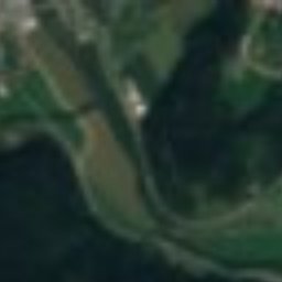
Teigitsch from above

Nature nearbyAll of Austria
Photo: Liuthalas · CC BY-SA 4.0 · Wikimedia CommonsReport this photo · linked, not stored
GößnitzbachRiver2.7 kmWGößnitzbach
Photo: Clemens Stockner · CC BY-SA 3.0 · Wikimedia CommonsReport this photo · linked, not stored
Langmann-StauseeLake8.4 kmSWLangmann-Stausee
Photo: Clemens Stockner · CC BY-SA 3.0 · Wikimedia CommonsReport this photo · linked, not stored
Hirzmann-StauseeLake9.9 kmWHirzmann-Stausee
Photo: Man77 · CC BY-SA 4.0 · Wikimedia CommonsReport this photo · linked, not stored
FleischhackerhöhleCave11 kmNWFleischhackerhöhle
Photo: Christian Pirkl · CC BY-SA 3.0 at · Wikimedia CommonsReport this photo · linked, not stored
HeidentempelCave11 kmNWHeidentempel
Photo: Man77 · CC BY-SA 4.0 · Wikimedia CommonsReport this photo · linked, not stored
OchsenlochCave11 kmNWOchsenloch
Summits nearbyMountains of Austria
Photo: WA-Wien · CC BY-SA 3.0 · Wikimedia CommonsReport this photo · linked, not stored
Rappoldkogel25 km W1,928 mJuly 16°Rappoldkogel
Photo: Josef Moser · CC BY-SA 3.0 · Wikimedia CommonsReport this photo · linked, not stored
Handalm24 km SW1,853 mJuly 15°Handalm
Photo: Liuthalas · CC BY-SA 4.0 · Wikimedia CommonsReport this photo · linked, not stored
Roßbachkogel23 km NW1,848 mJuly 16°Roßbachkogel
Photo: Josef Moser · CC BY-SA 3.0 · Wikimedia CommonsReport this photo · linked, not stored
Weberkogel, Osterwitz23 km SW1,805 mJuly 16°Weberkogel, Osterwitz
Photo: Schreckgespenst · CC BY-SA 4.0 · Wikimedia CommonsReport this photo · linked, not stored
Ternbachkogel24 km NW1,734 mJuly 17°Ternbachkogel
Photo: Naturpuur · CC BY-SA 4.0 · Wikimedia CommonsReport this photo · linked, not stored
Bärofen21 km SW1,720 mJuly 17°Bärofen
Stay nearby

Towns close by

Krottendorf bei Ligist
Photo: Isiwal · CC BY-SA 3.0 at · Wikimedia CommonsReport this photo · linked, not stored

Krottendorf bei Ligist

Styria · 1.5 km SE
15°Oct high
12wet days
54score
Krottendorf bei Ligist
Ligist
Photo: Liuthalas · CC BY-SA 4.0 · Wikimedia CommonsReport this photo · linked, not stored

Ligist

Styria · 3.3 km S
16°Oct high
9wet days
61score
Ligist
Stallhofen
Photo: Liuthalas · CC BY-SA 4.0 · Wikimedia CommonsReport this photo · linked, not stored

Stallhofen

Styria · 3.4 km NE
16°Oct high
12wet days
55score
Stallhofen
Voitsberg
Photo: Thomas Ledl · CC BY 4.0 · Wikimedia CommonsReport this photo · linked, not stored

Voitsberg

Styria · 4.2 km NW
15°Oct high
12wet days
54score
Voitsberg
Around here

Krottendorf bei Ligist and around

Krottendorf bei Ligist
Photo: Isiwal · CC BY-SA 3.0 at · Wikimedia CommonsReport this photo · linked, not stored

Krottendorf bei Ligist

Styria · Austria
May–Jun · Sepbest months
27°July high
358 maltitude
Krottendorf bei Ligist

Nature

Gößnitzbach
Photo: Liuthalas · CC BY-SA 4.0 · Wikimedia CommonsReport this photo · linked, not stored
4.1 km W

Gößnitzbach

River
Gößnitzbach
Langmann-Stausee
Photo: Clemens Stockner · CC BY-SA 3.0 · Wikimedia CommonsReport this photo · linked, not stored
9.4 km SW

Langmann-Stausee

Lake
Langmann-Stausee
Hirzmann-Stausee
Photo: Clemens Stockner · CC BY-SA 3.0 · Wikimedia CommonsReport this photo · linked, not stored
11 km W

Hirzmann-Stausee

Lake
Hirzmann-Stausee

Mountains

Ameringkogel
Photo: WA-Wien · CC BY-SA 3.0 · Wikimedia CommonsReport this photo · linked, not stored
32 km W

Ameringkogel

2,187 m · Stubalpe
Ameringkogel
Größenberg, Styria
Photo: Robert Guschelbauer · CC BY-SA 3.0 · Wikimedia CommonsReport this photo · linked, not stored
33 km W

Größenberg, Styria

2,152 m · Packalpe
Größenberg, Styria
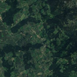
Satellite: Sentinel-2 cloudless 2016 by EOX IT Services GmbH · CC BY 4.0 · Contains modified Copernicus Sentinel data 2016
32 km SW

Grosser Speikkogel

2,140 m · Koralpe
Grosser Speikkogel

Heritage

Ruine Ligist
Photo: Hans Georg Zach · CC BY 3.0 · Wikimedia CommonsReport this photo · linked, not stored
2.4 km S

Ruine Ligist

Listed objects in Austria
Ruine Ligist
Satellite: Sentinel-2 cloudless 2016 by EOX IT Services GmbH · CC BY 4.0 · Contains modified Copernicus Sentinel data 2016
1.1 km SE

Kath. Pfarrkirche Sankt Johann-Köppling

Listed objects in Austria
Kath. Pfarrkirche Sankt Johann-Köppling
Schloss Hohenburg, Styria
Photo: Liuthalas · CC BY-SA 4.0 · Wikimedia CommonsReport this photo · linked, not stored
1.3 km SE

Schloss Hohenburg, Styria

Listed objects in Austria
Schloss Hohenburg, Styria

Museums

Gustinus Ambrosi-Museum
Photo: Liuthalas · CC BY-SA 3.0 at · Wikimedia CommonsReport this photo · linked, not stored
3.5 km N

Gustinus Ambrosi-Museum

Gustinus Ambrosi-Museum
Satellite: Sentinel-2 cloudless 2016 by EOX IT Services GmbH · CC BY 4.0 · Contains modified Copernicus Sentinel data 2016
3.0 km NW

Burgmuseum Krems

Burgmuseum Krems
Satellite: Sentinel-2 cloudless 2016 by EOX IT Services GmbH · CC BY 4.0 · Contains modified Copernicus Sentinel data 2016
3.8 km NE

Traktormuseum Lackner

Traktormuseum Lackner