Skip to content
Destinations
Weather & climate
Nature
Outdoors
Culture
Events
Sky & live
Kohlenbach
Photo: Braveheart · CC BY-SA 4.0 · Wikimedia Commons
KohlenbachReport this photo · linked, not stored
Schwarzlofer
Photo: Braveheart · CC BY-SA 4.0 · Wikimedia Commons
SchwarzloferReport this photo · linked, not stored
Schwarzlofer
Taubensee
Photo: Datenquelle: Bayerische Vermessungsverwaltung – www.geodaten.bayern.de · CC BY 3.0 de · Wikimedia Commons
TaubenseeReport this photo · linked, not stored
Taubensee
Brunnbach (Hagertal)
Photo: Notiro · CC BY-SA 4.0 · Wikimedia Commons
Brunnbach (Hagertal)Report this photo · linked, not stored
Brunnbach (Hagertal)
Walchsee
Photo: Powerbiker1 (Thomas Kees) · CC BY-SA 2.0 de · Wikimedia Commons
WalchseeReport this photo · linked, not stored
Walchsee
RiverKössen, Tyrol

Kohlenbach

RiverBest May · Jul–Aug
Elevation–above sea level
Length16 kmsource to mouth
Nearest townKössen0.6 km
47.67° N, 12.40° EUTC+2 · Central European Summer Time
When to goKössen · weather score
JanFebMarAprMayJunJulAugSepOctNovDec48October
Best timeMay · Jul–Aug
October: high / low15° / 5°
River

Kohlenbach in brief

Kohlenbach is a river in Kössen, Tyrol, Austria.

The nearest town in the atlas is Kössen, 0.6 km to the NE, where the weather is best in May, July and August.

Kohlenbach is 16 km long.

Kössen: weather and travel guide

Weather nearby now

Forecast for Kössen
11°
Sunny now
Wind7 km/h
Humidity54%
Cloud cover0%
Today
22 Oct
11°
1°
4 mm
Fri
23 Oct
14°
0°
6 mm
Sat
24 Oct
8°
1°
5 mm
Sun
25 Oct
11°
1°
13 mm
Mon
26 Oct
11°
7°

Model run 00:00 UTCRefreshed several times a day

When to go

The best months around Kohlenbach

Climate of Kössen

Month score in Kössen

Comfort, dry days and sunshine · out of 100
21
Jan
25
Feb
19
Mar
54
Apr
64
May
64
Jun
66
Jul
65
Aug
64
Sep
48
Oct
27
Nov
20
Dec
Map

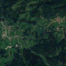
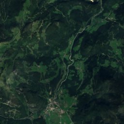
Kohlenbach from above

Nature nearbyAll of Austria
Photo: Braveheart · CC BY-SA 4.0 · Wikimedia CommonsReport this photo · linked, not stored
SchwarzloferRiver1.6 kmESchwarzlofer
Photo: Datenquelle: Bayerische Vermessungsverwaltung – www.geodaten.bayern.de · CC BY 3.0 de · Wikimedia CommonsReport this photo · linked, not stored
TaubenseeLake4.0 kmNETaubensee
Photo: Notiro · CC BY-SA 4.0 · Wikimedia CommonsReport this photo · linked, not stored
Brunnbach (Hagertal)River5.5 kmSEBrunnbach (Hagertal)
Photo: Powerbiker1 (Thomas Kees) · CC BY-SA 2.0 de · Wikimedia CommonsReport this photo · linked, not stored
WalchseeLake6.0 kmWWalchsee
Photo: FreeriderMuc666 · CC0 · Wikimedia CommonsReport this photo · linked, not stored
Priener HütteMountain hut6.8 kmNWPriener Hütte
Photo: Thorsten Hartmann · CC BY-SA 3.0 · Wikimedia CommonsReport this photo · linked, not stored
Wössener SeeLake8.6 kmNEWössener See
Summits nearbyMountains of Austria
Photo: Jörg Braukmann · CC BY-SA 3.0 · Wikimedia CommonsReport this photo · linked, not stored
Großes Ochsenhorn24 km SE2,511 mJuly 12°Großes Ochsenhorn
Photo: Jörg Braukmann · CC BY-SA 3.0 · Wikimedia CommonsReport this photo · linked, not stored
Mitterhorn, Tyrol21 km SE2,506 mJuly 12°Mitterhorn, Tyrol
Satellite: Sentinel-2 cloudless 2016 by EOX IT Services GmbH · CC BY 4.0 · Contains modified Copernicus Sentinel data 2016
Breithorn, Salzburg22 km SE2,415 mJuly 13°Breithorn, Salzburg
Satellite: Sentinel-2 cloudless 2016 by EOX IT Services GmbH · CC BY 4.0 · Contains modified Copernicus Sentinel data 2016
Rothorn, Tyrol20 km SE2,404 mJuly 13°Rothorn, Tyrol
Photo: Unknown author · CC BY-SA 3.0 · Wikimedia CommonsReport this photo · linked, not stored
Ellmauer Halt14 km SW2,344 mJuly 14°Ellmauer Halt
Photo: Blutgretchen · CC BY-SA 3.0 · Wikimedia CommonsReport this photo · linked, not stored
Ackerlspitze14 km S2,329 mJuly 14°Ackerlspitze
Stay nearby

Towns close by

Kössen
Photo: Braveheart · CC BY-SA 4.0 · Wikimedia CommonsReport this photo · linked, not stored

Kössen

Tyrol · 0.6 km NE
15°Oct high
13wet days
48score
Kössen
Schwendt
Photo: Braveheart · CC BY-SA 4.0 · Wikimedia CommonsReport this photo · linked, not stored

Schwendt

Tyrol · 3.8 km S
14°Oct high
13wet days
46score
Schwendt
Reit im Winkl
Photo: en:stone · CC BY 2.5 · Wikimedia CommonsReport this photo · linked, not stored

Reit im Winkl

Bavaria · 5.5 km E
14°Oct high
13wet days
43score
Reit im Winkl
Schleching
Photo: en:stone · CC BY-SA 3.0 · Wikimedia CommonsReport this photo · linked, not stored

Schleching

Bavaria · 6.2 km N
15°Oct high
13wet days
48score
Schleching
Around here

Kössen and around

Kössen
Photo: Braveheart · CC BY-SA 4.0 · Wikimedia CommonsReport this photo · linked, not stored

Kössen

Tyrol · Austria
May · Jul–Augbest months
24°July high
589 maltitude
Kössen

Nature

Walchsee
Photo: Powerbiker1 (Thomas Kees) · CC BY-SA 2.0 de · Wikimedia CommonsReport this photo · linked, not stored
6.6 km SW

Walchsee

Lake · 655 m
Walchsee
Schwarzlofer
Photo: Braveheart · CC BY-SA 4.0 · Wikimedia CommonsReport this photo · linked, not stored
1.4 km SE

Schwarzlofer

River
Schwarzlofer
Weitsee
Photo: Carsten Steger · CC BY-SA 4.0 · Wikimedia CommonsReport this photo · linked, not stored
12 km E

Weitsee

Lake · 753 m
Weitsee

Mountains

Birnhorn
Photo: Luidger · CC BY 3.0 · Wikimedia CommonsReport this photo · linked, not stored
33 km SE

Birnhorn

2,634 m · Loferer und Leoganger Steinberge
Birnhorn
Hochkalter
Photo: Jörg Braukmann · CC BY-SA 3.0 · Wikimedia CommonsReport this photo · linked, not stored
36 km E

Hochkalter

2,607 m
Hochkalter
Hocheisspitze
Photo: J. Braukmann Milseburg · CC BY-SA 3.0 · Wikimedia CommonsReport this photo · linked, not stored
36 km E

Hocheisspitze

2,523 m
Hocheisspitze

Heritage

Saint Anna chapel in Kössen
Photo: Rollroboter · CC BY-SA 4.0 · Wikimedia CommonsReport this photo · linked, not stored
1.4 km SW

Saint Anna chapel in Kössen

Listed objects in Austria · 1725
Saint Anna chapel in Kössen
Pfarrkirche hll. Petrus und Paulus, Kössen
Photo: User: Bbb at wikivoyage shared · CC BY-SA 3.0 · Wikimedia CommonsReport this photo · linked, not stored
under 100 m SW

Pfarrkirche hll. Petrus und Paulus, Kössen

Listed objects in Austria · 1719
Pfarrkirche hll. Petrus und Paulus, Kössen
Maria Klobenstein
Photo: Rufus46 · CC BY-SA 3.0 · Wikimedia CommonsReport this photo · linked, not stored
2.2 km N

Maria Klobenstein

Listed objects in Austria · 1707
Maria Klobenstein

Museums

Heimatmuseum Niederndorf
Photo: Rufus46 · CC BY-SA 4.0 · Wikimedia CommonsReport this photo · linked, not stored
14 km W

Heimatmuseum Niederndorf

Local museum · 2002
Heimatmuseum Niederndorf
Müllner Peter Museum
Photo: User: Bbb at wikivoyage shared · CC BY-SA 3.0 · Wikimedia CommonsReport this photo · linked, not stored
11 km W

Müllner Peter Museum

Biographical museum
Müllner Peter Museum
Museum Metzgerhof
Photo: Leitzsche · CC0 · Wikimedia CommonsReport this photo · linked, not stored
13 km S

Museum Metzgerhof

Local museum
Museum Metzgerhof