Skip to content
Destinations
Weather & climate
Nature
Outdoors
Culture
Events
Sky & live
Floitenkees
Photo: Whgler · CC BY-SA 3.0 · Wikimedia Commons
FloitenkeesReport this photo · linked, not stored
Schwarzensteinhütte
Photo: Cactus26 · CC BY-SA 3.0 · Wikimedia Commons
SchwarzensteinhütteReport this photo · linked, not stored
Schwarzensteinhütte
Greizer Hütte
Photo: Holger.Ellgaard 18:18, 9. Jan. 2008 (CET) · CC BY-SA 2.0 de · Wikimedia Commons
Greizer HütteReport this photo · linked, not stored
Greizer Hütte
Schwarzensteinkees
Photo: Whgler · CC BY-SA 3.0 · Wikimedia Commons
SchwarzensteinkeesReport this photo · linked, not stored
Schwarzensteinkees
Schwarzsee (Zillertaler Alpen)
Photo: Nawi112 · CC BY-SA 3.0 · Wikimedia Commons
Schwarzsee (Zillertaler Alpen)Report this photo · linked, not stored
Schwarzsee (Zillertaler Alpen)
GlacierFinkenberg, Tyrol

Floitenkees

GlacierBest Jun–Aug
Elevation–above sea level
Area–surface
Nearest townValle Aurina - Ahrntal7.5 km
47.03° N, 11.89° EUTC+1 · Central European Standard Time
When to goFinkenberg · weather score
JanFebMarAprMayJunJulAugSepOctNovDec43October
Best timeMay · Jul–Aug
October: high / low14° / 4°
Glacier

Floitenkees in brief

Floitenkees is a glacier in Finkenberg, Tyrol, Austria.

The nearest town is Valle Aurina - Ahrntal, 7.5 km to the SE, where the weather is best in June, July and August.

Valle Aurina - Ahrntal: weather and travel guide

Weather nearby now

Forecast for Valle Aurina - Ahrntal
7°
Rain now
Wind5 km/h
Humidity88%
Cloud cover100%
Today
25 Oct
7°
-2°
8 mm
Mon
26 Oct
8°
-1°
Tue
27 Oct
13°
2°
Wed
28 Oct
10°
6°
Thu
29 Oct
11°
2°

Model run 00:00 UTCRefreshed several times a day

When to go

The best months around Floitenkees

Climate of Valle Aurina - Ahrntal

Month score in Valle Aurina - Ahrntal

Comfort, dry days and sunshine · out of 100
24
Jan
25
Feb
21
Mar
37
Apr
60
May
63
Jun
65
Jul
64
Aug
63
Sep
37
Oct
21
Nov
23
Dec
Map

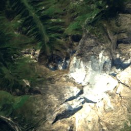
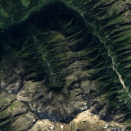
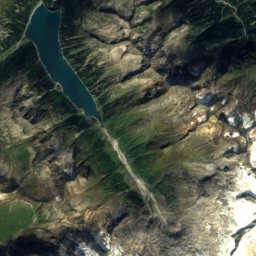
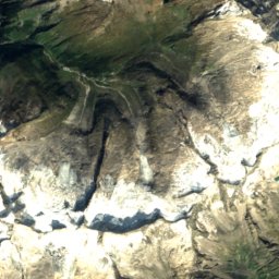
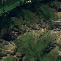
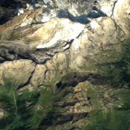
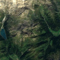
Floitenkees from above

Nature nearbyAll of Austria
Photo: Cactus26 · CC BY-SA 3.0 · Wikimedia CommonsReport this photo · linked, not stored
SchwarzensteinhütteMountain hut1.8 kmSSchwarzensteinhütte
Photo: Holger.Ellgaard 18:18, 9. Jan. 2008 (CET) · CC BY-SA 2.0 de · Wikimedia CommonsReport this photo · linked, not stored
Greizer HütteMountain hut1.8 kmNGreizer Hütte
Photo: Whgler · CC BY-SA 3.0 · Wikimedia CommonsReport this photo · linked, not stored
SchwarzensteinkeesGlacier2.9 kmSWSchwarzensteinkees
Photo: Nawi112 · CC BY-SA 3.0 · Wikimedia CommonsReport this photo · linked, not stored
Schwarzsee (Zillertaler Alpen)Lake4.9 kmWSchwarzsee (Zillertaler Alpen)
Photo: Hejkal · CC BY-SA 3.0 · Wikimedia CommonsReport this photo · linked, not stored
Kasseler HütteMountain hut5.5 kmNEKasseler Hütte
Photo: Krischan74 · CC BY 2.5 · Wikimedia CommonsReport this photo · linked, not stored
Berliner HütteMountain hut6.0 kmWBerliner Hütte
Summits nearbyMountains of Austria
Photo: Carsten Steger · CC BY-SA 4.0 · Wikimedia CommonsReport this photo · linked, not stored
Hochfeiler14 km SW3,509 mJuly 6°Hochfeiler
Photo: ReddishClover · CC BY 4.0 · Wikimedia CommonsReport this photo · linked, not stored
Rötspitze24 km E3,496 mJuly 6°Rötspitze
Photo: Carsten Steger · CC BY-SA 4.0 · Wikimedia CommonsReport this photo · linked, not stored
Großer Möseler9.3 km SW3,480 mJuly 6°Großer Möseler
Photo: Haneburger · Public domain · Wikimedia CommonsReport this photo · linked, not stored
Olperer18 km W3,476 mJuly 6°Olperer
Satellite: Sentinel-2 cloudless 2016 by EOX IT Services GmbH · CC BY 4.0 · Contains modified Copernicus Sentinel data 2016
Hochfernerspitze14 km SW3,470 mJuly 6°Hochfernerspitze
Photo: I, Michael Kranewitter · CC BY 2.5 · Wikimedia CommonsReport this photo · linked, not stored
Hochgall23 km SE3,436 mJuly 6°Hochgall
Stay nearby

Towns close by

Valle Aurina - Ahrntal
Photo: Pmk58 · CC BY-SA 4.0 · Wikimedia CommonsReport this photo · linked, not stored

Valle Aurina - Ahrntal

Trentino-Alto Adige · 7.5 km SE
13°Oct high
13wet days
37score
Valle Aurina - Ahrntal
Luttach
Photo: Alletto · CC BY-SA 3.0 · Wikimedia CommonsReport this photo · linked, not stored

Luttach

Trentino-Alto Adige · 9.0 km S
13°Oct high
13wet days
38score
Luttach
Sand in Taufers
Photo: Josef Tinkhauser · CC BY-SA 3.0 · Wikimedia CommonsReport this photo · linked, not stored

Sand in Taufers

Trentino-Alto Adige · 14 km S
14°Oct high
13wet days
43score
Sand in Taufers
Mühlen in Taufers
Photo: Josef Tinkhauser · CC BY-SA 3.0 · Wikimedia CommonsReport this photo · linked, not stored

Mühlen in Taufers

Trentino-Alto Adige · 15 km S
14°Oct high
13wet days
42score
Mühlen in Taufers
Around here

Finkenberg and around

Finkenberg
Photo: Feel free to use my photos, but please mention me as the author and if you want · CC BY-SA 3.0 at · Wikimedia CommonsReport this photo · linked, not stored

Finkenberg

Tyrol · Austria
May · Jul–Augbest months
24°July high
868 maltitude
Finkenberg

Nature

Gerlosbach
Photo: Sönke Kraft aka Arnulf zu Linden · CC BY-SA 3.0 · Wikimedia CommonsReport this photo · linked, not stored
11 km NE

Gerlosbach

River
Gerlosbach
Zemmbach
Photo: Gehirnpfirsich · CC BY-SA 3.0 · Wikimedia CommonsReport this photo · linked, not stored
3.3 km NE

Zemmbach

River
Zemmbach
Tuxbach
Photo: Simon Koopmann · CC BY-SA 2.0 de · Wikimedia CommonsReport this photo · linked, not stored
1.2 km E

Tuxbach

River
Tuxbach

Mountains

Großvenediger
Photo: Jörg Braukmann · CC BY-SA 4.0 · Wikimedia CommonsReport this photo · linked, not stored
40 km E

Großvenediger

3,657 m · Venediger Group
Großvenediger
Hochfeiler
Photo: Carsten Steger · CC BY-SA 4.0 · Wikimedia CommonsReport this photo · linked, not stored
21 km S

Hochfeiler

3,509 m
Hochfeiler
Dreiherrnspitze
Photo: Schlesinger · CC BY-SA 4.0 · Wikimedia CommonsReport this photo · linked, not stored
33 km E

Dreiherrnspitze

3,499 m · Venediger Group
Dreiherrnspitze

Heritage

Pfarrkirche Finkenberg
Photo: Leitzsche · CC0 · Wikimedia CommonsReport this photo · linked, not stored
0.2 km NE

Pfarrkirche Finkenberg

Listed objects in Austria · 1720
Pfarrkirche Finkenberg
Teufelsbrücke Finkenberg
Photo: Haeferl · CC BY-SA 4.0 · Wikimedia CommonsReport this photo · linked, not stored
0.3 km SW

Teufelsbrücke Finkenberg

Listed objects in Austria · 1876
Teufelsbrücke Finkenberg
Pfarrkirche hl. Veit, Zell am Ziller
Photo: Haeferl · CC BY-SA 4.0 · Wikimedia CommonsReport this photo · linked, not stored
10 km NE

Pfarrkirche hl. Veit, Zell am Ziller

Listed objects in Austria · 1778
Pfarrkirche hl. Veit, Zell am Ziller

Museums

Satellite: Sentinel-2 cloudless 2016 by EOX IT Services GmbH · CC BY 4.0 · Contains modified Copernicus Sentinel data 2016
0.2 km W

Mineralien- und Kristallmuseum Finkenberg

Geological museum
Mineralien- und Kristallmuseum Finkenberg
Pfarrstadl Mitterstall
Photo: Haeferl · CC BY-SA 4.0 · Wikimedia CommonsReport this photo · linked, not stored
5.9 km E

Pfarrstadl Mitterstall

Pfarrstadl Mitterstall
Museum Strasser Häusl
Photo: DARIUSzpre · CC BY 3.0 · Wikimedia CommonsReport this photo · linked, not stored
7.9 km NE

Museum Strasser Häusl

Museum Strasser Häusl