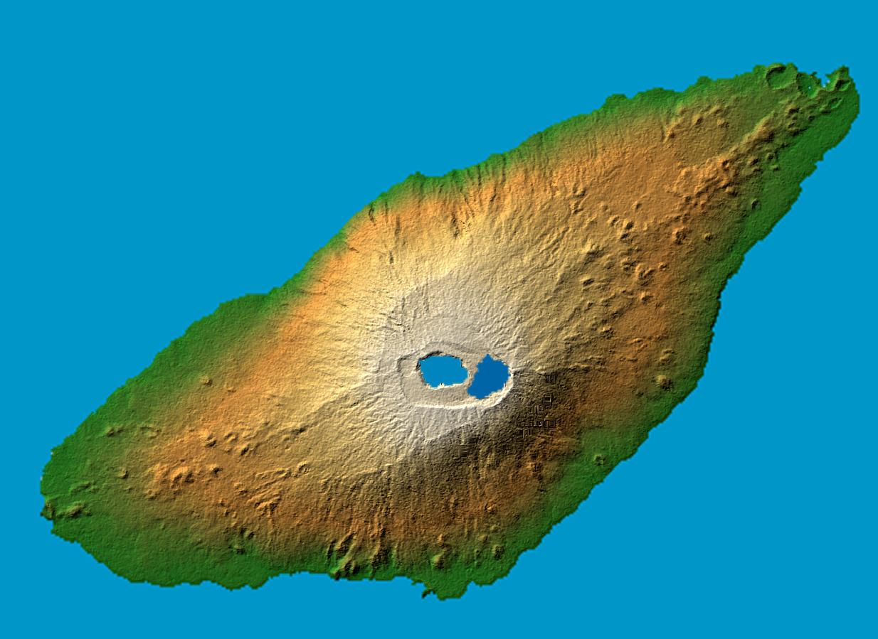
Photo: NASA/JPL/NGA · Public domain · Wikimedia Commons
Aoba IslandReport this photo · linked, not stored
Aoba IslandReport this photo · linked, not stored

VanuatuSummit weather, forecast and climate
Aoba Island
Shield volcano · last major eruption 20181,496 mMajor summit
Elevation1,496 mabove sea level
Prominence1,496 mindependent height
Isolation1.6 kmto a higher summit
Summit, Jul19°average high
15.40° S, 167.83° EElevation 1,496 mUTC+0 · Coordinated Universal Time
From the valley to the top
- Summit1,496 m
- Mid-mountain900 m
- Valley296 m
Freezing level in October: above the summit
iThe mountain
Aoba Island in brief
Aoba Island rises to 1,496 m, Vanuatu. Its topographic prominence — the height it stands above the lowest contour enclosing a higher summit — is 1,496 m, a major independent summit.
At the summit, March is the mildest month with average highs of 22°, while nights rarely fall below freezing.
Facts
- Elevation
- 1,496 m · 4,908 ft
- Prominence
- 1,496 m
- Country
- Vanuatu
- Coordinates
- -15.4000, 167.8333
- Nearest airport
- Santo Pekoa International Airport (SON) · 67 km
iiForecast
Weather at three heights
Temperatures are adjusted to each height; summits are usually colder and windier than the valley forecast suggests.
Loading the latest forecast…
Loading the latest forecast…
Loading the latest forecast…
iiiSummit climate
The top of Aoba Island by month
Summit temperatures and precipitation
Climate normals for the summit area (~1 km grid), station-adjusted| Month | Jan | Feb | Mar | Apr | May | Jun | Jul | Aug | Sep | Oct | Nov | Dec |
|---|---|---|---|---|---|---|---|---|---|---|---|---|
| Average high | 21° | 21° | 22° | 21° | 20° | 20° | 19° | 19° | 19° | 20° | 20° | 21° |
| Average low | 20° | 20° | 20° | 20° | 19° | 19° | 18° | 18° | 18° | 18° | 19° | 19° |
| Precipitation | 371 mm | 401 mm | 415 mm | 407 mm | 285 mm | 248 mm | 176 mm | 189 mm | 171 mm | 209 mm | 308 mm | 303 mm |
| Cloud cover | 57% | 64% | 59% | 48% | 47% | 43% | 42% | 39% | 39% | 38% | 42% | 46% |
| Daylight | 12h 57 | 12h 36 | 12h 12 | 11h 46 | 11h 24 | 11h 13 | 11h 17 | 11h 35 | 12h 00 | 12h 25 | 12h 49 | 13h 02 |
| Month score | 56 | 53 | 55 | 60 | 60 | 62 | 62 | 63 | 63 | 64 | 62 | 60 |
Snow and freezing level
Average height of the 0 °C level from the summit normals (6.5 °C per km); snow months have a summit mean at or below +1 °C| Month | Jan | Feb | Mar | Apr | May | Jun | Jul | Aug | Sep | Oct | Nov | Dec |
|---|---|---|---|---|---|---|---|---|---|---|---|---|
| Freezing level | 4,650 m | 4,650 m | 4,700 m | 4,600 m | 4,500 m | 4,450 m | 4,300 m | 4,300 m | 4,350 m | 4,400 m | 4,500 m | 4,550 m |
| Summit | above 0 °C | above 0 °C | above 0 °C | above 0 °C | above 0 °C | above 0 °C | above 0 °C | above 0 °C | above 0 °C | above 0 °C | above 0 °C | above 0 °C |
ivTerrain
Aoba Island in 3D
vNeighbours
Mountains of VanuatuPeaks nearby
| Mountain | Elevation | Prominence | Distance | July summit high |
|---|---|---|---|---|
| Lombenben | 1,496 m | 1,496 m | 1.6 km SE | 18° |