
Photo: Xabier Armendaritz · CC BY 3.0 · Wikimedia Commons
UsurbeReport this photo · linked, not stored
UsurbeReport this photo · linked, not stored

Photo: Mikel Larreategi · CC BY-SA 4.0 · Wikimedia Commons
AketegiReport this photo · linked, not stored
AketegiAketegiReport this photo · linked, not stored

Photo: Mikel Larreategi · CC BY-SA 4.0 · Wikimedia Commons
Aketegi erpinaReport this photo · linked, not stored
Aketegi erpinaAketegi erpinaReport this photo · linked, not stored
 Aizkorri

Photo: Mikel Larreategi · CC BY-SA 4.0 · Wikimedia Commons
AitxuriReport this photo · linked, not stored
AitxuriAitxuriReport this photo · linked, not stored
Murumendi-Urraki mountain range · Basque Country · SpainSummit weather, forecast and climate
Usurbe
707 m
Elevation707 mabove sea level
Prominence–independent height
Isolation2.9 kmto a higher summit
Summit, Jul24°average high
43.07° N, 2.20° WElevation 707 mUTC+1 · Central European Standard Time
From the valley to the top
- Summit707 m
- Mid-mountain470 m
- Valley · Beasain236 m
Freezing level in October: above the summit
iThe mountain
Usurbe in brief
Usurbe rises to 707 m in the Murumendi-Urraki mountain range, Basque Country, Spain.
At the summit, August is the mildest month with average highs of 25°, while nights rarely fall below freezing.
The nearest town is Beasain, 1.7 km to the S at 236 m.
Facts
- Elevation
- 707 m · 2,320 ft
- Range
- Murumendi-Urraki mountain range
- Region
- Basque Country
- Country
- Spain
- Coordinates
- 43.0657, -2.2038
- Nearest airport
- San Sebastián Airport (EAS) · 47 km
iiForecast
Weather at three heights
Temperatures are adjusted to each height; summits are usually colder and windier than the valley forecast suggests.
Loading the latest forecast…
Loading the latest forecast…
Loading the latest forecast…
iiiSummit climate
The top of Usurbe by month
Summit temperatures and precipitation
Climate normals for the summit area (~1 km grid), station-adjusted| Month | Jan | Feb | Mar | Apr | May | Jun | Jul | Aug | Sep | Oct | Nov | Dec |
|---|---|---|---|---|---|---|---|---|---|---|---|---|
| Average high | 9° | 10° | 13° | 15° | 19° | 22° | 24° | 25° | 22° | 18° | 12° | 10° |
| Average low | 3° | 2° | 4° | 6° | 9° | 12° | 13° | 14° | 11° | 9° | 6° | 3° |
| Precipitation | 175 mm | 138 mm | 145 mm | 165 mm | 138 mm | 91 mm | 72 mm | 90 mm | 99 mm | 151 mm | 191 mm | 188 mm |
| Cloud cover | 46% | 43% | 42% | 43% | 42% | 39% | 35% | 35% | 35% | 40% | 44% | 46% |
| Daylight | 9h 21 | 10h 32 | 11h 53 | 13h 23 | 14h 39 | 15h 21 | 15h 04 | 13h 58 | 12h 32 | 11h 05 | 9h 45 | 9h 01 |
| Month score | 18 | 20 | 36 | 46 | 62 | 71 | 78 | 73 | 71 | 61 | 31 | 18 |
Snow and freezing level
Average height of the 0 °C level from the summit normals (6.5 °C per km); snow months have a summit mean at or below +1 °C| Month | Jan | Feb | Mar | Apr | May | Jun | Jul | Aug | Sep | Oct | Nov | Dec |
|---|---|---|---|---|---|---|---|---|---|---|---|---|
| Freezing level | 1,600 m | 1,650 m | 2,050 m | 2,300 m | 2,800 m | 3,300 m | 3,550 m | 3,650 m | 3,250 m | 2,800 m | 2,100 m | 1,700 m |
| Summit | above 0 °C | above 0 °C | above 0 °C | above 0 °C | above 0 °C | above 0 °C | above 0 °C | above 0 °C | above 0 °C | above 0 °C | above 0 °C | above 0 °C |
ivTerrain
Usurbe in 3D
vNeighbours
Mountains of SpainPeaks nearby
| Mountain | Elevation | Prominence | Distance | July summit high |
|---|---|---|---|---|
| Aketegi | 1,551 m | 943 m | 16 km SW | 21° |
| Aketegi erpina | 1,548 m | 12 m | 16 km SW | 20° |
| Aizkorri | 1,523 m | 51 m | 16 km SW | 20° |
| Aitxuri | 1,508 m | 943 m | 16 km SW | 21° |
| Aratz | 1,443 m | 276 m | 18 km SW | 21° |
| Ganboa | 1,412 m | 200 m | 13 km SE | 20° |
| Artzanburu | 1,368 m | – | 16 km SW | 21° |
| Beoain | 1,359 m | – | 15 km SE | 21° |
viBase towns
Where to stay nearby


Around here
Beasain and around
Nature

Photo: playant http://www.guregipuzkoa.net/search/search.php?id_usuarios=10 · CC BY-SA 3.0 · Wikimedia CommonsReport this photo · linked, not stored
Arriaran Reservoir
Lake


Mountains
Heritage

Monastery of Santa Ana, Lazkao
Basque government heritage site · 1650

Monastery of Santa Teresa, Lazkao
Basque government heritage site · 1640

Museums

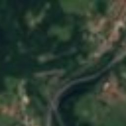
Satellite: Sentinel-2 cloudless 2016 by EOX IT Services GmbH · CC BY 4.0 · Contains modified Copernicus Sentinel data 2016
D'elikatuz, Centro de la Alimentación y la Gastronomía


International Centre of the Puppet of Tolosa
2009