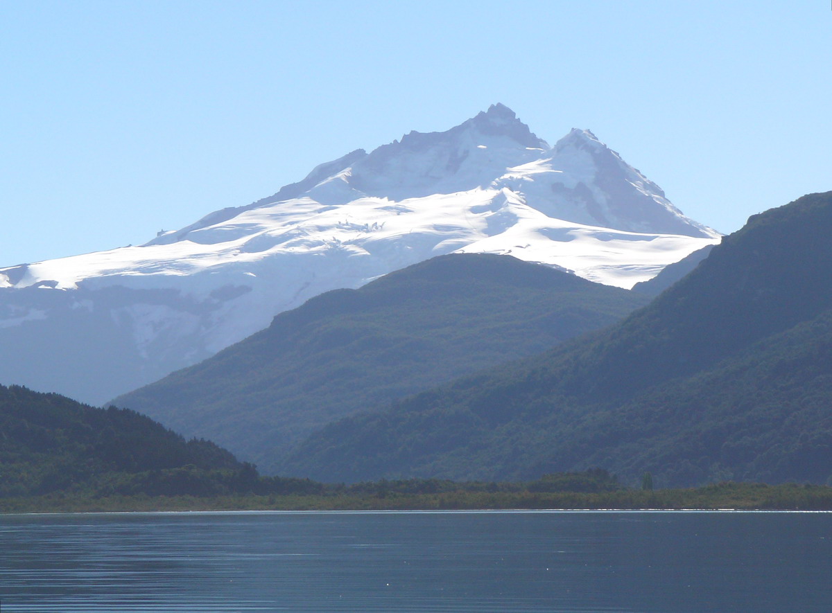

Andes · ChileSummit weather, forecast and climate
Tronador
3,491 mChile / Argentina borderUltra-prominent peakSnow likely Jan–Dec
Elevation3,491 mabove sea level
Prominence2,642 mindependent height
Isolation173 kmto a higher summit
Summit, Jul-9°average high
41.16° S, 71.89° WElevation 3,491 mUTC+0 · Coordinated Universal Time
From the valley to the top
- Summit3,491 m
- Mid-mountain2,890 m
- Valley2,291 m
Freezing level in October: 2,000 m
iThe mountain
Tronador in brief
Tronador rises to 3,491 m in the Andes, Chile. Its topographic prominence — the height it stands above the lowest contour enclosing a higher summit — is 2,642 m, which makes it an ultra-prominent peak.
At the summit, February is the mildest month with average highs of 4°, while nights stay below freezing all year. Daytime highs climb above zero from January to December.
The summit lies on the border between Chile and Argentina, so it appears in the mountain lists of both countries.
Facts
- Elevation
- 3,491 m · 11,453 ft
- Prominence
- 2,642 m
- Range
- Andes
- Country
- Chile
- Coordinates
- -41.1608, -71.8875
- Nearest airport
- Teniente Luis Candelaria International Airport (BRC) · 61 km
iiForecast
Weather at three heights
Temperatures are adjusted to each height; summits are usually colder and windier than the valley forecast suggests.
Loading the latest forecast…
Loading the latest forecast…
Loading the latest forecast…
iiiSummit climate
The top of Tronador by month
Summit temperatures and precipitation
Climate normals for the summit area (~1 km grid), station-adjusted| Month | Jan | Feb | Mar | Apr | May | Jun | Jul | Aug | Sep | Oct | Nov | Dec |
|---|---|---|---|---|---|---|---|---|---|---|---|---|
| Average high | 3° | 4° | 2° | -3° | -6° | -9° | -9° | -9° | -7° | -5° | -2° | 1° |
| Average low | -7° | -7° | -8° | -10° | -12° | -14° | -14° | -14° | -15° | -14° | -12° | -9° |
| Precipitation | 153 mm | 125 mm | 189 mm | 314 mm | 593 mm | 713 mm | 572 mm | 498 mm | 312 mm | 268 mm | 194 mm | 182 mm |
| Cloud cover | 23% | 21% | 31% | 38% | 51% | 56% | 53% | 53% | 45% | 40% | 35% | 28% |
| Daylight | 14h 48 | 13h 40 | 12h 24 | 11h 00 | 9h 51 | 9h 13 | 9h 29 | 10h 28 | 11h 48 | 13h 09 | 14h 26 | 15h 07 |
| Month score | 25 | 25 | 25 | 22 | 16 | 14 | 15 | 15 | 19 | 21 | 23 | 25 |
Snow and freezing level
Average height of the 0 °C level from the summit normals (6.5 °C per km); snow months have a summit mean at or below +1 °C| Month | Jan | Feb | Mar | Apr | May | Jun | Jul | Aug | Sep | Oct | Nov | Dec |
|---|---|---|---|---|---|---|---|---|---|---|---|---|
| Freezing level | 3,150 m | 3,300 m | 3,000 m | 2,500 m | 2,100 m | 1,750 m | 1,700 m | 1,700 m | 1,800 m | 2,000 m | 2,450 m | 2,850 m |
| Summit | ❄ snow | ❄ snow | ❄ snow | ❄ snow | ❄ snow | ❄ snow | ❄ snow | ❄ snow | ❄ snow | ❄ snow | ❄ snow | ❄ snow |
ivTerrain
Tronador in 3D
vNeighbours
Mountains of ChilePeaks nearby
| Mountain | Elevation | Prominence | Distance | July summit high |
|---|---|---|---|---|
| Cerro Volcánico | 1,930 m | – | 18 km S | 1° |