
Photo: NOAA Historical Collection. · Public domain · Wikimedia Commons
Execution Rocks LightReport this photo · linked, not stored
Execution Rocks LightReport this photo · linked, not stored

Photo: ALT55-VictorM · CC BY-SA 3.0 · Wikimedia Commons
Lispenard-Rodman-Davenport HouseReport this photo · linked, not stored
Lispenard-Rodman-Davenport HouseLispenard-Rodman-Davenport HouseReport this photo · linked, not stored

Photo: English Wikipedia user Daniel Case · CC BY-SA 3.0 · Wikimedia Commons
John Philip Sousa HouseReport this photo · linked, not stored
John Philip Sousa HouseJohn Philip Sousa HouseReport this photo · linked, not stored

Photo: ALT55-VictorM · CC BY-SA 3.0 · Wikimedia Commons
WildcliffReport this photo · linked, not stored
WildcliffWildcliffReport this photo · linked, not stored
lighthouseSands Point, New York
Execution Rocks Light
National Register of Historic Places listed placeBuilt 1849
Typelighthouse
Built1849by Alexander Parris
Best monthsMay · Sep–Octweather in Sands Point
40.88° N, 73.74° WUTC−4 · Eastern Daylight Time
Standing for177 years
built 1849today 2026
When to goSands Point · weather score
Best timeMay · Sep–Oct
October: high / low65° / 49°
iAbout
Execution Rocks Light in brief
Execution Rocks Light is a lighthouse in Sands Point, New York, United States.
It holds the designation National Register of Historic Places listed place.
The lighthouse dates from 1849 and was designed by Alexander Parris.
For a visit, the weather in Sands Point is best in May, September and October; in October afternoons average 65°.
Facts
- Type
- lighthouse
- Designation
- National Register of Historic Places listed place
- Built
- 1849
- Architect
- Alexander Parris
- Nearest town
- Sands Point
- Region
- New York
- Coordinates
- 40.87814, -73.73786
iiLocation
Where to find it
iiiWhen to visit
Climate guideWeather in Sands Point
Month score for sightseeing
Best May · Sep–Oct32
Jan
33
Feb
30
Mar
62
Apr
66
May
60
Jun
51
Jul
56
Aug
76
Sep
76
Oct
46
Nov
29
Dec
ivNearby
All monuments in the United StatesMore heritage close by
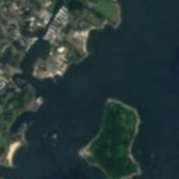







Satellite: Sentinel-2 cloudless 2016 by EOX IT Services GmbH · CC BY 4.0 · Contains modified Copernicus Sentinel data 2016
Sands Family Cemetery
1.6 mi SE
National Register of Historic Places listed place
Lispenard-Rodman-Davenport House
2.4 mi NW
New York State Register of Historic Places listed place





Satellite: Sentinel-2 cloudless 2016 by EOX IT Services GmbH · CC BY 4.0 · Contains modified Copernicus Sentinel data 2016
Davenport House, New Rochelle
2.4 mi NW
National Register of Historic Places listed place
Photo: English Wikipedia user Daniel Case · CC BY-SA 3.0 · Wikimedia CommonsReport this photo · linked, not stored
John Philip Sousa House
2.4 mi S
National Historic Landmark

Satellite: Sentinel-2 cloudless 2016 by EOX IT Services GmbH · CC BY 4.0 · Contains modified Copernicus Sentinel data 2016
Hempstead House
2.5 mi SE
National Register of Historic Places listed place
Around here
Sands Point and around

Nature


Mountains

Heritage

William Landsberg House
National Register of Historic Places listed place · 1951
Photo: English Wikipedia user Daniel Case · CC BY-SA 3.0 · Wikimedia CommonsReport this photo · linked, not stored
John Philip Sousa House
National Historic Landmark

Thomas Dodge Homestead
National Register of Historic Places listed place
Museums

Satellite: Sentinel-2 cloudless 2016 by EOX IT Services GmbH · CC BY 4.0 · Contains modified Copernicus Sentinel data 2016
Polish American Museum
Museum of culture · 1977


Photo: Zoirusha at English Wikipedia · Public domain · Wikimedia CommonsReport this photo · linked, not stored

Edgar Allan Poe Cottage
Historic house museum