Satellite: Sentinel-2 cloudless 2016 by EOX IT Services GmbH · CC BY 4.0 · Contains modified Copernicus Sentinel data 2016

Photo: Storye book · CC BY 4.0 · Wikimedia Commons
Church of St James, BoroughbridgeReport this photo · linked, not stored
Church of St James, BoroughbridgeChurch of St James, BoroughbridgeReport this photo · linked, not stored

Photo: Three Horse Shoes, Boroughbridge by Ian S · CC BY-SA 2.0 · Wikimedia Commons
The Three Horse Shoes Public HouseReport this photo · linked, not stored
The Three Horse Shoes Public HouseThe Three Horse Shoes Public HouseReport this photo · linked, not stored

Photo: Mtaylor848 · CC BY-SA 4.0 · Wikimedia Commons
Borough BridgeReport this photo · linked, not stored
Borough BridgeBorough BridgeReport this photo · linked, not stored

Photo: Mtaylor848 · CC BY-SA 3.0 · Wikimedia Commons
Church of St Andrew, BoroughbridgeReport this photo · linked, not stored
Church of St Andrew, BoroughbridgeChurch of St Andrew, BoroughbridgeReport this photo · linked, not stored
scheduled monumentBoroughbridge, England
Devil's Arrows
scheduled monument
Typescheduled monument
Built–
Best monthsJul–Sepweather in Boroughbridge
54.09° N, 1.40° WUTC+0 · Greenwich Mean Time
When to goBoroughbridge · weather score
Best timeJul–Sep
October: high / low14° / 7°
iAbout
Devil's Arrows in brief
Devil's Arrows is a scheduled monument in Boroughbridge, England, United Kingdom. Menhir.
It holds the designation scheduled monument.
For a visit, the weather in Boroughbridge is best in July, August and September; in October afternoons average 14°.
Facts
- Type
- scheduled monument
- Designation
- scheduled monument
- Nearest town
- Boroughbridge
- Region
- England
- Coordinates
- 54.09300, -1.40347
iiLocation
Where to find it
iiiWhen to visit
Climate guideWeather in Boroughbridge
Month score for sightseeing
Best Jul–Sep16
Jan
18
Feb
23
Mar
41
Apr
56
May
61
Jun
62
Jul
62
Aug
65
Sep
39
Oct
17
Nov
16
Dec
ivNearby
All monuments in the United KingdomMore heritage close by
Photo: Three Horse Shoes, Boroughbridge by Ian S · CC BY-SA 2.0 · Wikimedia CommonsReport this photo · linked, not stored
The Three Horse Shoes Public House
0.6 km NE
Grade II listed building
Satellite: Sentinel-2 cloudless 2016 by EOX IT Services GmbH · CC BY 4.0 · Contains modified Copernicus Sentinel data 2016
Battle of Boroughbridge
0.7 km NE
Registered Battlefield
Satellite: Sentinel-2 cloudless 2016 by EOX IT Services GmbH · CC BY 4.0 · Contains modified Copernicus Sentinel data 2016
Aldborough Cross
1.4 km E
scheduled monument
Around here
Boroughbridge and around

Nature
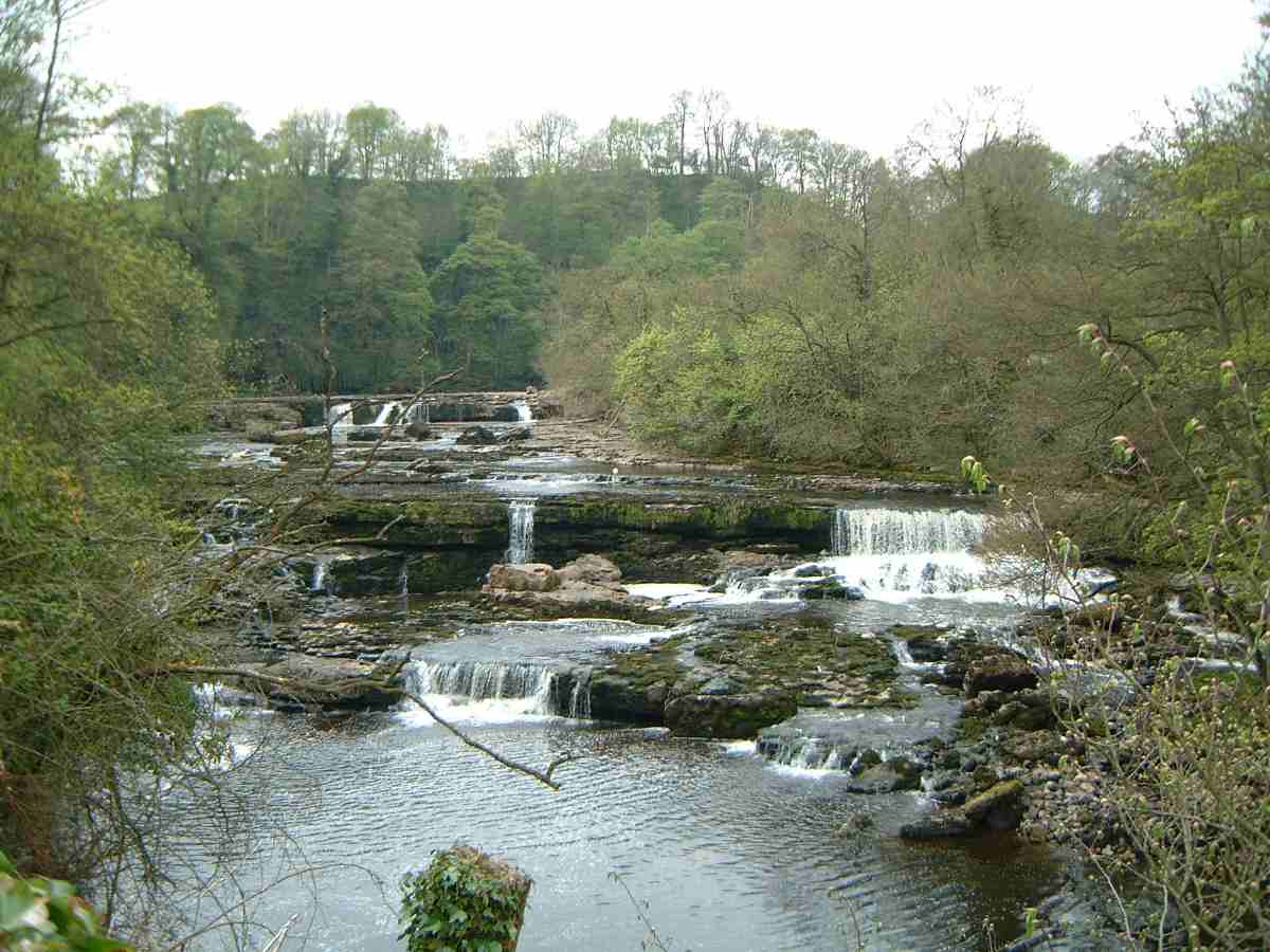
Photo: User Mick Knapton on en.wikipedia · CC BY-SA 3.0 · Wikimedia CommonsReport this photo · linked, not stored
River Ure
River


Mountains
Satellite: Sentinel-2 cloudless 2016 by EOX IT Services GmbH · CC BY 4.0 · Contains modified Copernicus Sentinel data 2016
Great Whernside
704 m
Satellite: Sentinel-2 cloudless 2016 by EOX IT Services GmbH · CC BY 4.0 · Contains modified Copernicus Sentinel data 2016
Little Whernside
604 m
Heritage
Satellite: Sentinel-2 cloudless 2016 by EOX IT Services GmbH · CC BY 4.0 · Contains modified Copernicus Sentinel data 2016
St Mary's Church, Roecliffe
Grade II* listed building · 1843
Church of St Andrew, Boroughbridge
Grade I listed building · 1333
Museums
Satellite: Sentinel-2 cloudless 2016 by EOX IT Services GmbH · CC BY 4.0 · Contains modified Copernicus Sentinel data 2016
Aldborough Roman Town
History museum


Photo: Graham Roberts, the uploader is Gcr22 · CC BY-SA 3.0 · Wikimedia CommonsReport this photo · linked, not stored

Fountains Hall
Historic house museum