

Satellite: Sentinel-2 cloudless 2016 by EOX IT Services GmbH · CC BY 4.0 · Contains modified Copernicus Sentinel data 2016
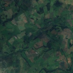
archaeological siteRochester, England
Bremenium
scheduled monument
Typearchaeological site
Built–
Best monthsJun–Augweather in Rochester
55.28° N, 2.26° WUTC+0 · Greenwich Mean Time
When to goRochester · weather score
Best timeJun–Aug
October: high / low12° / 5°
iAbout
Bremenium in brief
Bremenium is an archaeological site in Rochester, England, United Kingdom.
It holds the designation scheduled monument.
For a visit, the weather in Rochester is best in June, July and August; in October afternoons average 12°.
iiLocation
Where to find it
iiiWhen to visit
Climate guideWeather in Rochester
Month score for sightseeing
Best Jun–Aug14
Jan
16
Feb
17
Mar
28
Apr
42
May
53
Jun
61
Jul
60
Aug
52
Sep
27
Oct
15
Nov
14
Dec
ivNearby
All monuments in the United KingdomMore heritage close by
Satellite: Sentinel-2 cloudless 2016 by EOX IT Services GmbH · CC BY 4.0 · Contains modified Copernicus Sentinel data 2016
Durtrees Burn Grassland
3.7 km E
Site of Special Scientific Interest

Satellite: Sentinel-2 cloudless 2016 by EOX IT Services GmbH · CC BY 4.0 · Contains modified Copernicus Sentinel data 2016
Northumberland National Park
5.0 km NE
International Dark Sky Park
Around here
Rochester and around
Nature

Satellite: Sentinel-2 cloudless 2016 by EOX IT Services GmbH · CC BY 4.0 · Contains modified Copernicus Sentinel data 2016
Northumberland National Park
National park

Photo: John-Paul Stephenson · CC BY-SA 2.5 · Wikimedia CommonsReport this photo · linked, not stored
River Coquet
River
Satellite: Sentinel-2 cloudless 2016 by EOX IT Services GmbH · CC BY 4.0 · Contains modified Copernicus Sentinel data 2016
Catcleugh Reservoir
Lake · 247 m
Mountains

Satellite: Sentinel-2 cloudless 2016 by EOX IT Services GmbH · CC BY 4.0 · Contains modified Copernicus Sentinel data 2016
Hedgehope Hill
714 m

Heritage














Satellite: Sentinel-2 cloudless 2016 by EOX IT Services GmbH · CC BY 4.0 · Contains modified Copernicus Sentinel data 2016
Northumberland National Park
International Dark Sky Park · 1956

Photo: maître d'antoine de bourgogne et collab · Public domain · Wikimedia CommonsReport this photo · linked, not stored
Battle of Otterburn
Registered Battlefield


