Skip to content
Destinations
Weather & climate
Nature
Outdoors
Culture
Events
Sky & live
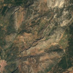
Ocuri
Photo: Davidruiz91 · CC BY-SA 4.0 · Wikimedia Commons
OcuriReport this photo · linked, not stored
Castillo de Fátima
Photo: Alejandro Pérez Ordóñez · CC BY-SA 3.0 es · Wikimedia Commons
Castillo de FátimaReport this photo · linked, not stored
Castillo de Fátima
human settlementUbrique, Andalusia

Ocuri

bien de interés cultural
Typehuman settlement
Built–
Best monthsApr–May · Octweather in Ubrique
36.69° N, 5.44° WUTC+2 · Central European Summer Time
When to goUbrique · weather score
JanFebMarAprMayJunJulAugSepOctNovDec81October
Best timeApr–May · Oct
October: high / low25° / 13°
iAbout

Ocuri in brief

Ocuri is a human settlement in Ubrique, Andalusia, Spain.

It holds the designation bien de interés cultural.

For a visit, the weather in Ubrique is best in April, May and October; in October afternoons average 25°.

Ubrique: weather and travel guide

Facts

Type
human settlement
Designation
bien de interés cultural
Nearest town
Ubrique
Region
Andalusia
Coordinates
36.68711, -5.44486
iiLocation

Where to find it

iiiWhen to visit

Weather in Ubrique

Climate guide

Month score for sightseeing

Best Apr–May · Oct
ivNearby

More heritage close by

All monuments in Spain
Castillo de Fátima
Photo: Alejandro Pérez Ordóñez · CC BY-SA 3.0 es · Wikimedia CommonsReport this photo · linked, not stored

Castillo de Fátima

4.1 km W
bien de interés cultural
Castillo de Fátima
Around here

Ubrique and around

Ubrique
Photo: Grez · CC BY-SA 3.0 · Wikimedia CommonsReport this photo · linked, not stored

Ubrique

Andalusia · Spain
Apr–May · Octbest months
34°July high
325 maltitude
Ubrique

Nature

Los Hurones Reservoir
Photo: El Pantera · CC BY-SA 4.0 · Wikimedia CommonsReport this photo · linked, not stored
9.1 km W

Los Hurones Reservoir

Lake · 208 m
Los Hurones Reservoir
Chorrero
Photo: El Pantera · CC BY-SA 4.0 · Wikimedia CommonsReport this photo · linked, not stored
6.3 km E

Chorrero

Waterfall
Chorrero
Embalse del Fresnillo
Photo: El Pantera · CC BY-SA 4.0 · Wikimedia CommonsReport this photo · linked, not stored
12 km NE

Embalse del Fresnillo

Lake
Embalse del Fresnillo

Mountains

Cerro de la Alcazaba
Photo: Juan Pablo Olmo · CC BY 2.0 · Wikimedia CommonsReport this photo · linked, not stored
38 km E

Cerro de la Alcazaba

1,699 m · Sierra de las Nieves
Cerro de la Alcazaba
Simancon Peak
Photo: Davidruiz91 · CC BY-SA 4.0 · Wikimedia CommonsReport this photo · linked, not stored
8.5 km NE

Simancon Peak

1,566 m
Simancon Peak
Satellite: Sentinel-2 cloudless 2016 by EOX IT Services GmbH · CC BY 4.0 · Contains modified Copernicus Sentinel data 2016
8.8 km NE

Reloj Peak

1,539 m · Cordillera Subbética
Reloj Peak

Heritage

Castillo de Aznalmara
Photo: El Pantera · CC BY-SA 4.0 · Wikimedia CommonsReport this photo · linked, not stored
6.0 km N

Castillo de Aznalmara

bien de interés cultural
Castillo de Aznalmara
Iptuci
Photo: Menesteo · CC BY-SA 3.0 · Wikimedia CommonsReport this photo · linked, not stored
12 km NW

Iptuci

bien de interés cultural
Iptuci
Castillo de Fátima
Photo: Alejandro Pérez Ordóñez · CC BY-SA 3.0 es · Wikimedia CommonsReport this photo · linked, not stored
3.9 km W

Castillo de Fátima

bien de interés cultural
Castillo de Fátima

Museums

Centro de Interpretación de la Historia de Ubrique "San Juan de Letrán"
Photo: El Pantera · CC BY-SA 4.0 · Wikimedia CommonsReport this photo · linked, not stored
0.3 km NE

Centro de Interpretación de la Historia de Ubrique "San Juan de Letrán"

Interpretation centre
Centro de Interpretación de la Historia de Ubrique "San Juan de Letrán"
Museo de la Piel
Photo: El Pantera · CC BY-SA 4.0 · Wikimedia CommonsReport this photo · linked, not stored
0.3 km NE

Museo de la Piel

Museo de la Piel
EcoMuseo Histórico de Benaocaz
Photo: El Pantera · CC BY-SA 4.0 · Wikimedia CommonsReport this photo · linked, not stored
3.3 km NE

EcoMuseo Histórico de Benaocaz

Ethnographic museum
EcoMuseo Histórico de Benaocaz