Skip to content
Destinations
Weather & climate
Nature
Outdoors
Culture
Events
Sky & live
Can Lluci
Photo: Enric · CC BY-SA 4.0 · Wikimedia Commons
Can LluciReport this photo · linked, not stored
Can Mateu, Tavertet
Photo: Enric · CC BY-SA 4.0 · Wikimedia Commons
Can Mateu, TavertetReport this photo · linked, not stored
Can Mateu, Tavertet
Can Rocarols
Photo: Enric · CC BY-SA 4.0 · Wikimedia Commons
Can RocarolsReport this photo · linked, not stored
Can Rocarols
La Pallissa
Photo: Enric · CC BY-SA 4.0 · Wikimedia Commons
La PallissaReport this photo · linked, not stored
La Pallissa
Cal Pelat
Photo: Enric · CC BY-SA 4.0 · Wikimedia Commons
Cal PelatReport this photo · linked, not stored
Cal Pelat
houseTavertet, Catalonia

Can Lluci

Cultural Asset part of the cultural heritage of CataloniaBuilt 1800
Typehousevernacular
Built1800
Best monthsJun–Jul · Sepweather in Tavertet
42.00° N, 2.42° EUTC+1 · Central European Standard Time
Standing for226 years
built 1800today 2026
When to goTavertet · weather score
JanFebMarAprMayJunJulAugSepOctNovDec78October
Best timeJun–Jul · Sep
October: high / low18° / 8°
iAbout

Can Lluci in brief

Can Lluci is a house in Tavertet, Catalonia, Spain.

It holds the designation Cultural Asset part of the cultural heritage of Catalonia.

The house dates from 1800 and is built in the vernacular style.

For a visit, the weather in Tavertet is best in June, July and September; in October afternoons average 18°.

Tavertet: weather and travel guide

Facts

Type
house
Designation
Cultural Asset part of the cultural heritage of Catalonia
Built
1800
Style
vernacular
Nearest town
Tavertet
Region
Catalonia
Coordinates
41.99540, 2.41866
iiLocation

Where to find it

iiiWhen to visit

Weather in Tavertet

Climate guide

Month score for sightseeing

Best Jun–Jul · Sep
43
Jan
48
Feb
57
Mar
67
Apr
75
May
83
Jun
78
Jul
75
Aug
80
Sep
78
Oct
57
Nov
48
Dec
ivNearby

More heritage close by

All monuments in Spain
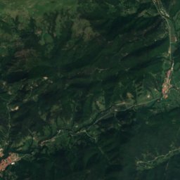
Satellite: Sentinel-2 cloudless 2016 by EOX IT Services GmbH · CC BY 4.0 · Contains modified Copernicus Sentinel data 2016

Nucli antic de Tavertet

under 100 m NW
Cultural Asset of National Interest
Nucli antic de Tavertet
Can Mateu, Tavertet
Photo: Enric · CC BY-SA 4.0 · Wikimedia CommonsReport this photo · linked, not stored

Can Mateu, Tavertet

under 100 m SW
Cultural Asset part of the cultural heritage of Catalonia
Can Mateu, Tavertet
Can Rocarols
Photo: Enric · CC BY-SA 4.0 · Wikimedia CommonsReport this photo · linked, not stored

Can Rocarols

under 100 m NE
Cultural Asset part of the cultural heritage of Catalonia
Can Rocarols
La Pallissa
Photo: Enric · CC BY-SA 4.0 · Wikimedia CommonsReport this photo · linked, not stored

La Pallissa

under 100 m SW
Cultural Asset part of the cultural heritage of Catalonia
La Pallissa
Cal Pelat
Photo: Enric · CC BY-SA 4.0 · Wikimedia CommonsReport this photo · linked, not stored

Cal Pelat

under 100 m SE
Cultural Asset part of the cultural heritage of Catalonia
Cal Pelat
Ca l'Eulàlia
Photo: Enric · CC BY-SA 4.0 · Wikimedia CommonsReport this photo · linked, not stored

Ca l'Eulàlia

under 100 m SW
Cultural Asset part of the cultural heritage of Catalonia
Ca l'Eulàlia
Around here

Tavertet and around

Tavertet
Photo: Jvilardell · Public domain · Wikimedia CommonsReport this photo · linked, not stored

Tavertet

Catalonia · Spain
Jun–Jul · Sepbest months
27°July high
927 maltitude
Tavertet

Nature

Pantà de Sau
Photo: Quico Llach · Public domain · Wikimedia CommonsReport this photo · linked, not stored
3.7 km SW

Pantà de Sau

Lake · 422 m
Pantà de Sau
Susqueda Reservoir
Photo: Angela Llop from Spain · CC BY-SA 2.0 · Wikimedia CommonsReport this photo · linked, not stored
9.2 km E

Susqueda Reservoir

Lake · 351 m
Susqueda Reservoir
Salt de Sallent, Rupit
Photo: Pallares · CC BY-SA 3.0 · Wikimedia CommonsReport this photo · linked, not stored
5.0 km NE

Salt de Sallent, Rupit

Waterfall
Salt de Sallent, Rupit

Mountains

Taga
Photo: Mikipons · CC BY-SA 3.0 · Wikimedia CommonsReport this photo · linked, not stored
36 km NW

Taga

2,040 m · Pyrenees
Taga
Puig Estela
Photo: Gelatdeneu · CC BY-SA 3.0 · Wikimedia CommonsReport this photo · linked, not stored
35 km NW

Puig Estela

2,013 m
Puig Estela
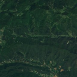
Satellite: Sentinel-2 cloudless 2016 by EOX IT Services GmbH · CC BY 4.0 · Contains modified Copernicus Sentinel data 2016
39 km N

Puig de Mont-roig

1,991 m · serra de Mont-roig
Puig de Mont-roig

Heritage

Cal Cabré
Photo: Enric · CC BY-SA 4.0 · Wikimedia CommonsReport this photo · linked, not stored
under 100 m N

Cal Cabré

Cultural Asset part of the cultural heritage of Catalonia · 1900
Cal Cabré
Can Baumes
Photo: Amador Alvarez · CC BY-SA 3.0 · Wikimedia CommonsReport this photo · linked, not stored
under 100 m NW

Can Baumes

Cultural Asset part of the cultural heritage of Catalonia · 1701
Can Baumes
Can Rocarols
Photo: Enric · CC BY-SA 4.0 · Wikimedia CommonsReport this photo · linked, not stored
under 100 m SE

Can Rocarols

Cultural Asset part of the cultural heritage of Catalonia · 1800
Can Rocarols

Museums

Verdaguer House-Museum
Photo: Enric · CC BY-SA 4.0 · Wikimedia CommonsReport this photo · linked, not stored
11 km SW

Verdaguer House-Museum

Historic house museum · 1967
Verdaguer House-Museum
El Ter Industrial Museum – Can Sanglas
Photo: Enric · CC BY-SA 4.0 · Wikimedia CommonsReport this photo · linked, not stored
11 km W

El Ter Industrial Museum – Can Sanglas

Industry museum · 2004
El Ter Industrial Museum – Can Sanglas
Satellite: Sentinel-2 cloudless 2016 by EOX IT Services GmbH · CC BY 4.0 · Contains modified Copernicus Sentinel data 2016
9.2 km W

L'Esquerda Archaeological Museum

1988
L'Esquerda Archaeological Museum