Skip to content
Destinations
Weather & climate
Nature
Outdoors
Culture
Events
Sky & live
Ca Marcó
Photo: flamenc · CC BY-SA 3.0 · Wikimedia Commons
Ca MarcóReport this photo · linked, not stored
Ca Conrado
Photo: flamenc · CC BY-SA 3.0 · Wikimedia Commons
Ca ConradoReport this photo · linked, not stored
Ca Conrado
House in Carrer Ample, 1
Photo: flamenc · CC BY-SA 3.0 · Wikimedia Commons
House in Carrer Ample, 1Report this photo · linked, not stored
House in Carrer Ample, 1
Nucli històric de Ginestar
Photo: Asolepascual · CC BY-SA 3.0 · Wikimedia Commons
Nucli històric de GinestarReport this photo · linked, not stored
Nucli històric de Ginestar
Ca Tramontà
Photo: flamenc · CC BY-SA 3.0 · Wikimedia Commons
Ca TramontàReport this photo · linked, not stored
Ca Tramontà
houseGinestar, Catalonia

Ca Marcó

Cultural Asset of Local InterestBuilt 1904
Typehouseeclectic
Built1904
Best monthsMar–Apr · Novweather in Ginestar
41.04° N, 0.63° EUTC+1 · Central European Standard Time
Standing for122 years
built 1904today 2026
When to goGinestar · weather score
JanFebMarAprMayJunJulAugSepOctNovDec81October
Best timeMar–Apr · Nov
October: high / low24° / 13°
iAbout

Ca Marcó in brief

Ca Marcó is a house in Ginestar, Catalonia, Spain.

It holds the designation Cultural Asset of Local Interest.

The house dates from 1904 and is built in the eclectic style.

For a visit, the weather in Ginestar is best in March, April and November; in October afternoons average 24°.

Ginestar: weather and travel guide

Facts

Type
house
Designation
Cultural Asset of Local Interest
Built
1904
Style
eclectic
Nearest town
Ginestar
Region
Catalonia
Coordinates
41.04199, 0.63348
iiLocation

Where to find it

iiiWhen to visit

Weather in Ginestar

Climate guide

Month score for sightseeing

Best Mar–Apr · Nov
63
Jan
78
Feb
84
Mar
82
Apr
79
May
69
Jun
59
Jul
55
Aug
65
Sep
81
Oct
83
Nov
66
Dec
ivNearby

More heritage close by

All monuments in Spain
Ca Conrado
Photo: flamenc · CC BY-SA 3.0 · Wikimedia CommonsReport this photo · linked, not stored

Ca Conrado

under 100 m E
Cultural Asset of Local Interest
Ca Conrado
House in Carrer Ample, 1
Photo: flamenc · CC BY-SA 3.0 · Wikimedia CommonsReport this photo · linked, not stored

House in Carrer Ample, 1

under 100 m NW
Cultural Asset of Local Interest
House in Carrer Ample, 1
Nucli històric de Ginestar
Photo: Asolepascual · CC BY-SA 3.0 · Wikimedia CommonsReport this photo · linked, not stored

Nucli històric de Ginestar

under 100 m W
Cultural Asset of Local Interest
Nucli històric de Ginestar
Ca Tramontà
Photo: flamenc · CC BY-SA 3.0 · Wikimedia CommonsReport this photo · linked, not stored

Ca Tramontà

under 100 m NE
Cultural Asset of Local Interest
Ca Tramontà
Església parroquial de Sant Martí, Ginestar
Photo: Jtorta · CC BY-SA 3.0 · Wikimedia CommonsReport this photo · linked, not stored

Església parroquial de Sant Martí, Ginestar

under 100 m W
Cultural Asset of Local Interest
Església parroquial de Sant Martí, Ginestar
Església de Sant Martí de Ginestar
Photo: flamenc · CC BY-SA 3.0 · Wikimedia CommonsReport this photo · linked, not stored

Església de Sant Martí de Ginestar

0.1 km N
Cultural Asset of Local Interest
Església de Sant Martí de Ginestar
Around here

Ginestar and around

Ginestar
Photo: flamenc · CC BY-SA 3.0 · Wikimedia CommonsReport this photo · linked, not stored

Ginestar

Catalonia · Spain
Mar–Apr · Novbest months
32°July high
31 maltitude
Ginestar

Nature

Pantà dels Guiamets
Photo: Gustau Erill i Pinyot · Public domain · Wikimedia CommonsReport this photo · linked, not stored
12 km NE

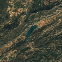
Pantà dels Guiamets

Lake · 176 m
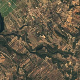
Pantà dels Guiamets
Satellite: Sentinel-2 cloudless 2016 by EOX IT Services GmbH · CC BY 4.0 · Contains modified Copernicus Sentinel data 2016
6.3 km SE

Cova del Pi

Cave
Cova del Pi
Satellite: Sentinel-2 cloudless 2016 by EOX IT Services GmbH · CC BY 4.0 · Contains modified Copernicus Sentinel data 2016
6.3 km SE

Cova del Ramat

Cave
Cova del Ramat

Mountains

Mont Caro
Photo: Mont_Caro.jpg: Xvazquez derivative work: Quico (talk) · CC BY-SA 3.0 · Wikimedia CommonsReport this photo · linked, not stored
36 km SW

Mont Caro

1,442 m · Ports de Tortosa-Beseit
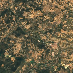
Mont Caro
Satellite: Sentinel-2 cloudless 2016 by EOX IT Services GmbH · CC BY 4.0 · Contains modified Copernicus Sentinel data 2016
37 km SW

Moleta Rodona

1,358 m
Moleta Rodona
La Barcina
Photo: Pere López · CC BY-SA 3.0 · Wikimedia CommonsReport this photo · linked, not stored
34 km SW

La Barcina

1,354 m
La Barcina

Heritage

Nucli històric de Ginestar
Photo: Asolepascual · CC BY-SA 3.0 · Wikimedia CommonsReport this photo · linked, not stored
under 100 m NW

Nucli històric de Ginestar

Cultural Asset of Local Interest · 1800
Nucli històric de Ginestar
House in Carrer Ample, 1
Photo: flamenc · CC BY-SA 3.0 · Wikimedia CommonsReport this photo · linked, not stored
under 100 m N

House in Carrer Ample, 1

Cultural Asset of Local Interest · 2000
House in Carrer Ample, 1
Ca Conrado
Photo: flamenc · CC BY-SA 3.0 · Wikimedia CommonsReport this photo · linked, not stored
under 100 m E

Ca Conrado

Cultural Asset of Local Interest · 1700
Ca Conrado

Museums

Railway Interpretation Centre
Photo: Conrad Miquel · CC BY-SA 4.0 · Wikimedia CommonsReport this photo · linked, not stored
7.4 km N

Railway Interpretation Centre

Interpretation centre · 2001
Railway Interpretation Centre
Satellite: Sentinel-2 cloudless 2016 by EOX IT Services GmbH · CC BY 4.0 · Contains modified Copernicus Sentinel data 2016
10 km W

Centre d'Interpretació Les Veus del Front

Centre d'Interpretació Les Veus del Front
Satellite: Sentinel-2 cloudless 2016 by EOX IT Services GmbH · CC BY 4.0 · Contains modified Copernicus Sentinel data 2016
14 km W

115 dies

Interpretation centre
115 dies