Skip to content
Destinations
Weather & climate
Nature
Outdoors
Culture
Events
Sky & live
Monastery Loreto
Photo: Romaine · CC0 · Wikimedia Commons
Monastery LoretoReport this photo · linked, not stored
Kloosterkerk van Maria Boodschap
Photo: Romaine · CC0 · Wikimedia Commons
Kloosterkerk van Maria BoodschapReport this photo · linked, not stored
Kloosterkerk van Maria Boodschap
Sint-Remigiuskerk, Simpelveld
Photo: Paul Hermans · CC BY-SA 2.5 · Wikimedia Commons
Sint-Remigiuskerk, SimpelveldReport this photo · linked, not stored
Sint-Remigiuskerk, Simpelveld
Simpelveld railway station
Photo: Wammes Waggel · CC BY-SA 3.0 · Wikimedia Commons
Simpelveld railway stationReport this photo · linked, not stored
Simpelveld railway station
Oude Molen, Simpelveld
Photo: Romaine · CC0 · Wikimedia Commons
Oude Molen, SimpelveldReport this photo · linked, not stored
Oude Molen, Simpelveld
architectural ensembleSimpelveld, Limburg

Monastery Loreto

Rijksmonument complex
Typearchitectural ensemble
Built–
Best monthsMay–Jun · Sepweather in Simpelveld
50.83° N, 5.99° EUTC+1 · Central European Standard Time
When to goSimpelveld · weather score
JanFebMarAprMayJunJulAugSepOctNovDec47October
Best timeMay–Jun · Sep
October: high / low15° / 8°
iAbout

Monastery Loreto in brief

Monastery Loreto is an architectural ensemble in Simpelveld, Limburg, Netherlands.

It holds the designation Rijksmonument complex.

For a visit, the weather in Simpelveld is best in May, June and September; in October afternoons average 15°.

Simpelveld: weather and travel guide

Facts

Type
architectural ensemble
Designation
Rijksmonument complex
Nearest town
Simpelveld
Region
Limburg
Coordinates
50.83438, 5.98905
iiLocation

Where to find it

iiiWhen to visit

Weather in Simpelveld

Climate guide

Month score for sightseeing

Best May–Jun · Sep
15
Jan
20
Feb
24
Mar
55
Apr
65
May
66
Jun
64
Jul
64
Aug
70
Sep
47
Oct
17
Nov
14
Dec
ivNearby

More heritage close by

All monuments in the Netherlands
Kloosterkerk van Maria Boodschap
Photo: Romaine · CC0 · Wikimedia CommonsReport this photo · linked, not stored

Kloosterkerk van Maria Boodschap

under 100 m SW
Rijksmonument
Kloosterkerk van Maria Boodschap
Sint-Remigiuskerk, Simpelveld
Photo: Paul Hermans · CC BY-SA 2.5 · Wikimedia CommonsReport this photo · linked, not stored

Sint-Remigiuskerk, Simpelveld

0.5 km W
Rijksmonument
Sint-Remigiuskerk, Simpelveld
Simpelveld railway station
Photo: Wammes Waggel · CC BY-SA 3.0 · Wikimedia CommonsReport this photo · linked, not stored

Simpelveld railway station

0.8 km SW
Rijksmonument
Simpelveld railway station
Oude Molen, Simpelveld
Photo: Romaine · CC0 · Wikimedia CommonsReport this photo · linked, not stored

Oude Molen, Simpelveld

1.2 km W
Rijksmonument
Oude Molen, Simpelveld
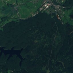
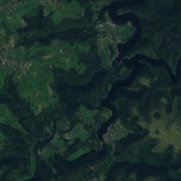
Satellite: Sentinel-2 cloudless 2016 by EOX IT Services GmbH · CC BY 4.0 · Contains modified Copernicus Sentinel data 2016

Castle De Bongard

1.6 km SE
Rijksmonument
Castle De Bongard
Bulkemsmolen
Photo: Romaine · CC0 · Wikimedia CommonsReport this photo · linked, not stored

Bulkemsmolen

2.0 km W
Rijksmonument
Bulkemsmolen
Around here

Simpelveld and around

Simpelveld
Photo: Paul Hermans · CC BY-SA 2.5 · Wikimedia CommonsReport this photo · linked, not stored

Simpelveld

Limburg · Netherlands
May–Jun · Sepbest months
24°July high
138 maltitude
Simpelveld

Nature

Gulp River
Photo: Poldi rijke · CC BY-SA 3.0 · Wikimedia CommonsReport this photo · linked, not stored
6.2 km W

Gulp River

River · 105 m
Gulp River
Pau
Photo: BBKurt · CC BY 3.0 · Wikimedia CommonsReport this photo · linked, not stored
10 km SE

Pau

River
Pau
Paunell
Photo: BBKurt · CC BY 3.0 · Wikimedia CommonsReport this photo · linked, not stored
10 km SE

Paunell

River
Paunell

Mountains

Signal de Botrange
Photo: LucT · CC BY-SA 3.0 · Wikimedia CommonsReport this photo · linked, not stored
38 km S

Signal de Botrange

694 m · High Fens
Signal de Botrange
Baraque Michel
Photo: Geolina163 · CC BY-SA 3.0 · Wikimedia CommonsReport this photo · linked, not stored
36 km S

Baraque Michel

674 m · High Fens
Baraque Michel
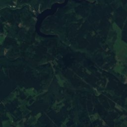
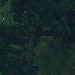
Satellite: Sentinel-2 cloudless 2016 by EOX IT Services GmbH · CC BY 4.0 · Contains modified Copernicus Sentinel data 2016
33 km SE

Steling

658 m · High Fens
Steling

Heritage

James the Greater Church
Photo: Romaine · CC0 · Wikimedia CommonsReport this photo · linked, not stored
2.5 km SE

James the Greater Church

Rijksmonument · 1873
James the Greater Church
Villa Imstenrade
Photo: Romaine · CC0 · Wikimedia CommonsReport this photo · linked, not stored
2.1 km N

Villa Imstenrade

Rijksmonument · 1908
Villa Imstenrade
Kloosterkerk van Maria Boodschap
Photo: Romaine · CC0 · Wikimedia CommonsReport this photo · linked, not stored
0.5 km E

Kloosterkerk van Maria Boodschap

Rijksmonument · 1878
Kloosterkerk van Maria Boodschap

Museums

Zuid-Limburgse Stoomtrein Maatschappij
Photo: Poldiri1 · CC BY-SA 3.0 · Wikimedia CommonsReport this photo · linked, not stored
0.4 km SW

Zuid-Limburgse Stoomtrein Maatschappij

Heritage railway · 1988
Zuid-Limburgse Stoomtrein Maatschappij
Friedrichs Customs Museum
Photo: ArthurMcGill · CC BY-SA 4.0 · Wikimedia CommonsReport this photo · linked, not stored
3.0 km NE

Friedrichs Customs Museum

Friedrichs Customs Museum
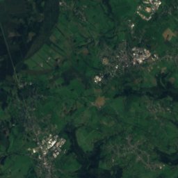
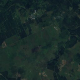
Satellite: Sentinel-2 cloudless 2016 by EOX IT Services GmbH · CC BY 4.0 · Contains modified Copernicus Sentinel data 2016
0.5 km E

Museum de Schat van Simpelveld

Museum de Schat van Simpelveld