Skip to content
Destinations
Weather & climate
Nature
Outdoors
Culture
Events
Sky & live
IJkbasis
Photo: Peter Donker · CC BY-SA 4.0 · Wikimedia Commons
IJkbasisReport this photo · linked, not stored
built structureWoeste Hoeve, Gelderland

IJkbasis

RijksmonumentBuilt 1957
Typebuilt structure
Built1957
Best monthsMay–Jun · Sepweather in Woeste Hoeve
52.08° N, 6.00° EUTC+1 · Central European Standard Time
Standing for69 years
built 1957today 2026
When to goWoeste Hoeve · weather score
JanFebMarAprMayJunJulAugSepOctNovDec43October
Best timeMay–Jun · Sep
October: high / low14° / 7°
iAbout

IJkbasis in brief

IJkbasis is a built structure in Woeste Hoeve, Gelderland, Netherlands.

It holds the designation Rijksmonument.

The built structure dates from 1957.

For a visit, the weather in Woeste Hoeve is best in May, June and September; in October afternoons average 14°.

Woeste Hoeve: weather and travel guide

Facts

Type
built structure
Designation
Rijksmonument
Built
1957
Nearest town
Woeste Hoeve
Region
Gelderland
Coordinates
52.07889, 5.99917
iiLocation

Where to find it

iiiWhen to visit

Weather in Woeste Hoeve

Climate guide

Month score for sightseeing

Best May–Jun · Sep
15
Jan
21
Feb
25
Mar
55
Apr
66
May
65
Jun
64
Jul
64
Aug
66
Sep
43
Oct
16
Nov
14
Dec
Around here

Woeste Hoeve and around

Woeste Hoeve
Photo: Apdency · Public domain · Wikimedia CommonsReport this photo · linked, not stored

Woeste Hoeve

Gelderland · Netherlands
May–Jun · Sepbest months
23°July high
74 maltitude
Woeste Hoeve

Nature

Hoge Veluwe National Park
Photo: Deb Collins · CC BY 2.0 · Wikimedia CommonsReport this photo · linked, not stored
11 km W

Hoge Veluwe National Park

National park
Hoge Veluwe National Park
Veluwezoom National Park
Photo: MartinD · CC BY-SA 3.0 · Wikimedia CommonsReport this photo · linked, not stored
7.8 km SE

Veluwezoom National Park

National park
Veluwezoom National Park
waterfalls of the Vrijenberger Spreng
Photo: Apdency at Dutch Wikipedia · CC BY-SA 3.0 · Wikimedia CommonsReport this photo · linked, not stored
5.1 km NE

waterfalls of the Vrijenberger Spreng

Waterfall
waterfalls of the Vrijenberger Spreng

Mountains

Signaal Imbosch
Photo: p.welters · CC BY 3.0 · Wikimedia CommonsReport this photo · linked, not stored
8.1 km SE

Signaal Imbosch

110 m
Signaal Imbosch
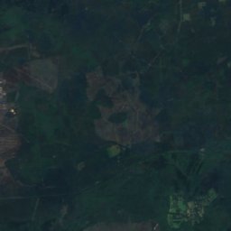
Satellite: Sentinel-2 cloudless 2016 by EOX IT Services GmbH · CC BY 4.0 · Contains modified Copernicus Sentinel data 2016
16 km NW

Torenberg

107 m
Torenberg
Posbank
Photo: Gouwenaar · CC0 · Wikimedia CommonsReport this photo · linked, not stored
9.8 km SE

Posbank

90 m
Posbank

Heritage

John Frost Bridge
Photo: Post-Work: User:W.wolny · Public domain · Wikimedia CommonsReport this photo · linked, not stored
15 km S

John Frost Bridge

Rijksmonument · 1935
John Frost Bridge
De Rots
Photo: Apdency · CC BY-SA 3.0 · Wikimedia CommonsReport this photo · linked, not stored
12 km N

De Rots

Rijksmonument · 1972
De Rots
St Eusebius' Church, Arnhem
Photo: de:Benutzer:AlterVista · CC BY-SA 3.0 · Wikimedia CommonsReport this photo · linked, not stored
14 km S

St Eusebius' Church, Arnhem

Rijksmonument · 1550
St Eusebius' Church, Arnhem

Museums

Stadsmuseum Hof van Hessen
Photo: Electionworld · CC BY-SA 4.0 · Wikimedia CommonsReport this photo · linked, not stored
2.1 km S

Stadsmuseum Hof van Hessen

1647
Stadsmuseum Hof van Hessen
Kröller-Müller Museum
Photo: Gerardus · Public domain · Wikimedia CommonsReport this photo · linked, not stored
9.2 km W

Kröller-Müller Museum

Sculpture garden · 1938
Kröller-Müller Museum
Netherlands Open Air Museum
Photo: Ciell · CC BY 2.5 · Wikimedia CommonsReport this photo · linked, not stored
11 km S

Netherlands Open Air Museum

Open-air museum · 1912
Netherlands Open Air Museum