Skip to content
Destinations
Weather & climate
Nature
Outdoors
Culture
Events
Sky & live
Groot Hell
Photo: Jcb · CC BY-SA 3.0 nl · Wikimedia Commons
Groot HellReport this photo · linked, not stored
Den Aller
Photo: Jcb · CC BY-SA 3.0 nl · Wikimedia Commons
Den AllerReport this photo · linked, not stored
Den Aller
Kasteel Oldenaller
Photo: Gouwenaar · CC0 · Wikimedia Commons
Kasteel OldenallerReport this photo · linked, not stored
Kasteel Oldenaller
Landhuis Salentein
Photo: Gouwenaar · CC0 · Wikimedia Commons
Landhuis SalenteinReport this photo · linked, not stored
Landhuis Salentein
De Keut (Putten)
Photo: Gouwenaar · CC0 · Wikimedia Commons
De Keut (Putten)Report this photo · linked, not stored
De Keut (Putten)
farmKruishaar, Gelderland

Groot Hell

Rijksmonument
Typefarm
Built–
Best monthsMay–Jun · Sepweather in Kruishaar
52.23° N, 5.55° EUTC+2 · Central European Summer Time
When to goKruishaar · weather score
JanFebMarAprMayJunJulAugSepOctNovDec43October
Best timeMay–Jun · Sep
October: high / low15° / 7°
iAbout

Groot Hell in brief

Groot Hell is a farm in Kruishaar, Gelderland, Netherlands.

It holds the designation Rijksmonument.

For a visit, the weather in Kruishaar is best in May, June and September; in October afternoons average 15°.

Kruishaar: weather and travel guide

Facts

Type
farm
Designation
Rijksmonument
Nearest town
Kruishaar
Region
Gelderland
Coordinates
52.23306, 5.54750
iiLocation

Where to find it

iiiWhen to visit

Weather in Kruishaar

Climate guide

Month score for sightseeing

Best May–Jun · Sep
16
Jan
21
Feb
26
Mar
58
Apr
66
May
66
Jun
64
Jul
64
Aug
66
Sep
43
Oct
16
Nov
15
Dec
ivNearby

More heritage close by

All monuments in the Netherlands
Den Aller
Photo: Jcb · CC BY-SA 3.0 nl · Wikimedia CommonsReport this photo · linked, not stored

Den Aller

2.1 km NW
Rijksmonument complex
Den Aller
Kasteel Oldenaller
Photo: Gouwenaar · CC0 · Wikimedia CommonsReport this photo · linked, not stored

Kasteel Oldenaller

2.4 km NW
Rijksmonument
Kasteel Oldenaller
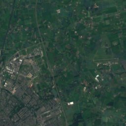
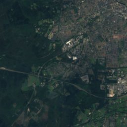
Satellite: Sentinel-2 cloudless 2016 by EOX IT Services GmbH · CC BY 4.0 · Contains modified Copernicus Sentinel data 2016

Bijstein

3.3 km NE
Rijksmonument complex
Bijstein
Landhuis Salentein
Photo: Gouwenaar · CC0 · Wikimedia CommonsReport this photo · linked, not stored

Landhuis Salentein

3.5 km W
Rijksmonument
Landhuis Salentein
De Keut (Putten)
Photo: Gouwenaar · CC0 · Wikimedia CommonsReport this photo · linked, not stored

De Keut (Putten)

3.5 km SE
Rijksmonument
De Keut (Putten)
Hardenbergerweg 2, Putten
Photo: Gouwenaar · CC0 · Wikimedia CommonsReport this photo · linked, not stored

Hardenbergerweg 2, Putten

3.6 km W
Rijksmonument
Hardenbergerweg 2, Putten
Around here

Kruishaar and around

Kruishaar
Photo: Jcb · CC BY-SA 3.0 nl · Wikimedia CommonsReport this photo · linked, not stored

Kruishaar

Gelderland · Netherlands
May–Jun · Sepbest months
23°July high
11 maltitude
Kruishaar

Nature

Nuldernauw
Photo: Swarte Kees at Western Frisian Wikipedia · Public domain · Wikimedia CommonsReport this photo · linked, not stored
7.6 km N

Nuldernauw

Lake
Nuldernauw
Nijkerkernauw
Photo: Arthurwilliam · CC BY-SA 3.0 · Wikimedia CommonsReport this photo · linked, not stored
9.3 km NW

Nijkerkernauw

Lake · -4 m
Nijkerkernauw
Solse Gat
Photo: Romaine · CC0 · Wikimedia CommonsReport this photo · linked, not stored
10 km NE

Solse Gat

Lake
Solse Gat

Mountains

Signaal Imbosch
Photo: p.welters · CC BY 3.0 · Wikimedia CommonsReport this photo · linked, not stored
36 km SE

Signaal Imbosch

110 m
Signaal Imbosch
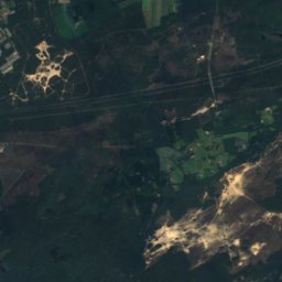
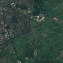
Satellite: Sentinel-2 cloudless 2016 by EOX IT Services GmbH · CC BY 4.0 · Contains modified Copernicus Sentinel data 2016
22 km E

Torenberg

107 m
Torenberg
Posbank
Photo: Gouwenaar · CC0 · Wikimedia CommonsReport this photo · linked, not stored
38 km SE

Posbank

90 m
Posbank

Heritage

De Hoop, Appel
Photo: Rasbak · CC BY-SA 3.0 · Wikimedia CommonsReport this photo · linked, not stored
1.6 km SW

De Hoop, Appel

Rijksmonument
De Hoop, Appel
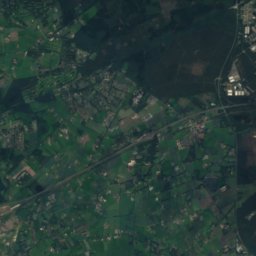
Satellite: Sentinel-2 cloudless 2016 by EOX IT Services GmbH · CC BY 4.0 · Contains modified Copernicus Sentinel data 2016
1.4 km S

Appelse walburg

Rijksmonument
Appelse walburg
Constantinianum
Photo: Rijksdienst voor het Cultureel Erfgoed · CC BY-SA 4.0 · Wikimedia CommonsReport this photo · linked, not stored
15 km SW

Constantinianum

Rijksmonument · 1952
Constantinianum

Museums

192 Museum
Photo: Ymnes · CC0 · Wikimedia CommonsReport this photo · linked, not stored
3.4 km NW

192 Museum

192 Museum
Oude Ambachten & Speelgoed Museum
Photo: Marion Golsteijn · CC BY-SA 3.0 · Wikimedia CommonsReport this photo · linked, not stored
3.8 km S

Oude Ambachten & Speelgoed Museum

Craft museum
Oude Ambachten & Speelgoed Museum
Dutch Cavalry Museum
Photo: Pat boen · CC BY-SA 4.0 · Wikimedia CommonsReport this photo · linked, not stored
15 km SW

Dutch Cavalry Museum

Military museum
Dutch Cavalry Museum