
Photo: Mark Ahsmann · CC BY-SA 4.0 · Wikimedia Commons
GasometerReport this photo · linked, not stored
GasometerReport this photo · linked, not stored
 Cokesfabriek
 Eiffelgebouw

Photo: Cumulus form NL Wikipedia · CC BY-SA 3.0 · Wikimedia Commons
Sint-AndrieskloosterReport this photo · linked, not stored
Sint-AndrieskloosterSint-AndrieskloosterReport this photo · linked, not stored

Photo: China Crisis · CC BY 3.0 · Wikimedia Commons
Du Moulin LineReport this photo · linked, not stored
Du Moulin LineDu Moulin LineReport this photo · linked, not stored
industrial heritage siteMaastricht, Limburg
Gasometer
municipal monument in the NetherlandsBuilt 1956
Typeindustrial heritage site
Built1956
Best monthsMay–Jun · Sepweather in Maastricht
50.86° N, 5.68° EUTC+1 · Central European Standard Time
Standing for70 years
built 1956today 2026
When to goMaastricht · weather score
Best timeMay–Jun · Sep
October: high / low15° / 8°
iAbout
Gasometer in brief
Gasometer is an industrial heritage site in Maastricht, Limburg, Netherlands. Gasometer from 1958, situated in Frontenpark.
It holds the designation municipal monument in the Netherlands.
The industrial heritage site dates from 1956.
For a visit, the weather in Maastricht is best in May, June and September; in October afternoons average 15°.
Facts
- Type
- industrial heritage site
- Designation
- municipal monument in the Netherlands
- Built
- 1956
- Nearest town
- Maastricht
- Region
- Limburg
- Coordinates
- 50.85694, 5.68331
iiLocation
Where to find it
ivNearby
All monuments in the NetherlandsMore heritage close by
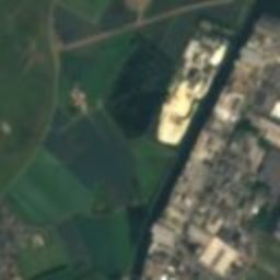
Satellite: Sentinel-2 cloudless 2016 by EOX IT Services GmbH · CC BY 4.0 · Contains modified Copernicus Sentinel data 2016
Fort Willem I
0.4 km W
Rijksmonument
Photo: Cumulus form NL Wikipedia · CC BY-SA 3.0 · Wikimedia CommonsReport this photo · linked, not stored
Sint-Andriesklooster
0.4 km SE
Rijksmonument
Satellite: Sentinel-2 cloudless 2016 by EOX IT Services GmbH · CC BY 4.0 · Contains modified Copernicus Sentinel data 2016
Timmerfabriek
0.5 km E
Rijksmonument
Around here
Maastricht and around

Nature

Photo: GerardM at Dutch Wikipedia · CC BY-SA 3.0 · Wikimedia CommonsReport this photo · linked, not stored
Jeker
River
Satellite: Sentinel-2 cloudless 2016 by EOX IT Services GmbH · CC BY 4.0 · Contains modified Copernicus Sentinel data 2016
Berwinne
River · 52 m

Mountains


Heritage


Photo: User:Les Meloures at lb.wikipedia · CC BY-SA 3.0 · Wikimedia CommonsReport this photo · linked, not stored
Sint-Lambertuskerk, Maastricht
Rijksmonument · 1916

Photo: © Raimond Spekking / CC BY-SA 4.0 (via Wikimedia Commons) · CC BY-SA 4.0 · Wikimedia CommonsReport this photo · linked, not stored
Basilica of Saint Servatius
Rijksmonument · 600


