Skip to content
Destinations
Weather & climate
Nature
Outdoors
Culture
Events
Sky & live
Beusdaelshof
Photo: Romaine · CC0 · Wikimedia Commons
BeusdaelshofReport this photo · linked, not stored
Hoeve Sint Antoniusbank
Photo: Romaine · CC0 · Wikimedia Commons
Hoeve Sint AntoniusbankReport this photo · linked, not stored
Hoeve Sint Antoniusbank
Bemelerbosgroeve III
Photo: Romaine · CC0 · Wikimedia Commons
Bemelerbosgroeve IIIReport this photo · linked, not stored
Bemelerbosgroeve III
Sint-Laurentiuskerk, Bemelen
Photo: Romaine · CC0 · Wikimedia Commons
Sint-Laurentiuskerk, BemelenReport this photo · linked, not stored
Sint-Laurentiuskerk, Bemelen
Roman villa Backerbosch
Photo: Romaine · CC0 · Wikimedia Commons
Roman villa BackerboschReport this photo · linked, not stored
Roman villa Backerbosch
farmhouseBemelen, Limburg

Beusdaelshof

Rijksmonument
Typefarmhouse
Built–
Best monthsMay–Jun · Sepweather in Bemelen
50.84° N, 5.77° EUTC+2 · Central European Summer Time
When to goBemelen · weather score
JanFebMarAprMayJunJulAugSepOctNovDec49October
Best timeMay–Jun · Sep
October: high / low15° / 8°
iAbout

Beusdaelshof in brief

Beusdaelshof is a farmhouse in Bemelen, Limburg, Netherlands.

It holds the designation Rijksmonument.

For a visit, the weather in Bemelen is best in May, June and September; in October afternoons average 15°.

Bemelen: weather and travel guide

Facts

Type
farmhouse
Designation
Rijksmonument
Nearest town
Bemelen
Region
Limburg
Coordinates
50.84252, 5.76685
iiLocation

Where to find it

iiiWhen to visit

Weather in Bemelen

Climate guide

Month score for sightseeing

Best May–Jun · Sep
15
Jan
20
Feb
27
Mar
58
Apr
65
May
66
Jun
64
Jul
65
Aug
71
Sep
49
Oct
18
Nov
14
Dec
ivNearby

More heritage close by

All monuments in the Netherlands
Hoeve Sint Antoniusbank
Photo: Romaine · CC0 · Wikimedia CommonsReport this photo · linked, not stored

Hoeve Sint Antoniusbank

0.3 km NW
Rijksmonument
Hoeve Sint Antoniusbank
Bemelerbosgroeve III
Photo: Romaine · CC0 · Wikimedia CommonsReport this photo · linked, not stored

Bemelerbosgroeve III

0.5 km N
Rijksmonument
Bemelerbosgroeve III
Sint-Laurentiuskerk, Bemelen
Photo: Romaine · CC0 · Wikimedia CommonsReport this photo · linked, not stored

Sint-Laurentiuskerk, Bemelen

0.6 km N
Rijksmonument
Sint-Laurentiuskerk, Bemelen
Roman villa Backerbosch
Photo: Romaine · CC0 · Wikimedia CommonsReport this photo · linked, not stored

Roman villa Backerbosch

0.9 km W
Rijksmonument
Roman villa Backerbosch
Kerkhofkapel Missiehuis Cadier en Keer
Photo: Romaine · CC0 · Wikimedia CommonsReport this photo · linked, not stored

Kerkhofkapel Missiehuis Cadier en Keer

1.0 km SW
Rijksmonument
Kerkhofkapel Missiehuis Cadier en Keer
Lourdesgrot Missiehuis Cadier en Keer
Photo: Romaine · CC0 · Wikimedia CommonsReport this photo · linked, not stored

Lourdesgrot Missiehuis Cadier en Keer

1.0 km SW
Rijksmonument
Lourdesgrot Missiehuis Cadier en Keer
Around here

Bemelen and around

Bemelen
Photo: Rijksdienst voor het Cultureel Erfgoed · CC BY-SA 4.0 · Wikimedia CommonsReport this photo · linked, not stored

Bemelen

Limburg · Netherlands
May–Jun · Sepbest months
24°July high
82 maltitude
Bemelen

Nature

Jeker
Photo: GerardM at Dutch Wikipedia · CC BY-SA 3.0 · Wikimedia CommonsReport this photo · linked, not stored
7.1 km SW

Jeker

River
Jeker
Gulp River
Photo: Poldi rijke · CC BY-SA 3.0 · Wikimedia CommonsReport this photo · linked, not stored
9.9 km E

Gulp River

River · 105 m
Gulp River
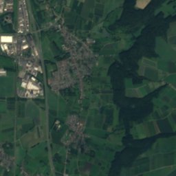
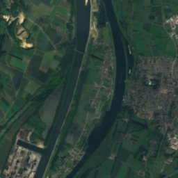
Satellite: Sentinel-2 cloudless 2016 by EOX IT Services GmbH · CC BY 4.0 · Contains modified Copernicus Sentinel data 2016
12 km SW

Berwinne

River · 52 m
Berwinne

Mountains

Donnerberg
Photo: KR712 · CC BY-SA 3.0 · Wikimedia CommonsReport this photo · linked, not stored
35 km E

Donnerberg

287 m
Donnerberg
Schlangenberg
Photo: --BBKurt 12:43, 1 August 2007 (UTC) · CC BY-SA 3.0 · Wikimedia CommonsReport this photo · linked, not stored
36 km E

Schlangenberg

276 m
Schlangenberg
Lousberg
Photo: Euku:⇄ · CC BY-SA 3.0 · Wikimedia CommonsReport this photo · linked, not stored
23 km E

Lousberg

264 m
Lousberg

Heritage

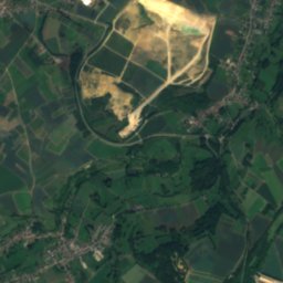
Satellite: Sentinel-2 cloudless 2016 by EOX IT Services GmbH · CC BY 4.0 · Contains modified Copernicus Sentinel data 2016
1.2 km SW

Mission house

Rijksmonument · 1955
Mission house
Sint-Laurentiuskerk, Bemelen
Photo: Romaine · CC0 · Wikimedia CommonsReport this photo · linked, not stored
0.1 km NE

Sint-Laurentiuskerk, Bemelen

Rijksmonument · 1845
Sint-Laurentiuskerk, Bemelen
Heilige-Kruisverheffingskerk
Photo: Romaine · CC0 · Wikimedia CommonsReport this photo · linked, not stored
2.2 km S

Heilige-Kruisverheffingskerk

Rijksmonument · 1958
Heilige-Kruisverheffingskerk

Museums

Bonnefanten Museum
Photo: Mark Ahsmann · CC BY-SA 3.0 · Wikimedia CommonsReport this photo · linked, not stored
4.3 km W

Bonnefanten Museum

Art museum · 1884
Bonnefanten Museum
Fort Eben-Emael
Photo: Paul Hermans · CC BY-SA 4.0 · Wikimedia CommonsReport this photo · linked, not stored
8.0 km SW

Fort Eben-Emael

Military museum · 1932
Fort Eben-Emael
Fort d'Aubin-Neufchâteau
Photo: HalderschenNL · CC BY-SA 3.0 · Wikimedia CommonsReport this photo · linked, not stored
14 km S

Fort d'Aubin-Neufchâteau

Military museum
Fort d'Aubin-Neufchâteau