




























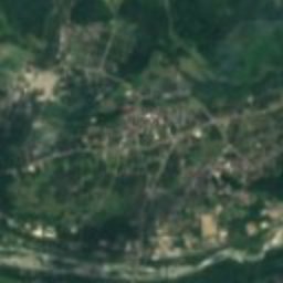




















Satellite: Sentinel-2 cloudless 2016 by EOX IT Services GmbH · CC BY 4.0 · Contains modified Copernicus Sentinel data 2016
human settlementHakuba, Nagano
Aoni
Important Preservation District for a Group of Traditional Buildings
Typehuman settlement
Built–
Best monthsMay–Jun · Sepweather in Hakuba
36.72° N, 137.90° EUTC+9 · Japan Standard Time
When to goHakuba · weather score
Best timeMay–Jun · Sep
October: high / low17° / 9°
iAbout
Aoni in brief
Aoni is a human settlement in Hakuba, Nagano, Japan.
It holds the designation Important Preservation District for a Group of Traditional Buildings.
For a visit, the weather in Hakuba is best in May, June and September; in October afternoons average 17°.
iiLocation
Where to find it
iiiWhen to visit
Climate guideWeather in Hakuba
Month score for sightseeing
Best May–Jun · Sep19
Jan
19
Feb
19
Mar
32
Apr
62
May
57
Jun
57
Jul
56
Aug
60
Sep
55
Oct
21
Nov
21
Dec
Around here
Hakuba and around

Nature


Mountains


Heritage

Photo: photo: Qurren (talk) Taken with Canon IXY 430F (Digital IXUS 245 HS) · CC BY-SA 3.0 · Wikimedia CommonsReport this photo · linked, not stored
Shogan-ji Temple
Municipal Cultural Property · 969















Satellite: Sentinel-2 cloudless 2016 by EOX IT Services GmbH · CC BY 4.0 · Contains modified Copernicus Sentinel data 2016
Shirahige Shrine, Ogawa
Important Cultural Property of Japan · 685
Museums
















Satellite: Sentinel-2 cloudless 2016 by EOX IT Services GmbH · CC BY 4.0 · Contains modified Copernicus Sentinel data 2016
Hakuba Saegusa Art Museum
Art museum

Photo: photo: Qurren (talk) Taken with Canon IXY 430F (Digital IXUS 245 HS) · CC BY-SA 3.0 · Wikimedia CommonsReport this photo · linked, not stored

Kinasa Folk Museum
Folk museum