


Skip to content
Destinations
Weather & climate
Nature
Outdoors
Culture
Events
Sky & live
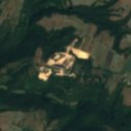
Satellite: Sentinel-2 cloudless 2016 by EOX IT Services GmbH · CC BY 4.0 · Contains modified Copernicus Sentinel data 2016
San Valentino
Photo: LigaDue · CC BY-SA 4.0 · Wikimedia Commons
San ValentinoReport this photo · linked, not stored
San Valentino
archaeological siteSan Quirico, Tuscany

Vitozza

Italian national heritage
Typearchaeological site
Built–
Best monthsMay–Jun · Sepweather in San Quirico
42.68° N, 11.76° EUTC+1 · Central European Standard Time
When to goSan Quirico · weather score
JanFebMarAprMayJunJulAugSepOctNovDec75October
Best timeMay–Jun · Sep
October: high / low19° / 10°
iAbout

Vitozza in brief

Vitozza is an archaeological site in San Quirico, Tuscany, Italy.

It holds the designation Italian national heritage.

For a visit, the weather in San Quirico is best in May, June and September; in October afternoons average 19°.

San Quirico: weather and travel guide

Facts

Type
archaeological site
Designation
Italian national heritage
Nearest town
San Quirico
Region
Tuscany
Coordinates
42.67780, 11.75690
iiLocation

Where to find it

iiiWhen to visit

Weather in San Quirico

Climate guide

Month score for sightseeing

Best May–Jun · Sep
32
Jan
32
Feb
48
Mar
66
Apr
75
May
77
Jun
68
Jul
66
Aug
78
Sep
75
Oct
45
Nov
27
Dec
ivNearby

More heritage close by

All monuments in Italy
San Valentino
Photo: LigaDue · CC BY-SA 4.0 · Wikimedia CommonsReport this photo · linked, not stored

San Valentino

3.2 km NW
Italian national heritage
San Valentino
Around here

San Quirico and around

San Quirico
Photo: LigaDue · CC BY-SA 4.0 · Wikimedia CommonsReport this photo · linked, not stored

San Quirico

Tuscany · Italy
May–Jun · Sepbest months
30°July high
486 maltitude
San Quirico

Nature

Fiora River
Photo: LigaDue · CC BY 3.0 · Wikimedia CommonsReport this photo · linked, not stored
23 km NW

Fiora River

River
Fiora River
Marta
Photo: LigaDue · CC BY-SA 4.0 · Wikimedia CommonsReport this photo · linked, not stored
20 km SE

Marta

River
Marta
Lago di San Casciano
Photo: LigaDue · CC BY-SA 4.0 · Wikimedia CommonsReport this photo · linked, not stored
20 km N

Lago di San Casciano

Lake · 383 m
Lago di San Casciano

Mountains

Mount Amiata
Photo: Ziegler175 · CC BY-SA 3.0 · Wikimedia CommonsReport this photo · linked, not stored
27 km NW

Mount Amiata

1,738 m
Mount Amiata
Monte Labbro
Photo: Alienautic · Public domain · Wikimedia CommonsReport this photo · linked, not stored
26 km NW

Monte Labbro

1,192 m · Mount Amiata
Monte Labbro
Monte Buceto
Photo: Gian Luca Corbelli · Public domain · Wikimedia CommonsReport this photo · linked, not stored
30 km NW

Monte Buceto

1,152 m · Mount Amiata
Monte Buceto

Heritage

Pitigliano Cathedral
Photo: Sidvics · CC BY-SA 3.0 · Wikimedia CommonsReport this photo · linked, not stored
8.9 km SW

Pitigliano Cathedral

Italian national heritage
Pitigliano Cathedral
Acquapendente Cathedral
Photo: Davide Papalini · CC BY-SA 3.0 · Wikimedia CommonsReport this photo · linked, not stored
12 km NE

Acquapendente Cathedral

Italian national heritage
Acquapendente Cathedral
Sovana Cathedral
Photo: Sailko · CC BY-SA 3.0 · Wikimedia CommonsReport this photo · linked, not stored
10 km W

Sovana Cathedral

Italian national heritage
Sovana Cathedral

Museums

Museum of the Prehistory of Tuscia and of the Rocca Farnese
Photo: Cristina Delmi · Public domain · Wikimedia CommonsReport this photo · linked, not stored
12 km S

Museum of the Prehistory of Tuscia and of the Rocca Farnese

Archaeological museum · 1996
Museum of the Prehistory of Tuscia and of the Rocca Farnese
Museum of Farnese Garments
Photo: Annacap92 · CC BY-SA 3.0 · Wikimedia CommonsReport this photo · linked, not stored
8.1 km E

Museum of Farnese Garments

Art museum · 1998
Museum of Farnese Garments
Archeological park Città del Tufo
Photo: Sidvics · CC BY-SA 3.0 · Wikimedia CommonsReport this photo · linked, not stored
11 km W

Archeological park Città del Tufo

Archaeological park · 1998
Archeological park Città del Tufo