
Photo: Heinz Schmitz · CC BY-SA 2.5 · Wikimedia Commons
OrchomenusReport this photo · linked, not stored
OrchomenusReport this photo · linked, not stored

Photo: C messier · CC BY-SA 4.0 · Wikimedia Commons
Church of Panagia, LevidiReport this photo · linked, not stored
Church of Panagia, LevidiChurch of Panagia, LevidiReport this photo · linked, not stored
ancient cityLevídion, Peloponnese
Orchomenus
archaeological site in Greece
Typeancient city
Built–
Best monthsMay–Jun · Sepweather in Levídion
37.72° N, 22.32° EUTC+2 · Eastern European Standard Time
When to goLevídion · weather score
Best timeMay–Jun · Sep
October: high / low19° / 9°
iAbout
Orchomenus in brief
Orchomenus is an ancient city in Levídion, Peloponnese, Greece. Ancient Greek city-state of Arcadia.
It holds the designation archaeological site in Greece.
For a visit, the weather in Levídion is best in May, June and September; in October afternoons average 19°.
Facts
- Type
- ancient city
- Designation
- archaeological site in Greece
- Nearest town
- Levídion
- Region
- Peloponnese
- Coordinates
- 37.72473, 22.31527
iiLocation
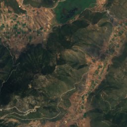
Where to find it
iiiWhen to visit
Climate guideWeather in Levídion
Month score for sightseeing
Best May–Jun · Sep21
Jan
26
Feb
37
Mar
69
Apr
85
May
85
Jun
79
Jul
80
Aug
85
Sep
80
Oct
43
Nov
20
Dec
ivNearby
All monuments in GreeceMore heritage close by
Around here
Levídion and around

Nature


Mountains


Photo: Thodoris Κ. Mavraganis · CC BY-SA 4.0 · Wikimedia CommonsReport this photo · linked, not stored
Mainalo
1,981 m
Heritage


Photo: Apostolos Papageorgiou · CC BY-SA 3.0 · Wikimedia CommonsReport this photo · linked, not stored

Bezeniko Fort
protected building in Greece · 1500