Skip to content
Destinations
Weather & climate
Nature
Outdoors
Culture
Events
Sky & live
Wasserturm (Schweinheim)
Photo: Sozi · CC0 · Wikimedia Commons
Wasserturm (Schweinheim)Report this photo · linked, not stored
Pestkapelle (Schweinheim)
Photo: Hagen von Eitzen · CC BY-SA 3.0 · Wikimedia Commons
Pestkapelle (Schweinheim)Report this photo · linked, not stored
Pestkapelle (Schweinheim)
Klufterhof
Photo: Leit · CC BY-SA 4.0 · Wikimedia Commons
KlufterhofReport this photo · linked, not stored
Klufterhof
Burgfriedhof Bad Godesberg
Photo: Hagman · CC BY-SA 3.0 · Wikimedia Commons
Burgfriedhof Bad GodesbergReport this photo · linked, not stored
Burgfriedhof Bad Godesberg
Bad Godesberg Jewish cemetery
Photo: Eifeljanes · CC BY-SA 3.0 · Wikimedia Commons
Bad Godesberg Jewish cemeteryReport this photo · linked, not stored
Bad Godesberg Jewish cemetery
water towerPech, North Rhine-Westphalia

Wasserturm (Schweinheim)

architectural heritage monument in North Rhine-Westphalia
Typewater tower
Built–
Best monthsJul–Sepweather in Pech
50.68° N, 7.13° EUTC+1 · Central European Standard Time
When to goPech · weather score
JanFebMarAprMayJunJulAugSepOctNovDec47October
Best timeJul–Sep
October: high / low15° / 7°
iAbout

Wasserturm (Schweinheim) in brief

Wasserturm (Schweinheim) is a water tower in Pech, North Rhine-Westphalia, Germany.

It holds the designation architectural heritage monument in North Rhine-Westphalia.

For a visit, the weather in Pech is best in July, August and September; in October afternoons average 15°.

Pech: weather and travel guide

Facts

Type
water tower
Designation
architectural heritage monument in North Rhine-Westphalia
Nearest town
Pech
Region
North Rhine-Westphalia
Coordinates
50.68474, 7.13129
iiLocation

Where to find it

iiiWhen to visit

Weather in Pech

Climate guide

Month score for sightseeing

Best Jul–Sep
16
Jan
19
Feb
25
Mar
57
Apr
63
May
63
Jun
65
Jul
65
Aug
69
Sep
47
Oct
16
Nov
15
Dec
ivNearby

More heritage close by

All monuments in Germany
Pestkapelle (Schweinheim)
Photo: Hagen von Eitzen · CC BY-SA 3.0 · Wikimedia CommonsReport this photo · linked, not stored

Pestkapelle (Schweinheim)

0.8 km SE
Kulturdenkmal
Pestkapelle (Schweinheim)
Klufterhof
Photo: Leit · CC BY-SA 4.0 · Wikimedia CommonsReport this photo · linked, not stored

Klufterhof

0.9 km N
architectural heritage monument in North Rhine-Westphalia
Klufterhof
Burgfriedhof Bad Godesberg
Photo: Hagman · CC BY-SA 3.0 · Wikimedia CommonsReport this photo · linked, not stored

Burgfriedhof Bad Godesberg

1.2 km E
architectural heritage monument in North Rhine-Westphalia
Burgfriedhof Bad Godesberg
Bad Godesberg Jewish cemetery
Photo: Eifeljanes · CC BY-SA 3.0 · Wikimedia CommonsReport this photo · linked, not stored

Bad Godesberg Jewish cemetery

1.2 km E
architectural heritage monument in North Rhine-Westphalia
Bad Godesberg Jewish cemetery
Turmhaus (Friesdorf)
Photo: Hagen von Eitzen · CC BY-SA 3.0 · Wikimedia CommonsReport this photo · linked, not stored

Turmhaus (Friesdorf)

1.3 km NW
architectural heritage monument in North Rhine-Westphalia
Turmhaus (Friesdorf)
Saint Michael Chapel (Bad Godesberg)
Photo: Hagman · CC BY-SA 3.0 · Wikimedia CommonsReport this photo · linked, not stored

Saint Michael Chapel (Bad Godesberg)

1.3 km E
architectural heritage monument in North Rhine-Westphalia
Saint Michael Chapel (Bad Godesberg)
Around here

Pech and around

Pech
Photo: Unknown author · CC BY-SA 3.0 · Wikimedia CommonsReport this photo · linked, not stored

Pech

North Rhine-Westphalia · Germany
Jul–Sepbest months
25°July high
143 maltitude
Pech

Nature

Götgesbach
Photo: Hydro Graf · CC BY-SA 4.0 · Wikimedia CommonsReport this photo · linked, not stored
4.3 km W

Götgesbach

River
Götgesbach
Godesberger Bach
Photo: Patrick Ch. Apfeld · CC BY-SA 3.0 · Wikimedia CommonsReport this photo · linked, not stored
6.2 km NE

Godesberger Bach

River
Godesberger Bach
Ankerbach
Photo: Bungert55 · CC BY-SA 3.0 · Wikimedia CommonsReport this photo · linked, not stored
7.6 km NE

Ankerbach

River
Ankerbach

Mountains

Hohe Acht
Photo: Jörg Braukmann · CC BY-SA 3.0 · Wikimedia CommonsReport this photo · linked, not stored
31 km S

Hohe Acht

746 m · High Eifel
Hohe Acht
Raßberg
Photo: Mabol! · CC BY-SA 3.0 · Wikimedia CommonsReport this photo · linked, not stored
30 km S

Raßberg

668 m · High Eifel
Raßberg
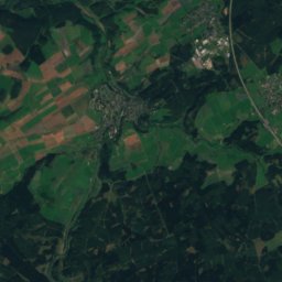
Satellite: Sentinel-2 cloudless 2016 by EOX IT Services GmbH · CC BY 4.0 · Contains modified Copernicus Sentinel data 2016
34 km SW

Aremberg

624 m · Ahr Hills
Aremberg

Heritage

Burg Gudenau
Photo: Carsten Steger · CC BY-SA 4.0 · Wikimedia CommonsReport this photo · linked, not stored
2.8 km SW

Burg Gudenau

architectural heritage monument in North Rhine-Westphalia · 1200

Burg Gudenau
Wattendorfer Mühle
Photo: Capellaria · CC BY-SA 4.0 · Wikimedia CommonsReport this photo · linked, not stored
1.8 km NE

Wattendorfer Mühle

architectural heritage monument in North Rhine-Westphalia
Wattendorfer Mühle
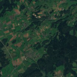
Satellite: Sentinel-2 cloudless 2016 by EOX IT Services GmbH · CC BY 4.0 · Contains modified Copernicus Sentinel data 2016
2.0 km N

Ringwall Venne

Bodendenkmal
Ringwall Venne

Museums

Museum Koenig
Photo: Simbel · CC BY-SA 3.0 · Wikimedia CommonsReport this photo · linked, not stored
7.7 km N

Museum Koenig

1912
Museum Koenig
LVR-Landesmuseum Bonn
Photo: © Raimond Spekking / CC BY-SA 4.0 (via Wikimedia Commons) · CC BY-SA 4.0 · Wikimedia CommonsReport this photo · linked, not stored
8.9 km N

LVR-Landesmuseum Bonn

1820
LVR-Landesmuseum Bonn
Kunstmuseum Bonn
Photo: © Raimond Spekking / CC BY-SA 4.0 (via Wikimedia Commons) · CC BY-SA 4.0 · Wikimedia CommonsReport this photo · linked, not stored
6.9 km N

Kunstmuseum Bonn

Art museum · 1985
Kunstmuseum Bonn