Skip to content
Destinations
Weather & climate
Nature
Outdoors
Culture
Events
Sky & live
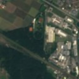
Satellite: Sentinel-2 cloudless 2016 by EOX IT Services GmbH · CC BY 4.0 · Contains modified Copernicus Sentinel data 2016
Schleuse Feudenheim
Photo: Dominiku~commonswiki · CC BY 2.5 · Wikimedia Commons
Schleuse FeudenheimReport this photo · linked, not stored
Schleuse Feudenheim
Luisenpark
Photo: Andromeda Altair · Public domain · Wikimedia Commons
LuisenparkReport this photo · linked, not stored
Luisenpark
Fernmeldeturm Mannheim
Photo: © Achim Lammerts (Syntaxys) / Wikimedia Commons · CC BY-SA 4.0 · Wikimedia Commons
Fernmeldeturm MannheimReport this photo · linked, not stored
Fernmeldeturm Mannheim
Alter Jüdischer Friedhof Feudenheim
Photo: Frank C. Müller · CC BY-SA 3.0 · Wikimedia Commons
Alter Jüdischer Friedhof FeudenheimReport this photo · linked, not stored
Alter Jüdischer Friedhof Feudenheim
churchMannheim, Baden-Wurttemberg

Thomaskirche, Mannheim

Kulturdenkmal
Typechurch
Built–by Christian Schrade
Best monthsApr · Jun · Sepweather in Mannheim
49.48° N, 8.51° EUTC+1 · Central European Standard Time
When to goMannheim · weather score
JanFebMarAprMayJunJulAugSepOctNovDec52October
Best timeApr · Jun · Sep
October: high / low16° / 7°
iAbout

Thomaskirche, Mannheim in brief

Thomaskirche, Mannheim is a church in Mannheim, Baden-Wurttemberg, Germany.

It holds the designation Kulturdenkmal.

The church was designed by Christian Schrade.

For a visit, the weather in Mannheim is best in April, June and September; in October afternoons average 16°.

Mannheim: weather and travel guide

Facts

Type
church
Designation
Kulturdenkmal
Architect
Christian Schrade
Nearest town
Mannheim
Region
Baden-Wurttemberg
Coordinates
49.47800, 8.50959
iiLocation

Where to find it

iiiWhen to visit

Weather in Mannheim

Climate guide

Month score for sightseeing

Best Apr · Jun · Sep
ivNearby

More heritage close by

All monuments in Germany
Schleuse Feudenheim
Photo: Dominiku~commonswiki · CC BY 2.5 · Wikimedia CommonsReport this photo · linked, not stored

Schleuse Feudenheim

0.7 km N
Kulturdenkmal
Schleuse Feudenheim
Luisenpark
Photo: Andromeda Altair · Public domain · Wikimedia CommonsReport this photo · linked, not stored

Luisenpark

1.0 km NW
Kulturdenkmal
Luisenpark
Fernmeldeturm Mannheim
Photo: © Achim Lammerts (Syntaxys) / Wikimedia Commons · CC BY-SA 4.0 · Wikimedia CommonsReport this photo · linked, not stored

Fernmeldeturm Mannheim

1.6 km NW
cultural heritage monument in Baden-Württemberg
Fernmeldeturm Mannheim
Alter Jüdischer Friedhof Feudenheim
Photo: Frank C. Müller · CC BY-SA 3.0 · Wikimedia CommonsReport this photo · linked, not stored

Alter Jüdischer Friedhof Feudenheim

1.6 km NE
Kulturdenkmal
Alter Jüdischer Friedhof Feudenheim
Epiphaniaskirche, Ilvesheim
Photo: Frank · CC BY-SA 3.0 · Wikimedia CommonsReport this photo · linked, not stored

Epiphaniaskirche, Ilvesheim

1.7 km NE
Kulturdenkmal
Epiphaniaskirche, Ilvesheim
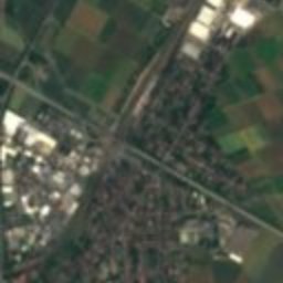
Satellite: Sentinel-2 cloudless 2016 by EOX IT Services GmbH · CC BY 4.0 · Contains modified Copernicus Sentinel data 2016

St.-Peter-und-Paul-Kirche (Mannheim)

1.8 km NE
Kulturdenkmal
St.-Peter-und-Paul-Kirche (Mannheim)
Around here

Mannheim and around

Mannheim
Photo: Simsalabimbam · CC BY-SA 3.0 · Wikimedia CommonsReport this photo · linked, not stored

Mannheim

Baden-Wurttemberg · Germany
Apr · Jun · Sepbest months
27°July high
100 maltitude
Mannheim

Nature

Neckar
Photo: Berndt Fernow · Public domain · Wikimedia CommonsReport this photo · linked, not stored
3.3 km NW

Neckar

River · 89 m
Neckar
Rehbach
Photo: Mundartpoet · CC BY-SA 3.0 · Wikimedia CommonsReport this photo · linked, not stored
5.0 km S

Rehbach

River
Rehbach
Leimbach, Baden-Wurttemberg
Photo: AnRo0002 · CC0 · Wikimedia CommonsReport this photo · linked, not stored
11 km S

Leimbach, Baden-Wurttemberg

River · 96 m
Leimbach, Baden-Wurttemberg

Mountains

Kalmit
Photo: Steffen 962 · CC0 · Wikimedia CommonsReport this photo · linked, not stored
34 km SW

Kalmit

674 m · Haardt
Kalmit
Kesselberg (Palatinate)
Photo: Steffen 962 · CC0 · Wikimedia CommonsReport this photo · linked, not stored
38 km SW

Kesselberg (Palatinate)

662 m · Haardt
Kesselberg (Palatinate)
Hochberg (Haardt)
Photo: Steffen 962 · CC0 · Wikimedia CommonsReport this photo · linked, not stored
36 km SW

Hochberg (Haardt)

635 m · Haardt
Hochberg (Haardt)

Heritage

Jesuit Church
Photo: Frank · CC BY-SA 3.0 · Wikimedia CommonsReport this photo · linked, not stored
0.6 km SW

Jesuit Church

Kulturdenkmal · 1760
Jesuit Church
Friedrich-Engelhorn-Hochhaus
Photo: Rudolf Stricker · Attribution · Wikimedia CommonsReport this photo · linked, not stored
2.6 km W

Friedrich-Engelhorn-Hochhaus

Kulturdenkmal · 1957
Friedrich-Engelhorn-Hochhaus
St. Sebastian, Mannheim
Photo: Hubert Berberich (HubiB) · CC BY 3.0 · Wikimedia CommonsReport this photo · linked, not stored
under 100 m N

St. Sebastian, Mannheim

Kulturdenkmal
St. Sebastian, Mannheim

Museums

Kunsthalle Mannheim
Photo: Immanuel Giel · Public domain · Wikimedia CommonsReport this photo · linked, not stored
0.9 km SE

Kunsthalle Mannheim

Art museum · 1907
Kunsthalle Mannheim
Technoseum
Photo: LoKiLeCh · CC BY-SA 4.0 · Wikimedia CommonsReport this photo · linked, not stored
2.6 km SE

Technoseum

Automobile museum · 1990
Technoseum
Wilhelm-Hack-Museum
Photo: Immanuel Giel · Public domain · Wikimedia CommonsReport this photo · linked, not stored
1.9 km SW

Wilhelm-Hack-Museum

1971
Wilhelm-Hack-Museum