Skip to content
Destinations
Weather & climate
Nature
Outdoors
Culture
Events
Sky & live
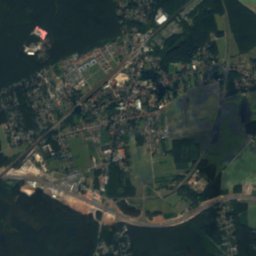
Struveshof
Photo: A.Savin · FAL · Wikimedia Commons
StruveshofReport this photo · linked, not stored
Village church Ahrensdorf (Ludwigsfelde)
Photo: Löwe 48 · CC BY-SA 3.0 · Wikimedia Commons
Village church Ahrensdorf (Ludwigsfelde)Report this photo · linked, not stored
Village church Ahrensdorf (Ludwigsfelde)
Village church Sputendorf
Photo: Hans G. Oberlack · CC BY-SA 4.0 · Wikimedia Commons
Village church SputendorfReport this photo · linked, not stored
Village church Sputendorf
St. Michael's church Ludwigsfelde
Photo: A.Savin · FAL · Wikimedia Commons
St. Michael's church LudwigsfeldeReport this photo · linked, not stored
St. Michael's church Ludwigsfelde
Stundeneiche
Photo: A.Savin · FAL · Wikimedia Commons
StundeneicheReport this photo · linked, not stored
Stundeneiche
human settlementLudwigsfelde, Brandenburg

Struveshof

Kulturdenkmal
Typehuman settlement
Built–
Best monthsMay · Aug–Sepweather in Ludwigsfelde
52.32° N, 13.23° EUTC+2 · Central European Summer Time
When to goLudwigsfelde · weather score
JanFebMarAprMayJunJulAugSepOctNovDec49October
Best timeMay · Aug–Sep
October: high / low14° / 6°
iAbout

Struveshof in brief

Struveshof is a human settlement in Ludwigsfelde, Brandenburg, Germany. Human settlement.

It holds the designation Kulturdenkmal.

For a visit, the weather in Ludwigsfelde is best in May, August and September; in October afternoons average 14°.

Ludwigsfelde: weather and travel guide

Facts

Type
human settlement
Designation
Kulturdenkmal
Nearest town
Ludwigsfelde
Region
Brandenburg
Coordinates
52.32056, 13.22889
iiLocation

Where to find it

iiiWhen to visit

Weather in Ludwigsfelde

Climate guide

Month score for sightseeing

Best May · Aug–Sep
ivNearby

More heritage close by

All monuments in Germany
Landesinstitut für Schule und Medien Berlin-Brandenburg
Photo: A.Savin · FAL · Wikimedia CommonsReport this photo · linked, not stored

Landesinstitut für Schule und Medien Berlin-Brandenburg

0.1 km SE
architectural heritage monument
Landesinstitut für Schule und Medien Berlin-Brandenburg
Village church Ahrensdorf (Ludwigsfelde)
Photo: Löwe 48 · CC BY-SA 3.0 · Wikimedia CommonsReport this photo · linked, not stored

Village church Ahrensdorf (Ludwigsfelde)

2.1 km W
architectural heritage monument in Brandenburg
Village church Ahrensdorf (Ludwigsfelde)
Village church Sputendorf
Photo: Hans G. Oberlack · CC BY-SA 4.0 · Wikimedia CommonsReport this photo · linked, not stored

Village church Sputendorf

2.2 km N
architectural heritage monument in Brandenburg
Village church Sputendorf
St. Michael's church Ludwigsfelde
Photo: A.Savin · FAL · Wikimedia CommonsReport this photo · linked, not stored

St. Michael's church Ludwigsfelde

2.9 km SE
architectural heritage monument in Brandenburg
St. Michael's church Ludwigsfelde
Stundeneiche
Photo: A.Savin · FAL · Wikimedia CommonsReport this photo · linked, not stored

Stundeneiche

3.1 km SE
single natural monument in Brandenburg
Stundeneiche
Village church Schenkenhorst (Stahnsdorf)
Photo: Hans G. Oberlack · CC BY-SA 4.0 · Wikimedia CommonsReport this photo · linked, not stored

Village church Schenkenhorst (Stahnsdorf)

3.1 km NW
architectural heritage monument in Brandenburg
Village church Schenkenhorst (Stahnsdorf)
Around here

Ludwigsfelde and around

Ludwigsfelde
Photo: A.Savin · FAL · Wikimedia CommonsReport this photo · linked, not stored

Ludwigsfelde

Brandenburg · Germany
May · Aug–Sepbest months
25°July high
47 maltitude
Ludwigsfelde

Nature

Bäke
Photo: A.Savin · FAL · Wikimedia CommonsReport this photo · linked, not stored
11 km N

Bäke

River
Bäke
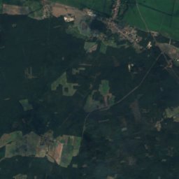
Satellite: Sentinel-2 cloudless 2016 by EOX IT Services GmbH · CC BY 4.0 · Contains modified Copernicus Sentinel data 2016
10 km SW

Grössinsee

Lake · 33 m
Grössinsee
Lake Machnow, Kleinmachnow
Photo: A.Savin · FAL · Wikimedia CommonsReport this photo · linked, not stored
11 km N

Lake Machnow, Kleinmachnow

Lake · 38 m
Lake Machnow, Kleinmachnow

Mountains

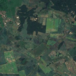
Satellite: Sentinel-2 cloudless 2016 by EOX IT Services GmbH · CC BY 4.0 · Contains modified Copernicus Sentinel data 2016
33 km S

Golmberg

178 m · Fläming Heath
Golmberg
Börnickenberg
Photo: Assenmacher · CC0 · Wikimedia CommonsReport this photo · linked, not stored
38 km S

Börnickenberg

129 m
Börnickenberg
Wietkikenberg
Photo: Lienhard Schulz · CC BY-SA 3.0 · Wikimedia CommonsReport this photo · linked, not stored
21 km W

Wietkikenberg

125 m
Wietkikenberg

Heritage

St. Michael's church Ludwigsfelde
Photo: A.Savin · FAL · Wikimedia CommonsReport this photo · linked, not stored
0.3 km SE

St. Michael's church Ludwigsfelde

architectural heritage monument in Brandenburg · 1955
St. Michael's church Ludwigsfelde
Ludwigsfelde railway station
Photo: A.Savin · FAL · Wikimedia CommonsReport this photo · linked, not stored
1.1 km SE

Ludwigsfelde railway station

architectural heritage monument in Brandenburg
Ludwigsfelde railway station
Stundeneiche
Photo: A.Savin · FAL · Wikimedia CommonsReport this photo · linked, not stored
0.5 km SE

Stundeneiche

single natural monument in Brandenburg
Stundeneiche

Museums

German Broadcasting Archive
Photo: Maximilian Schönherr · CC BY-SA 3.0 · Wikimedia CommonsReport this photo · linked, not stored
13 km NW

German Broadcasting Archive

Cinematheque
German Broadcasting Archive
Deutsches Schweinemuseum
Photo: Wassermüller · CC BY-SA 3.0 · Wikimedia CommonsReport this photo · linked, not stored
7.9 km N

Deutsches Schweinemuseum

Agricultural museum · 1993
Deutsches Schweinemuseum
Oldtimermuseum Bergholz-Rehbrücke
Photo: Buch-t · CC BY-SA 3.0 de · Wikimedia CommonsReport this photo · linked, not stored
11 km W

Oldtimermuseum Bergholz-Rehbrücke

Automobile museum
Oldtimermuseum Bergholz-Rehbrücke