
Photo: Den man tau · CC BY-SA 4.0 · Wikimedia Commons
Steintor 2Report this photo · linked, not stored
Steintor 2Report this photo · linked, not stored

Photo: Den man tau · CC BY-SA 4.0 · Wikimedia Commons
Steintor 3Report this photo · linked, not stored
Steintor 3Steintor 3Report this photo · linked, not stored

Photo: Den man tau · CC BY-SA 4.0 · Wikimedia Commons
Steinweg 14Report this photo · linked, not stored
Steinweg 14Steinweg 14Report this photo · linked, not stored

Photo: Den man tau · CC BY-SA 4.0 · Wikimedia Commons
Kriegerdenkmal von 1871Report this photo · linked, not stored
Kriegerdenkmal von 1871Kriegerdenkmal von 1871Report this photo · linked, not stored

Photo: Den man tau · CC BY-SA 4.0 · Wikimedia Commons
Steinweg 25, RonnenbergReport this photo · linked, not stored
Steinweg 25, RonnenbergSteinweg 25, RonnenbergReport this photo · linked, not stored
stationRonnenberg, Lower Saxony
Steintor 2
architectural heritage monument in Lower Saxony
Typestation
Built–
Best monthsMay–Jun · Sepweather in Ronnenberg
52.32° N, 9.60° EUTC+1 · Central European Standard Time
When to goRonnenberg · weather score
Best timeMay–Jun · Sep
October: high / low14° / 7°
iAbout
Steintor 2 in brief
Steintor 2 is a station in Ronnenberg, Lower Saxony, Germany.
It holds the designation architectural heritage monument in Lower Saxony.
For a visit, the weather in Ronnenberg is best in May, June and September; in October afternoons average 14°.
Facts
- Type
- station
- Designation
- architectural heritage monument in Lower Saxony
- Nearest town
- Ronnenberg
- Region
- Lower Saxony
- Coordinates
- 52.31519, 9.59815
iiLocation
Where to find it
ivNearby
All monuments in GermanyMore heritage close by
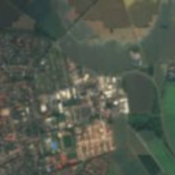
Satellite: Sentinel-2 cloudless 2016 by EOX IT Services GmbH · CC BY 4.0 · Contains modified Copernicus Sentinel data 2016
Türmchen, Ronnenberg
under 100 m SE
architectural heritage monument

Around here
Ronnenberg and around

Nature


Photo: Sönke Kraft aka Arnulf zu Linden · CC BY-SA 3.0 · Wikimedia CommonsReport this photo · linked, not stored
Ihme
River

Mountains

Photo: Foto: Axel Hindemith · CC BY-SA 4.0 · Wikimedia CommonsReport this photo · linked, not stored
Hohe Egge (Süntel)
440 m · Süntel


Heritage

Heimatmuseum Ronnenberg
cultural heritage monument in Lower Saxony · 1868


Photo: Mitarbeiter/-in NLD (Niedersächsisches Landesamt für Denkmalpflege · CC BY-SA 4.0 · Wikimedia CommonsReport this photo · linked, not stored
Gusseisernes Grabkreuz Christoph Schmedes
architectural heritage monument in Lower Saxony · 1862
Museums

Niedersächsisches Museum für Kali- und Salzbergbau


Photo: Christian A. Schröder (ChristianSchd) · CC BY-SA 4.0 · Wikimedia CommonsReport this photo · linked, not stored

Sprengel Museum
Art museum · 1979