
Photo: Ralf Lotys (Sicherlich) · CC BY 2.5 · Wikimedia Commons
SeigerturmReport this photo · linked, not stored
SeigerturmReport this photo · linked, not stored

Photo: Sicherlich · CC BY-SA 3.0 · Wikimedia Commons
Rathaus Stolberg (Harz)Report this photo · linked, not stored
Rathaus Stolberg (Harz)Rathaus Stolberg (Harz)Report this photo · linked, not stored

Photo: Ralf Lotys (Sicherlich) · CC BY 2.5 · Wikimedia Commons
St. Martini (Stolberg)Report this photo · linked, not stored
St. Martini (Stolberg)St. Martini (Stolberg)Report this photo · linked, not stored

Photo: Olaf Meister · CC BY-SA 3.0 · Wikimedia Commons
Old MintReport this photo · linked, not stored
Old MintOld MintReport this photo · linked, not stored

Photo: Olaf Meister · CC BY-SA 3.0 · Wikimedia Commons
Marienkapelle (Stolberg)Report this photo · linked, not stored
Marienkapelle (Stolberg)Marienkapelle (Stolberg)Report this photo · linked, not stored
towerStolberg, Saxony-Anhalt
Seigerturm
Kulturdenkmal
Typetower
Built–
Best monthsJun · Aug–Sepweather in Stolberg
51.57° N, 10.96° EUTC+1 · Central European Standard Time
When to goStolberg · weather score
Best timeJun · Aug–Sep
October: high / low13° / 5°
iAbout
Seigerturm in brief
Seigerturm is a tower in Stolberg, Saxony-Anhalt, Germany. Tower.
It holds the designation Kulturdenkmal.
For a visit, the weather in Stolberg is best in June, August and September; in October afternoons average 13°.
Facts
- Type
- tower
- Designation
- Kulturdenkmal
- Nearest town
- Stolberg
- Region
- Saxony-Anhalt
- Coordinates
- 51.57310, 10.95520
iiLocation
Where to find it
iiiWhen to visit
Climate guideWeather in Stolberg
Month score for sightseeing
Best Jun · Aug–Sep14
Jan
24
Feb
23
Mar
50
Apr
67
May
68
Jun
65
Jul
69
Aug
71
Sep
39
Oct
19
Nov
11
Dec
ivNearby
All monuments in GermanyMore heritage close by
Photo: Ralf Lotys (Sicherlich) · CC BY 2.5 · Wikimedia CommonsReport this photo · linked, not stored
St. Martini (Stolberg)
under 100 m NW
architectural heritage monument


Photo: Ralf Lotys (Sicherlich) · CC BY 2.5 · Wikimedia CommonsReport this photo · linked, not stored
Stolberg Castle
0.2 km NW
Kulturdenkmal
Around here
Stolberg and around
Photo: Ralf Lotys (Sicherlich) · CC BY 2.5 · Wikimedia CommonsReport this photo · linked, not stored
Stolberg
Saxony-Anhalt · Germany
Jun · Aug–Sepbest months
23°July high
314 maltitude
Nature


Photo: Sarkana from Spandau, Deutschland · FAL · Wikimedia CommonsReport this photo · linked, not stored
Glasebach (Selke)
River

Photo: Raik Schröter, Berga · CC BY-SA 4.0 · Wikimedia CommonsReport this photo · linked, not stored
Heimkehle
Cave
Mountains

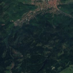
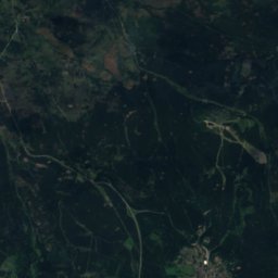
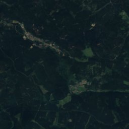
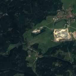
Satellite: Sentinel-2 cloudless 2016 by EOX IT Services GmbH · CC BY 4.0 · Contains modified Copernicus Sentinel data 2016
Heinrichshöhe
1,045 m · Harz
Satellite: Sentinel-2 cloudless 2016 by EOX IT Services GmbH · CC BY 4.0 · Contains modified Copernicus Sentinel data 2016
Königsberg (Brocken)
1,034 m · Harz
Heritage

Satellite: Sentinel-2 cloudless 2016 by EOX IT Services GmbH · CC BY 4.0 · Contains modified Copernicus Sentinel data 2016
Stolberg Castle
Kulturdenkmal

Museums
Satellite: Sentinel-2 cloudless 2016 by EOX IT Services GmbH · CC BY 4.0 · Contains modified Copernicus Sentinel data 2016
Old Mint Museum
Satellite: Sentinel-2 cloudless 2016 by EOX IT Services GmbH · CC BY 4.0 · Contains modified Copernicus Sentinel data 2016
Small town house museum


Satellite: Sentinel-2 cloudless 2016 by EOX IT Services GmbH · CC BY 4.0 · Contains modified Copernicus Sentinel data 2016
Mittelbau-Dora concentration camp
Military museum