Skip to content
Destinations
Weather & climate
Nature
Outdoors
Culture
Events
Sky & live
Schusterkaspar
Photo: Rudolph Buch · CC0 · Wikimedia Commons
SchusterkasparReport this photo · linked, not stored
Beim Stürzer
Photo: Rudolph Buch · Public domain · Wikimedia Commons
Beim StürzerReport this photo · linked, not stored
Beim Stürzer
Bräugasse 4
Photo: Rufus46 · CC BY-SA 3.0 · Wikimedia Commons
Bräugasse 4Report this photo · linked, not stored
Bräugasse 4
Münchener Straße 19
Photo: Rudolph Buch · CC0 · Wikimedia Commons
Münchener Straße 19Report this photo · linked, not stored
Münchener Straße 19
Einhaus, Aying
Photo: Rudolph Buch · CC0 · Wikimedia Commons
Einhaus, AyingReport this photo · linked, not stored
Einhaus, Aying
built structureAying, Bavaria

Schusterkaspar

architectural heritage monument in Bavaria
Typebuilt structure
Built–
Best monthsJun–Augweather in Aying
47.97° N, 11.78° EUTC+1 · Central European Standard Time
When to goAying · weather score
JanFebMarAprMayJunJulAugSepOctNovDec44October
Best timeJun–Aug
October: high / low14° / 5°
iAbout

Schusterkaspar in brief

Schusterkaspar is a built structure in Aying, Bavaria, Germany.

It holds the designation architectural heritage monument in Bavaria.

For a visit, the weather in Aying is best in June, July and August; in October afternoons average 14°.

Aying: weather and travel guide

Facts

Type
built structure
Designation
architectural heritage monument in Bavaria
Nearest town
Aying
Region
Bavaria
Coordinates
47.97293, 11.77960
iiLocation

Where to find it

iiiWhen to visit

Weather in Aying

Climate guide

Month score for sightseeing

Best Jun–Aug
19
Jan
24
Feb
19
Mar
48
Apr
62
May
63
Jun
65
Jul
65
Aug
63
Sep
44
Oct
25
Nov
17
Dec
ivNearby

More heritage close by

All monuments in Germany
Beim Stürzer
Photo: Rudolph Buch · Public domain · Wikimedia CommonsReport this photo · linked, not stored

Beim Stürzer

under 100 m S
architectural heritage monument in Bavaria
Beim Stürzer
Bräugasse 4
Photo: Rufus46 · CC BY-SA 3.0 · Wikimedia CommonsReport this photo · linked, not stored

Bräugasse 4

0.1 km S
architectural heritage monument in Bavaria
Bräugasse 4
Münchener Straße 19
Photo: Rudolph Buch · CC0 · Wikimedia CommonsReport this photo · linked, not stored

Münchener Straße 19

0.2 km W
architectural heritage monument in Bavaria
Münchener Straße 19
Einhaus, Aying
Photo: Rudolph Buch · CC0 · Wikimedia CommonsReport this photo · linked, not stored

Einhaus, Aying

0.2 km S
architectural heritage monument in Bavaria
Einhaus, Aying
Münchener Straße 17
Photo: Rudolph Buch · CC0 · Wikimedia CommonsReport this photo · linked, not stored

Münchener Straße 17

0.3 km SW
architectural heritage monument in Bavaria
Münchener Straße 17
Getreidekasten, Aying
Photo: Rudolph Buch · CC0 · Wikimedia CommonsReport this photo · linked, not stored

Getreidekasten, Aying

0.3 km SE
architectural heritage monument in Bavaria
Getreidekasten, Aying
Around here

Aying and around

Aying
Photo: 2015 Michael 2015 · CC BY-SA 4.0 · Wikimedia CommonsReport this photo · linked, not stored

Aying

Bavaria · Germany
Jun–Augbest months
24°July high
612 maltitude
Aying

Nature

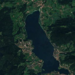
Stein See
Photo: Carsten Steger · CC BY-SA 4.0 · Wikimedia CommonsReport this photo · linked, not stored
8.5 km NE

Stein See

Lake · 577 m
Stein See
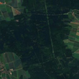
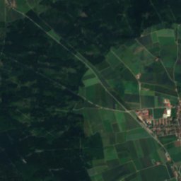
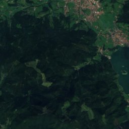
Satellite: Sentinel-2 cloudless 2016 by EOX IT Services GmbH · CC BY 4.0 · Contains modified Copernicus Sentinel data 2016
6.5 km NE

Glonn (Mangfall)

River
Glonn (Mangfall)
Kastenseeoner See
Photo: Carsten Steger · CC BY-SA 4.0 · Wikimedia CommonsReport this photo · linked, not stored
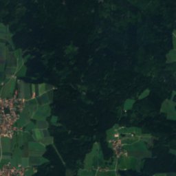
4.6 km NE

Kastenseeoner See

Lake · 612 m
Kastenseeoner See

Mountains

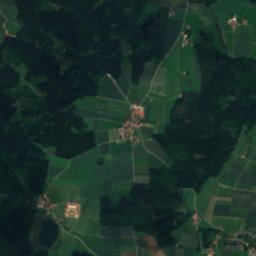
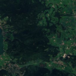
Satellite: Sentinel-2 cloudless 2016 by EOX IT Services GmbH · CC BY 4.0 · Contains modified Copernicus Sentinel data 2016
37 km S

Rotwand

1,884 m · Schliersee Mountains
Rotwand
Hochmiesing
Photo: User: Bbb at wikivoyage shared · CC BY-SA 1.0 · Wikimedia CommonsReport this photo · linked, not stored
37 km S

Hochmiesing

1,883 m · Schliersee Mountains
Hochmiesing
Wendelstein
Photo: Daniel Coral · CC BY 3.0 · Wikimedia CommonsReport this photo · linked, not stored
35 km SE

Wendelstein

1,838 m · Schliersee Mountains
Wendelstein

Heritage

Beim Biechl
Photo: Rufus46 · CC BY-SA 3.0 · Wikimedia CommonsReport this photo · linked, not stored
0.2 km NW

Beim Biechl

architectural heritage monument in Bavaria · 1800
Beim Biechl
Münchener Straße 17
Photo: Rudolph Buch · CC0 · Wikimedia CommonsReport this photo · linked, not stored
0.2 km N

Münchener Straße 17

architectural heritage monument in Bavaria · 1700
Münchener Straße 17
Münchener Straße 19
Photo: Rudolph Buch · CC0 · Wikimedia CommonsReport this photo · linked, not stored
0.3 km N

Münchener Straße 19

architectural heritage monument in Bavaria · 1800
Münchener Straße 19

Museums

Heimathaus Sixthof
Photo: Rudolph Buch · CC0 · Wikimedia CommonsReport this photo · linked, not stored
0.2 km NE

Heimathaus Sixthof

Local museum · 1978
Heimathaus Sixthof
Otto König von Griechenland-Museum
Photo: LepoRello · CC BY-SA 3.0 · Wikimedia CommonsReport this photo · linked, not stored
13 km NW

Otto König von Griechenland-Museum

Biographical museum · 1989
Otto König von Griechenland-Museum
Orgelzentrum Valley
Photo: Mtag · CC0 · Wikimedia CommonsReport this photo · linked, not stored
8.6 km S

Orgelzentrum Valley

Orgelzentrum Valley