Skip to content
Destinations
Weather & climate
Nature
Outdoors
Culture
Events
Sky & live
Schmerbach
Photo: Delta456 · CC BY-SA 4.0 · Wikimedia Commons
SchmerbachReport this photo · linked, not stored
Hutsburg
Photo: Antar2 · Public domain · Wikimedia Commons
HutsburgReport this photo · linked, not stored
Hutsburg
Evangelische Kirche (Weimarschmieden)
Photo: Tilman2007 · CC BY-SA 3.0 · Wikimedia Commons
Evangelische Kirche (Weimarschmieden)Report this photo · linked, not stored
Evangelische Kirche (Weimarschmieden)
Dom der Rhön
Photo: Tilman2007 · CC BY-SA 4.0 · Wikimedia Commons
Dom der RhönReport this photo · linked, not stored
Dom der Rhön
Evangelische Kirche (Sands)
Photo: Tilman2007 · CC BY-SA 3.0 · Wikimedia Commons
Evangelische Kirche (Sands)Report this photo · linked, not stored
Evangelische Kirche (Sands)
abandoned villageWillmars, Bavaria

Schmerbach

Kulturdenkmal
Typeabandoned village
Built–
Best monthsMay · Aug–Sepweather in Willmars
50.53° N, 10.23° EUTC+1 · Central European Standard Time
When to goWillmars · weather score
JanFebMarAprMayJunJulAugSepOctNovDec35October
Best timeMay · Aug–Sep
October: high / low13° / 5°
iAbout

Schmerbach in brief

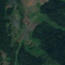
Schmerbach is an abandoned village in Willmars, Bavaria, Germany.

It holds the designation Kulturdenkmal.

For a visit, the weather in Willmars is best in May, August and September; in October afternoons average 13°.

Willmars: weather and travel guide

Facts

Type
abandoned village
Designation
Kulturdenkmal
Nearest town
Willmars
Region
Bavaria
Coordinates
50.53490, 10.22901
iiLocation

Where to find it

iiiWhen to visit

Weather in Willmars

Climate guide

Month score for sightseeing

Best May · Aug–Sep
13
Jan
21
Feb
22
Mar
50
Apr
65
May
65
Jun
65
Jul
68
Aug
71
Sep
35
Oct
16
Nov
11
Dec
ivNearby

More heritage close by

All monuments in Germany
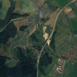
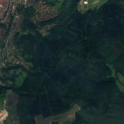
Satellite: Sentinel-2 cloudless 2016 by EOX IT Services GmbH · CC BY 4.0 · Contains modified Copernicus Sentinel data 2016

Ruine Mauerschädel

1.8 km S
architectural heritage monument in Bavaria
Ruine Mauerschädel
Hutsburg
Photo: Antar2 · Public domain · Wikimedia CommonsReport this photo · linked, not stored

Hutsburg

2.0 km NE
Heritage monument in Thuringia
Hutsburg
Evangelische Kirche (Weimarschmieden)
Photo: Tilman2007 · CC BY-SA 3.0 · Wikimedia CommonsReport this photo · linked, not stored

Evangelische Kirche (Weimarschmieden)

2.9 km NW
architectural heritage monument in Bavaria
Evangelische Kirche (Weimarschmieden)
Dom der Rhön
Photo: Tilman2007 · CC BY-SA 4.0 · Wikimedia CommonsReport this photo · linked, not stored

Dom der Rhön

3.1 km N
Heritage monument in Thuringia
Dom der Rhön
Evangelische Kirche (Sands)
Photo: Tilman2007 · CC BY-SA 3.0 · Wikimedia CommonsReport this photo · linked, not stored

Evangelische Kirche (Sands)

3.4 km SW
architectural heritage monument in Bavaria
Evangelische Kirche (Sands)
Protestant church Willmars
Photo: Tilman2007 · CC BY-SA 3.0 · Wikimedia CommonsReport this photo · linked, not stored

Protestant church Willmars

3.9 km S
architectural heritage monument in Bavaria
Protestant church Willmars
Around here

Willmars and around

Willmars
Photo: Tilman2007 · CC BY-SA 3.0 · Wikimedia CommonsReport this photo · linked, not stored

Willmars

Bavaria · Germany
May · Aug–Sepbest months
23°July high
440 maltitude
Willmars

Nature

Frickenhäuser See
Photo: Dietrich Krieger · CC BY-SA 3.0 · Wikimedia CommonsReport this photo · linked, not stored
11 km S

Frickenhäuser See

Lake · 315 m
Frickenhäuser See
Eis-Graben
Photo: Pascal Dihé / www.dihe.eu / CC BY-SA 4.0 · CC BY-SA 4.0 · Wikimedia CommonsReport this photo · linked, not stored
7.1 km W

Eis-Graben

River · 386 m
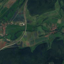
Eis-Graben
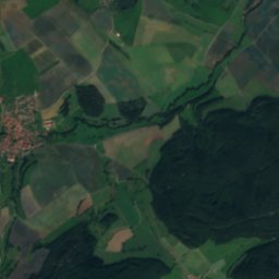
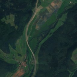
Satellite: Sentinel-2 cloudless 2016 by EOX IT Services GmbH · CC BY 4.0 · Contains modified Copernicus Sentinel data 2016
12 km NE

Sülze, Thuringia

River
Sülze, Thuringia

Mountains

Großer Beerberg
Photo: Elop · CC BY-SA 2.5 · Wikimedia CommonsReport this photo · linked, not stored
39 km NE

Großer Beerberg

983 m · Thuringian Forest
Großer Beerberg
Wasserkuppe
Photo: Jörg Braukmann · CC BY-SA 4.0 · Wikimedia CommonsReport this photo · linked, not stored
22 km W

Wasserkuppe

950 m · Wasserkuppen Rhön
Wasserkuppe
Dammersfeldkuppe
Photo: Dieter Schmitt, Fulda (DSC) · CC BY 3.0 · Wikimedia CommonsReport this photo · linked, not stored
30 km SW

Dammersfeldkuppe

928 m · Rhön Mountains
Dammersfeldkuppe

Heritage

Protestant church Willmars
Photo: Tilman2007 · CC BY-SA 3.0 · Wikimedia CommonsReport this photo · linked, not stored
0.5 km W

Protestant church Willmars

architectural heritage monument in Bavaria
Protestant church Willmars
Kirche, Willmars
Photo: Tilman2007 · CC BY-SA 3.0 · Wikimedia CommonsReport this photo · linked, not stored
2.3 km SE

Kirche, Willmars

architectural heritage monument in Bavaria
Kirche, Willmars
Turm, Stockheim
Photo: Superchaot · CC BY-SA 3.0 · Wikimedia CommonsReport this photo · linked, not stored
2.8 km SE

Turm, Stockheim

architectural heritage monument in Bavaria
Turm, Stockheim

Museums

Orgelbaumuseum Schloss Hanstein
Photo: Presse03 · CC BY-SA 3.0 · Wikimedia CommonsReport this photo · linked, not stored
4.7 km S

Orgelbaumuseum Schloss Hanstein

1993
Orgelbaumuseum Schloss Hanstein
Theatermuseum Meiningen
Photo: Photo: Andreas Praefcke · CC BY 3.0 · Wikimedia CommonsReport this photo · linked, not stored
14 km NE

Theatermuseum Meiningen

Theatre museum
Theatermuseum Meiningen
Fränkisches Freilandmuseum Fladungen
Photo: Fränkisches Freilandmuseum Fladungen · CC BY-SA 4.0 · Wikimedia CommonsReport this photo · linked, not stored
7.3 km W

Fränkisches Freilandmuseum Fladungen

Open-air museum
Fränkisches Freilandmuseum Fladungen